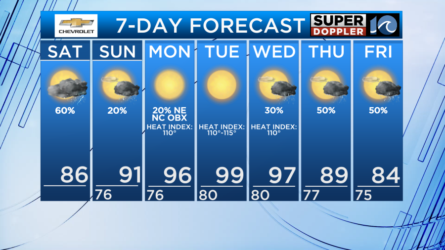
Welcome to the weekend! Showers and pop up t-storms are once again in the forecast for Saturday. Once we get to Sunday, hotter, but drier weather returns.
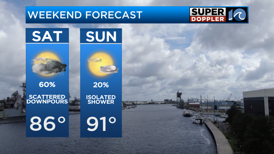
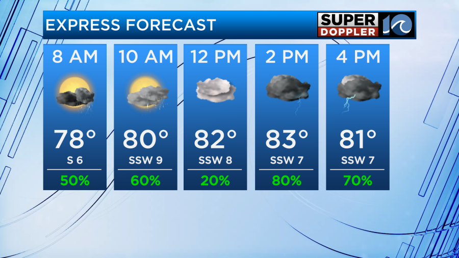
Scattered showers and thunderstorms are possible at any point on Saturday across our entire area. If you have outdoor plans, expect rain at some point. Rainfall amounts will be heavy in the t-storms that pop up. Saturday after 4pm we could see more widespread heavy rain. We will see highs in the 80s, but it will feel like the 90s at times.
On Sunday the front looks to fall apart, finally bringing our wet pattern to an end. We’ll have more sunshine and less rain chances. High temps will push back up to the low 90s. Feeling like 100.
The heat builds again next week, with drier conditions Monday and Tuesday and temperatures in the upper 90s. Heat index values of 105-115 will be expected again.
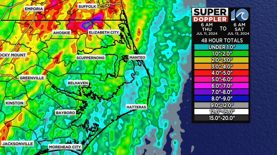
Rainfall totals over the past 48 hours have varied, with some BIG totals in spots and other locations seeing less rain. The heaviest amounts were in Gates County.
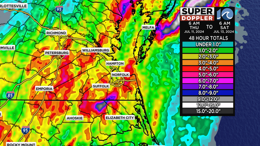
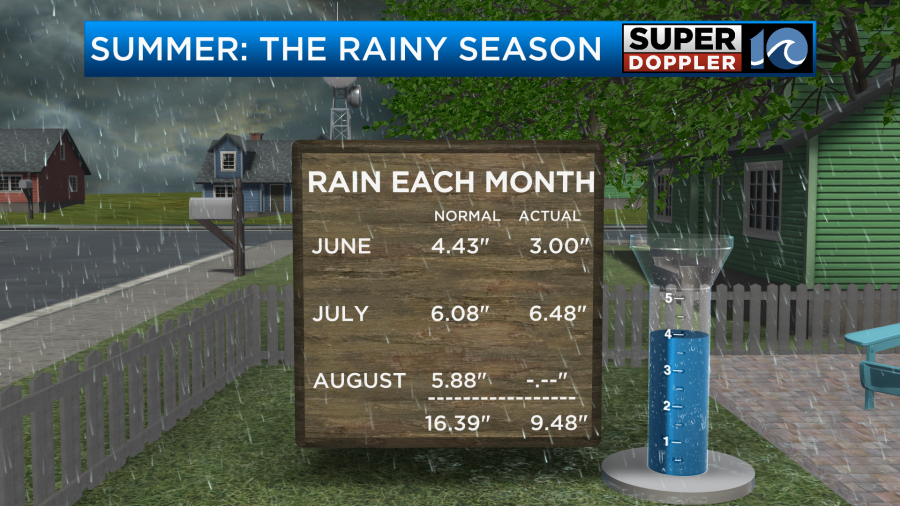
When we look at rainfall (at the Norfolk Airport for climate purposes) so far this Summer, we’ve already hit our average monthly rainfall for July!
Hope you have a great weekend!
Meteorologist Ricky Matthews
Follow Ricky on Facebook and Twitter