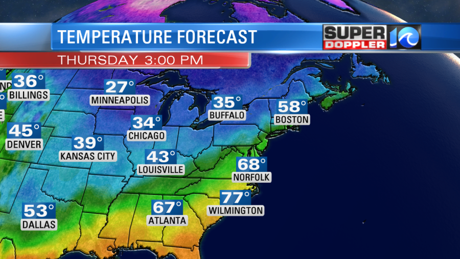
We will have some mild weather today before a blast of cold air moves into Hampton Roads. Locally we’ll have high temperatures in the upper 60s to near 70 this afternoon. It will be pretty nice out overall! Meanwhile they will only top off in the 30s and 40s over the Midwest and Great Lakes regions.
High pressure is moving away from us, and we are developing a light southwest wind.

We’ll have gradually increasing clouds through the day. by the evening we’ll be mostly cloudy, but the rain showers should stay to our west.
By tonight a strong cold front will move into the region. As it moves in we’ll have a line of showers develop over the area.
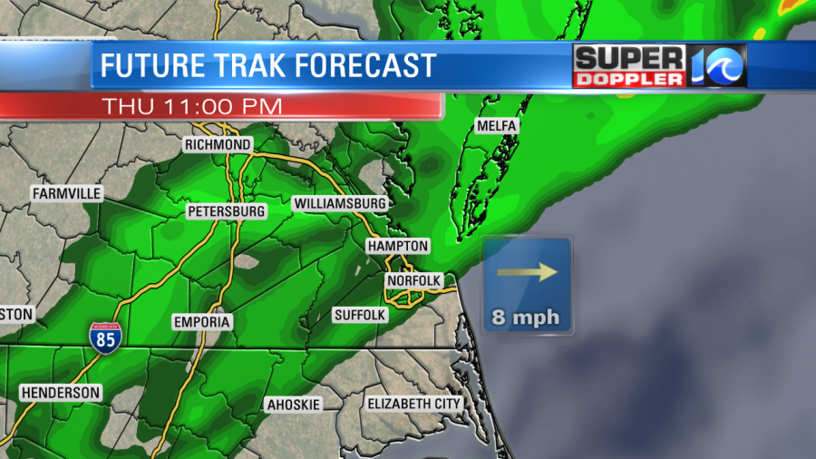
The strong front will drop to our south through early tomorrow morning. There will still be a few showers early.
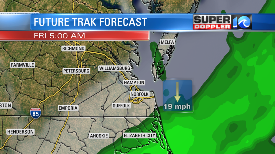
The widespread rain and the front will drop to our south through midday. Then we’ll be dry, windy, and cold. There will be one exception to the dryness. With the cold wind running right down along the bay, we will have some isolated bay-effect showers near the coast/bay.

The wind will increase tonight out of the north. It will run at 10-20mph with gusts 25-30mph. For the first half of tomorrow the wind could gust up to 30-35mph out of the north. This will keep the temps in the 40s through the day.
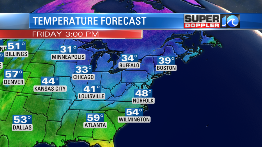
The wind will decrease some by the afternoon. We’ll be cold and dry tomorrow night. Temps will fall to the 30s with possibly some 20s inland. This may allow for some frost/freeze conditions to affect areas closer to the coast Saturday morning.
We’ll have quiet and chilly weather on Saturday. Highs will be near 50 with fair skies. We’ll be partly cloudy and milder on Sunday and Monday with highs in the 60s.
The latest models have rain moving in on Tuesday. They show a cold front moving into the region. With the current timing it looks like it will drop temperatures through the day. There may be some snow to our northwest, but the models disagree on how much moisture will be out there. Locally. this could lead to a possible brief wintry mix to wrap things up before dawn on Wednesday. HOWEVER……I’ll say it again. The models have been varying quite a bit lately. A few days ago the European model had a few inches of snow on Monday, and now it has partly cloudy skies with highs in the 60s. So wait a bit before you lock on to any specific forecast for that time. The general agreement is for another blast of cold air on Wednesday, but we’ll see if the timing of the cold air changes again.
Meteorologist: Jeremy Wheeler


