The weather was good this morning for kids heading back to school. Not all districts returned, but I’d say the majority are back today. We had a lot of sunshine with temps mainly in the 60s. We’ll have some pretty good weather today. Skies will be mostly to partly sunny. High pressure is offshore, but there is a dying cool front to our south.
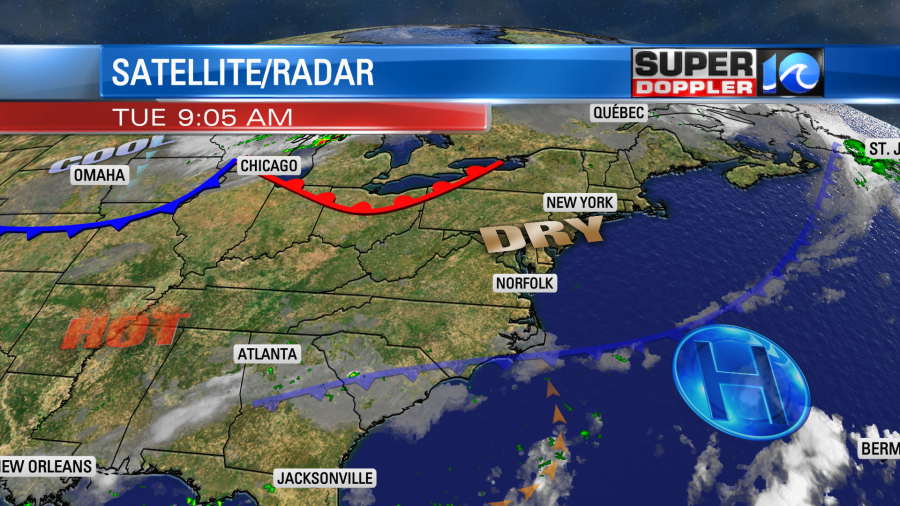
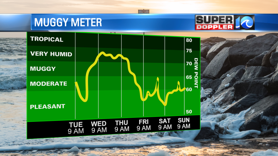
Other than a stray shower or storm in the whole region, we’ll have quiet weather. We’ll have a light wind out of the southeast. High temps will rise to the upper 80s this afternoon. The humidity is moderate.
Tomorrow we’ll have a few showers and storms develop ahead of a stronger cool front. They will fire up in the afternoon, but they will increase by the evening.
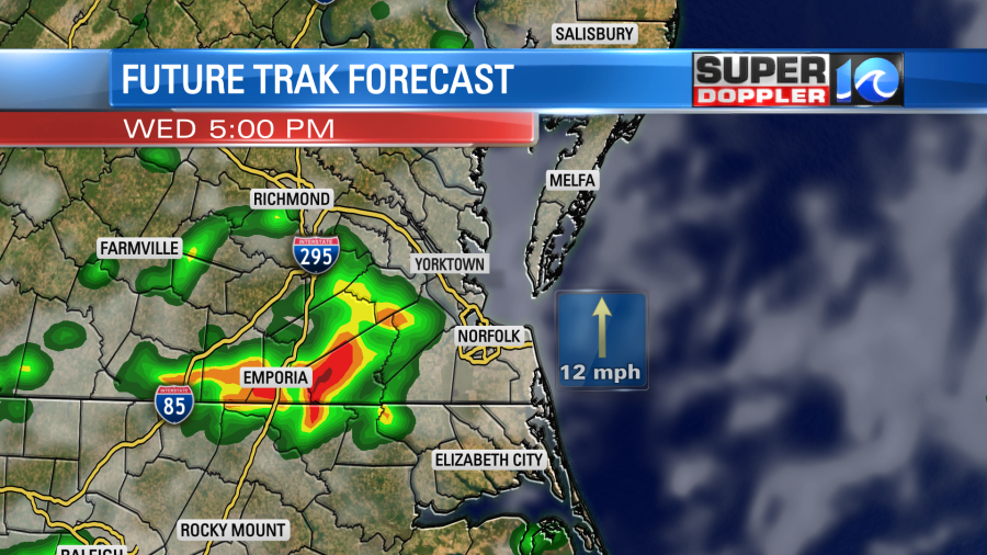
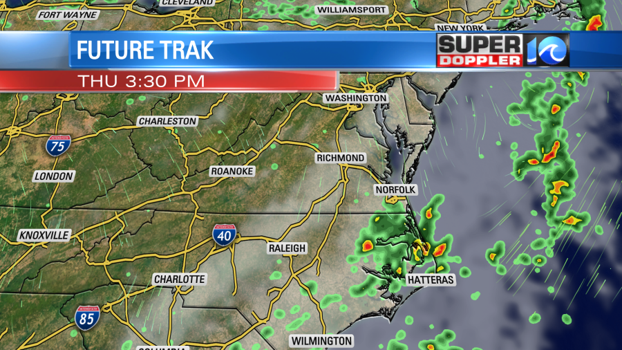
High temps will be in the upper 80s to near 90. The wind will be out of the south at 8-12mph. Rain will increase Wednesday night into Thursday as the cool front drops to the south. It won’t be a washout Thursday, but we’ll probably have some on/off showers through the day.
High temps will get knocked down to near 80 degrees as the winds turn out of the north. We’ll be cool/mild and dry behind that system going into the weekend. High temps will be near 80 on Friday and Saturday. We’ll have fair skies. Sunday looks good too. Humidity levels will be comfortable.
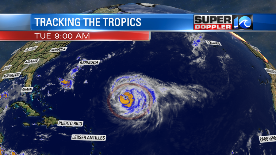
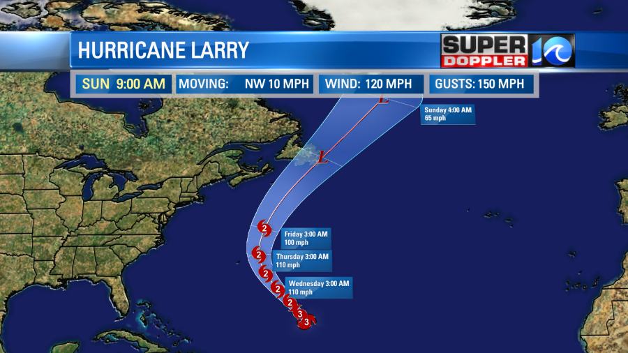
Here is an update on the tropics … Hurricane Larry is still a major hurricane. It has kept its sustained winds of 120 mph since yesterday. It is also still on a northwest track
The hurricane will move closer to Bermuda over the next couple of days. The center still looks like it will pass east of Bermuda. They will have some storm surge there as well as some high waves, but the strongest winds and heavy rain will stay offshore. The storm will then move north and then northeast. This puts it on a potential path over Newfoundland. By that time it would likely become post-tropical. Though it still could have some strong/gusty winds.
The waves from Larry will be huge out at sea. Our forecast model predicts waves up to about 20 feet near the center by Friday.
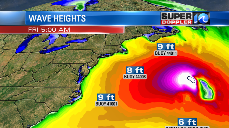
Our local waves aren’t big just yet, but there is already a high threat for rip currents along the Outer Banks. There is a moderate threat today along Virginia Beach. Waves today will be 1-2 ft in Virginia Beach. 1-3 feet along the Outer Banks. By Friday some of the waves over the OBX could be up to 6-7 feet. The rip current risk will be elevated through that time.
We are also tracking the tropical disturbance in the Gulf of Mexico. This morning there were some thunderstorms developing around the feature.
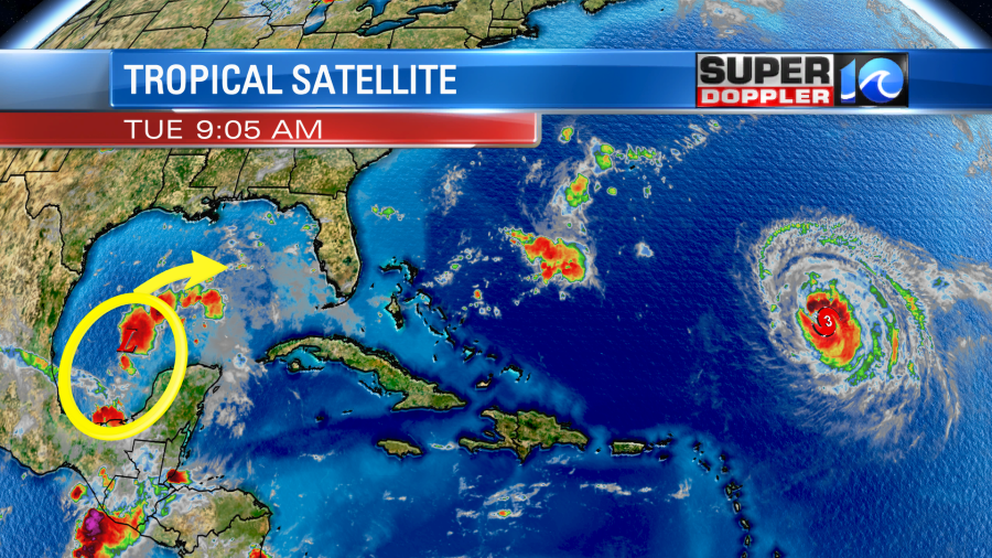
The forecast is tricky for this one. There is some wind shear now, but it should relax over the next couple of days. The models are all over the place with this feature as far as the track goes.

However, there are a couple which take it to the northeast close to the Florida panhandle. This is what the European model has been showing.
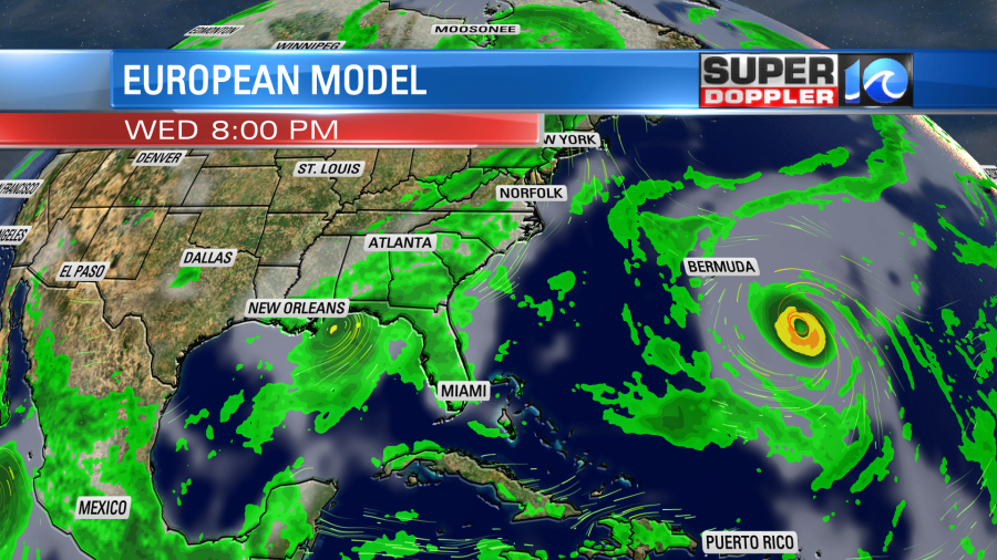
The Euro model then takes it east northeast over northern Florida and southern Georgia. Afterwards it looks like it would roll offshore and re-develop over the western Atlantic.

The National Hurricane Center is siding with this scenario. Though the GFS keeps it very weak and pushes it generally west. So we’ll see what happens over the next 24 hours. No matter what, let’s hope it stays away form Louisiana and Mississippi as they are still in a long recovery from Ida.
Meteorologist; Jeremy Wheeler