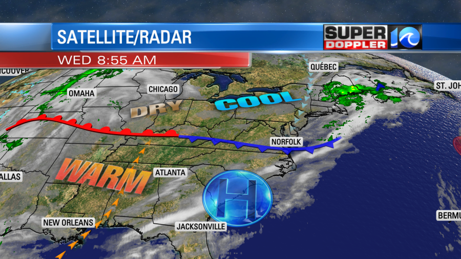
Today will be a pretty nice day overall, but it’s definitely not as sunny as yesterday. A weak cool front/wind shift was moving into the region this morning. There were some clouds, but the sun was still shining through. It was very pretty early in the day.

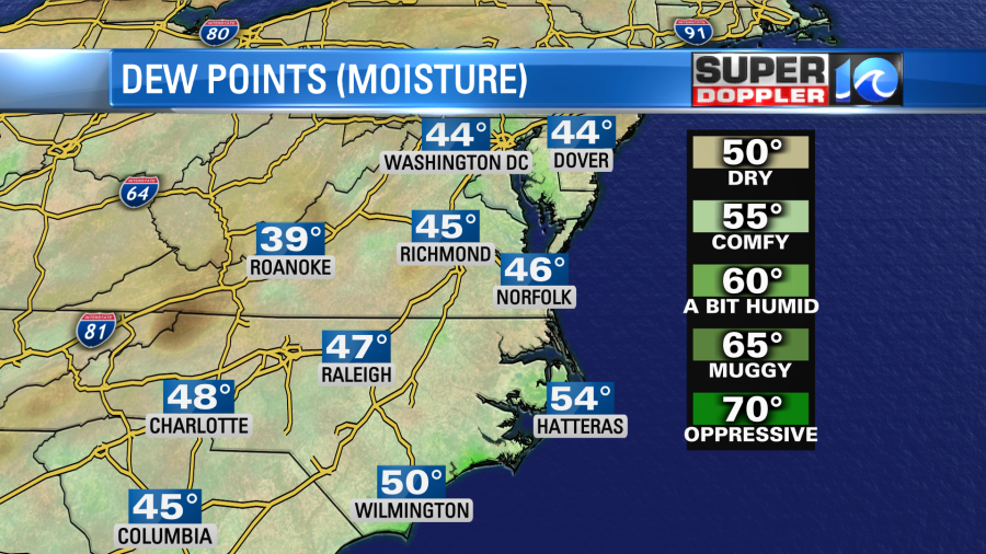
The front may cause a couple of sprinkles later this morning, but the surface moisture is very low. So most of them will fall apart.
After the front swings through we’ll have clearing skies this afternoon. Winds will be light and out of the northeast. High temps will be in the lower 70s. There may be a few upper 60s close to the shore. Tomorrow that boundary will move north as a warm front. However, we’ll also have increasing clouds. High temps will be in the mid-upper 70s. It should be nice for any Veterans Day events.
Between Thursday night and Friday we’ll have a deeper flow out of the south. Moisture will increase at all levels. So we’ll have scattered rain showers overnight Thursday into Friday morning.
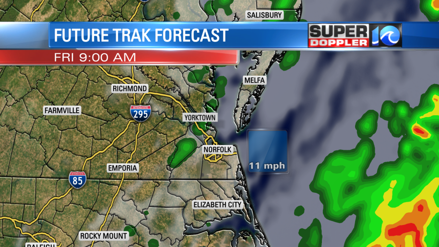
The models vary on how much coverage we’ll have for the rain showers, but for now I’m siding with the wetter scenario. The reason is that I think there will be some drizzle in-between the scattered showers. Either way the models do agree that we’ll dry out during the afternoon. A cold front will move through during the morning, and that will cause most of the rain showers. High temps will be in the mid 70s, but they may fall to the 60s later in the day.
On Saturday the front will stall for a bit offshore. A weak area of low pressure may form along the boundary (offshore). Plus, it looks like a second punch of colder air will be moving in from the west. The models each handle this a little differently with some drier than others. Here is the forecast map from the Weather Prediction Center (NOAA) for that time:

So for now I have a mix of sun and clouds and a few scattered rain showers. However, that forecast could easily still change. High temps will be closer to 60 degrees. We’ll be chilly and dry on Sunday. Low temps will be in the 30s and 40s Sunday morning. High temps will only be in the mid-upper 50s in the afternoon.
The area of low pressure that caused the recent tidal flooding is over the middle of the Atlantic. It is moving generally to the east. I wouldn’t even mention it, but the National Hurricane Center gives it a medium chance of becoming subtropical.

If it does then they would give it a name, and they would add it to the 2021 list of storms. Wanda was the last name on the list of regular season storms. If we get another storm, then we would start using the new list. The Greek alphabet is no longer being used. Adria would be the next name on the list. Whatever happens with the naming it will stay out to sea.
Meteorologist: Jeremy Wheeler