Yesterday, was a good day to stay inside. I had the day off, but unfortunately, I had to walk the dog several times, and I had to run an errand. So I was in the soggy/chilly rain a few times.
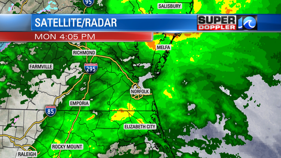
Rain added up to about a half inch to an inch over the area.
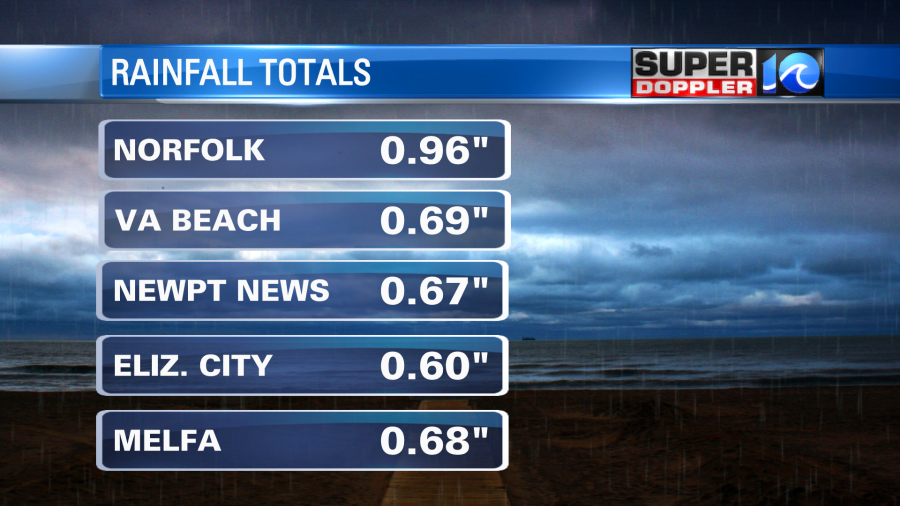
This did one really good thing. It cleaned up the salt on the roads from recent Winter weather treatments. It also, cleaned it off the of vehicles. It was that type of rain that just soaks into your clothes in a short period of time. Anyway, this was from an offshore low along with a pocket of energy in the upper levels. Both of those features have moved off to the northeast now. We have a weak cool front falling apart as it moves into the area. High pressure is to the west.

We’ll have gradual clearing today, but it may take a while. There is a light west wind that will pull in some drier air, but it will be a slow process. Temperatures will warm up a little bit. We’ll make it to the upper 40s this afternoon with a couple of 50s inland and south.
Tomorrow high pressure will build stronger into the region. We’ll be mostly sunny with a light south wind. So temps will warm up to the mid 50s.

It will be a nice day! We’ll have even nicer weather on Thursday with mostly sunny skies and high temps in the upper 50s to near 60. Then we’ll be in the 60s and dry on Friday and Saturday. Yes…Saturday looks warm and dry at this time. That will be the first warm/dry weekend day in a loooong time. However, temperatures will drop sharply Sunday into Monday. The models are (suggesting) that there will be an area of low pressure near the coast sometime between Sunday afternoon and Monday morning. This could create some rain, a wintry mix, and possibly even some snow as well. It’s still too early for the details, and the models are going back-and-forth. So I’ll focus more on that in tomorrow’s weather blog.
Meteorologist: Jeremy Wheeler


