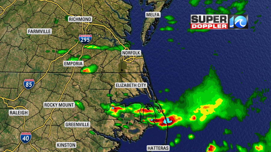
Yesterday we did have some heavy downpours over the region. Unfortunately, it did cause some flooding over parts of the Outer Banks. This was on top of the flooding from the other day with Dorian. So it was salt in the wound.
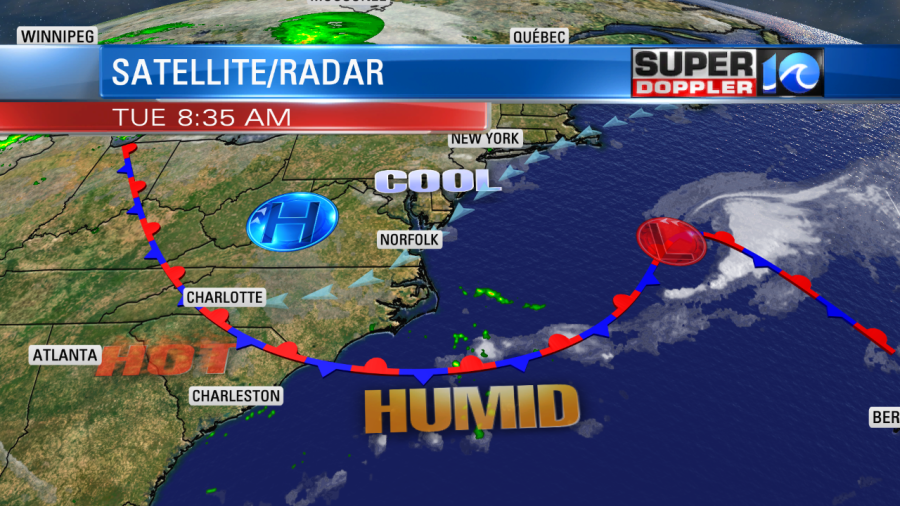
Today will be quiet across the region. A stationary front has drifted just to our south. We have high pressure building in from the north.
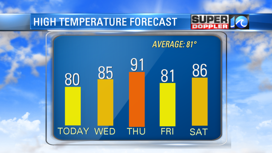
We’ll be partly cloudy today. It should be pretty nice out. High temps will be in the low 80s with upper 70s along the shore. It will hit the mid 80s inland. Winds will be out of the northeast at 8-12mph. I’m hoping that will drop the dew points a little bit. They were in the upper 60s to near 70 this morning. Hopefully they’ll drop to the mid 60s, and if we’re lucky then maybe the low 60s for some. We’ll see.
Tomorrow we’ll be mostly sunny with high pressure dominating the weather. High temps will warm to the mid-upper 80s with similar humidity. Then the heat and humidity will build on Thursday as the winds become more consistently out of south. Highs will be in the low 90s, but the heat index will be in the mid 90s. The average high this time of year is in the low 80s. We’ll cool down a little on Friday with a few showers and storms possible, but we’ll be above average for the weekend.
Things aren’t too busy in the tropics at this time, but we are watching 3 tropical disturbances in the Atlantic Basin. They all have a low chance of formation in the short term, but 1 or 2 of them may develop into a system over the next few days. Tropical storm Gabrielle is becoming non-tropical today. It will aim for the U.K. as a non-tropical system over the next 48 hours.
Meteorologist: Jeremy Wheeler