Hard to believe that just yesterday we had full sunshine, dry air, and a beautiful day. Now today we’ll have a lots of clouds, a few showers, and some thunderstorms. Then a line of storms will move in tonight. We really do need the rain. I’ve talked it about it a lot lately. We are 7.87″ below average for rainfall for the year so far. That is the number at Norfolk which is our main climate site for the region. It comes from the National Weather Service. Luckily, that should improve soon.
Today we are tracking an area of low pressure to our south with a cold front to our west. High pressure is moving out to sea.
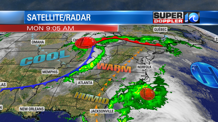
We’ll have some scattered showers and a few storms as the weak area of low pressure rides generally to the northeast today. It should stay offshore. However, our surface winds will still pick up out of the south. This will continue to pull up some warm/humid aid. Dew points will be in the mid 60s today. High temps will aim for the upper 70s to low 80s. It definitely won’t feel like Fall. Scattered rain showers and few storms will pick up from the south between the late morning and the early afternoon.
These showers and isolated thunderstorms will move north during the afternoon, but they should break up a bit too. So there’s actually a lower chance for rain during the late afternoon into the early evening. Upper level winds will also be out of the south. Sometimes that pulls up warmer air aloft that can act like a cap. so perhaps that will stabilize things for a bit in the early evening. However, during the overnight the cold front will move in from the west. That should break up that cap. A line of strong to severe storms will be rolling in from the west after 9pm.
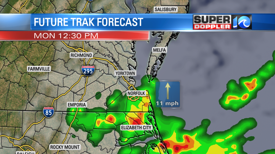
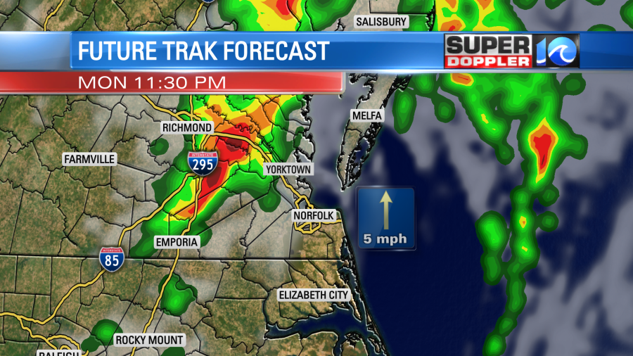
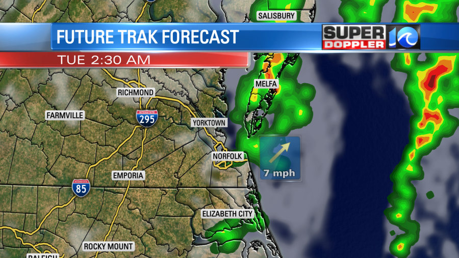
Now some models have the line weakening as it moves east. Some others keep it intact. Here is our Future Trak computer model around midnight and then 3am.
The furthest out the HRRR goes for me right now is 9pm. So here is its forecast during that time.
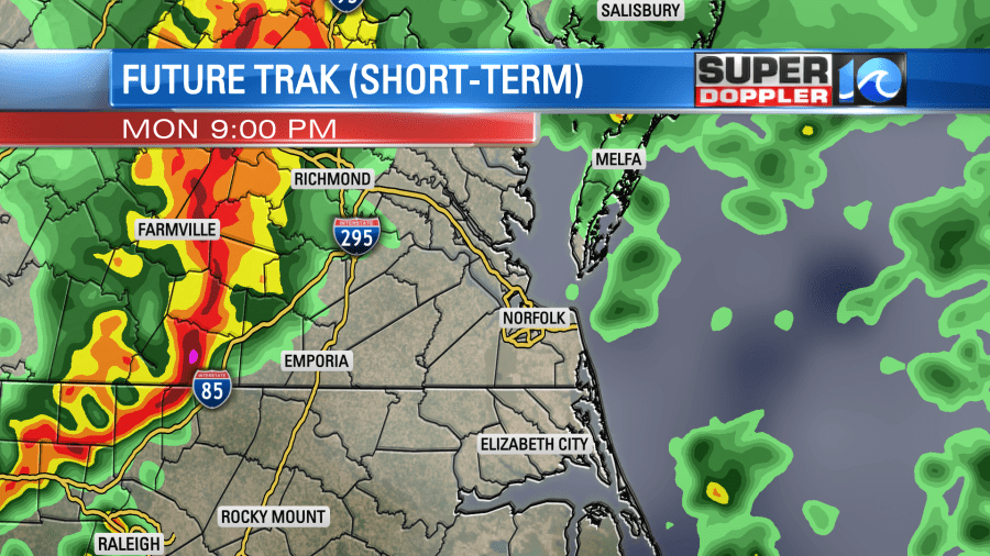
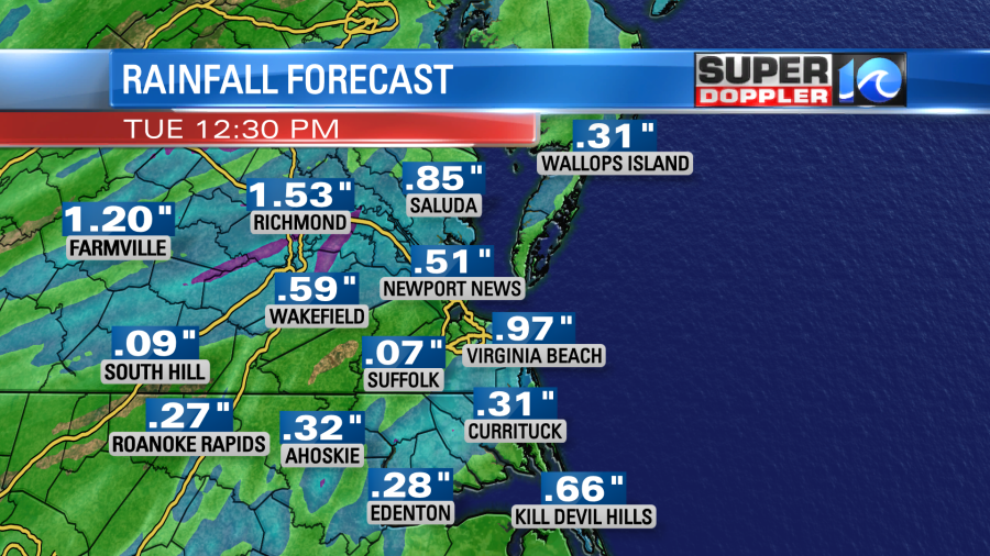
Keep in mind that it often tends to be overly strong with storms. So I do think we’ll get clipped by that batch of storms tonight, but I also think it will weaken some as it moves east. It will be late. So we will lose the heating of the day. However, there will probably also be some decent wind shear tonight. Either way that line of showers and storms will weaken into early tomorrow morning. Also, remember that the storms may speed up or slow down a bit which could change the overall forecast. We could see about a quarter to a half an inch of rain with a few lucky locations possibly getting a half inch up to an inch.
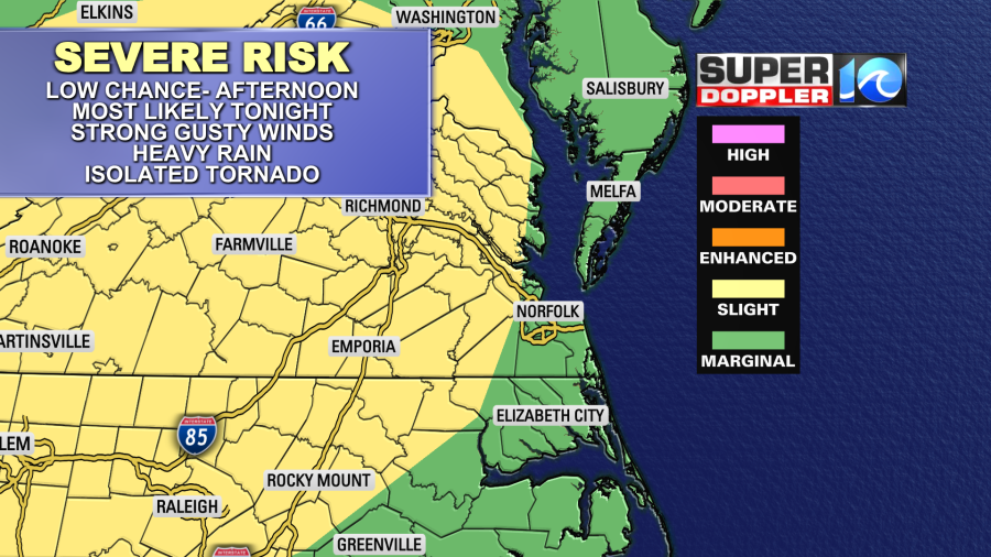
There is a marginal to slight risk for severe weather overnight. The main threat will be strong/gusty winds. Brief heavy rain will be possible as well which could create isolated street flooding. Small hail and isolated tornadoes will be possible. The higher threat for tornadoes will be just to our west.
Be sure to have a way to get alerts during the overnight hours.
Tomorrow, the front will push farther offshore through the day. However, an upper level low will hang back behind the front. This will give us some cloudiness tomorrow (with some sun mixed in). It will also produce some spotty/lingering showers. It should be too stable for thunderstorms. It will breezy and cooler tomorrow with high temps near 70 degrees. Winds could gust up to 25mph out of the northwest. We’ll be dry and somewhat cool Wednesday and Thursday. High temps will be in the upper 60s to near 70, but that’s actually close to the average.
There is a big system that is affecting the west coast today. While they needed rain desperately out west, they are getting too much-too soon. So there is going to be more flooding and mudslides out in California today.
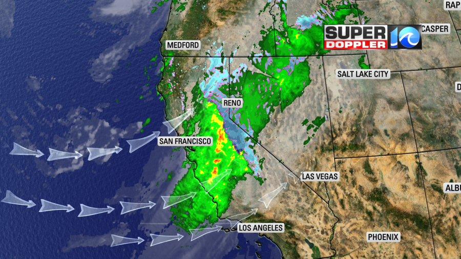
At least in the long-term this will help with the drought. This weather system will move east during the week. It will bring us some more rain by Friday, but as a weaker system. Stay tuned for updates on that.
Meteorologist: Jeremy Wheeler