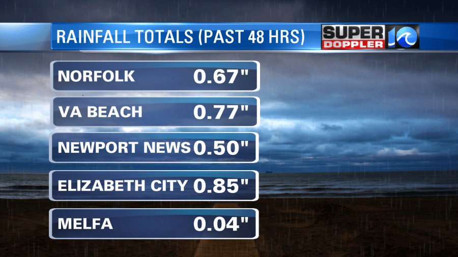
We’ve had a good soaking rain over the region over the past 24 hours. It hasn’t added up to much north of the metro, but more rain is on the way. These were the 48 hour totals as of this writing:

There was a lot of rain in Hampton roads this morning during the morning commute. Plus, the winds were gusty out of the northeast. We still have the upper level low sitting on top of our region. There is also still a stationary front to our south along with an area of low pressure.

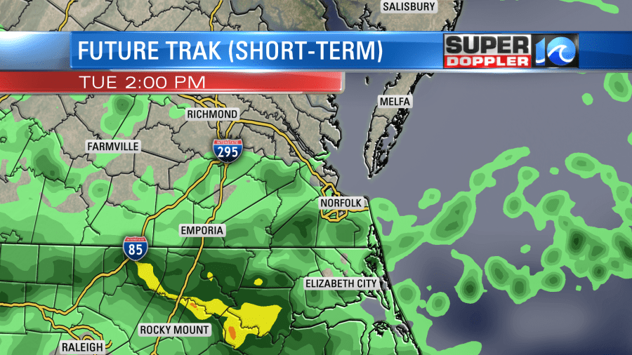
Rain showers will continue on and off through the day. It will mainly be light and showery, but there may be a few heavy downpours.

We Still have a strong northeast breeze. The gusts will be to 25mph. So between this, the clouds, and the rain; temps will only top off in the upper 60s this afternoon. That’s rough considering the average high for this time of year is in the low-mid 80s. Also, it will be in the 70s to our south AND our north. There will be 80s and 90s out west!

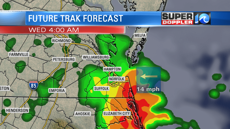
Tonight the weak area of low pressure will creep north a bit. It will pull in some warm/humid air off of the ocean. This will create some heavy rain and some thunderstorms along the coast last tonight into tomorrow morning. It could be heavy into Virginia Beach tomorrow early morning for a time.

The rain could even produce some brief/localized flooding. Then the low will drift east a bit through the day putting it just offshore. The upper level low will still be overhead though. So we’ll have more scattered showers tomorrow. However, the wind will be lighter and more out of the east. This will allow the temps to warm up to the 70s.
The upper level system will weaken between Thursday and Friday. So we’ll have a little more sunshine and less rain chances. There will still be some showers, but there will be a lot more time in-between the rain. High temps will run up to the 80s. Then, hopefully, the weather dries out some more this weekend. I don’t think we’ll be totally dry. There will be some lower rain chances. But at least it’s looking a lot better than today.
Rain totals will add up. We’ve had about a quarter of an inch up to an inch so far. We’ll have about another 0.75″ up to 2.5″ between now and Friday. There will be some areas that will have over 3″. Especially since there will be some heavy rain tonight. This is the forecast from the GFS model between now and Wednesday evening:

Stay tuned for updates to the rainfall forecast. Luckily tidal flooding will only be nuisance levels. However, this could lead to poor drainage during high tide. That’s something that has been a lot more common over the last 10 years.
Meteorologist: Jeremy Wheeler


