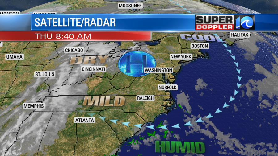
I ate lunch outside yesterday at a local park with some friends. Outdoors and distanced. It was Reaaaaalllly nice out. We had lots of sun with highs in the upper 60s to low 70s. It was very dry with a light breeze. Today will only have some subtle differences. We still have a big area of high pressure to our west. With its current position it will provide us with a light east/southeast wind and partly cloudy skies today.

High temps will rise to the low 70s. The humidity is still low. Dew points are in the 40s and 50s. However, they will steadily increase over the next 24 hours up closer to 60. Basically, we’ll start to filter in some more humid air off of the ocean due to the developing onshore breeze. By tonight the extra moisture will lead to mostly cloudy skies and some spotty showers. Then tomorrow we’ll have the same. It will be far from a washout, but some spotty showers will be possible at just about any time of the day tomorrow. High temps will be in the low 70s with a light east-northeast breeze.
Over the weekend we’ll have a mix of sun and clouds. There may be a couple of stray showers coming in off of the ocean, but it’s a very low chance. There’s a little better chance for that to happen across the Outer Banks. High temps will be in the 70s. Overall, the weekend is still looking pretty good.
Eta has drastically degraded since 48 hours ago. It is a weak depression (as I write this), but it is basically falling apart. Most of the storms are away from the center (mainly to the north), and the strongest winds are over the water.
trop sat
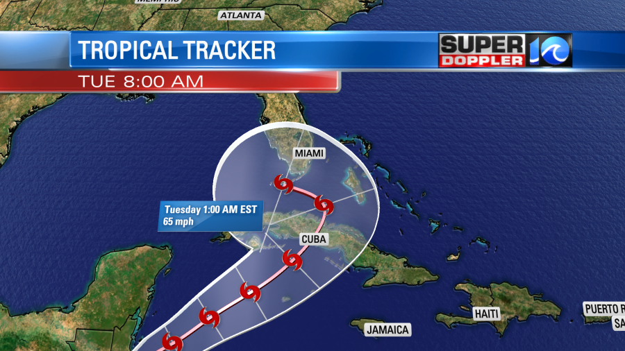
The system will likely move northeast tomorrow over some warm water. This should help Eta to regenerate into a depression and possibly even a tropical storm.

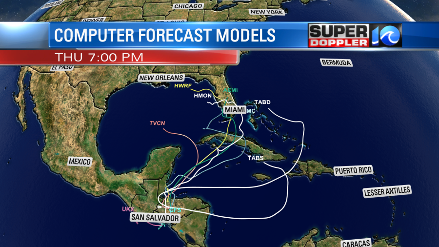
The models are pretty split as to what Eta is going to do beyond that. Some still have it remaining as a remnant low over land. Others move it not only onto Cuba but also into south Florida.

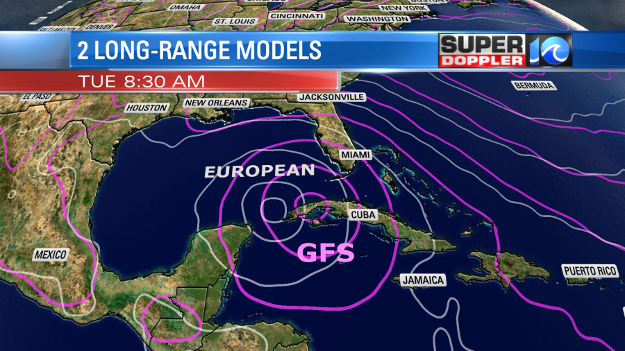
The GFS and European models are actually in decent agreement. They both take it up into Cuba as a very weak system. Then then hook it west, and have it just missing Florida.

The official track follows these models fairly closely. Keep in mind that the water temperatures closer to Florida are much cooler than a month ago, and shouldn’t support any strengthening at this point.

Either way it should stay far to our south due to our regional area of high pressure locked into place.
Let’s hope it stays away from the U.S. altogether. Stay tuned for updates.
Meteorologist: Jeremy Wheeler


