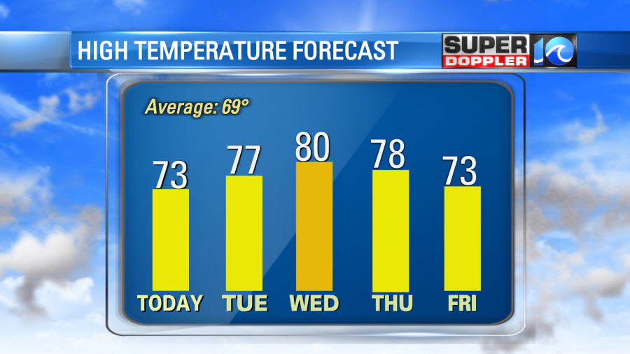
We had some nice weather this weekend. It was a little chilly in the mornings, but temps were great in the afternoons. It was seasonable. Going forward we will be pretty mild in the mornings and a bit warm in the afternoons during the week ahead.
High pressure has moved around a bit from yesterday. This will still bring us fair weather, but now we’ll have more of an easterly wind.
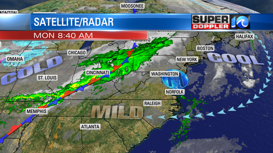
We’ll be partly cloudy today. There is a lot of rain (and some snow) off to our west. There is a smaller pocket of showers and moisture offshore. This will move west today, and could move over coastal North Carolina up to the Virginia state line. The rest of us will be dry and mild. High temps will be in the low-mid 70s. Humidity will be low to moderate. The moisture will increase tonight as the light flow off of the ocean continues. This will create some isolated showers in the region. We’ll have a mix of sun and clouds tomorrow with some isolated showers at times. It will be far from a washout, but an isolated shower will be possible at just about any time of the day. We’ll warm up tomorrow. High temps will be in the upper 70s.
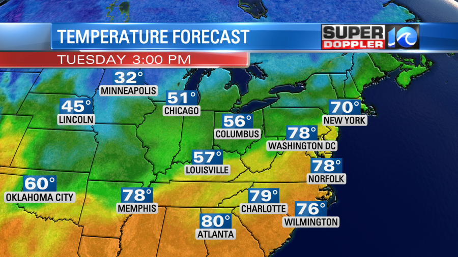
We’ll heat up even more on Wednesday with high temps in the low 80s. We should be dry for the rest of the week. High temps will be in the 70s. The average high temp is in the upper 60s for this time of year.
Low temps will be in the 60s.
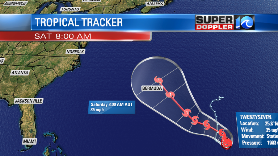
In the tropics there is a new system. Tropical depression 27 formed around the mid morning.
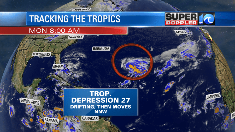
(Update: The tropical depression has become tropical storm Epsilon as of the 11am update. Still forecast to become a hurricane in about 3-4 days.)
This system is drifting around right now, but it will eventually move to the north/northwest, and it will gain some strength. It is forecast to become a tropical storm within the next 12 or so hours. The name will be Epsilon. The track takes it to the north and northwest for the next few days.
However, the models have the system turning to the north in about 5 days. Then they push it to the east or northeast as the upper level westerlies move the system.
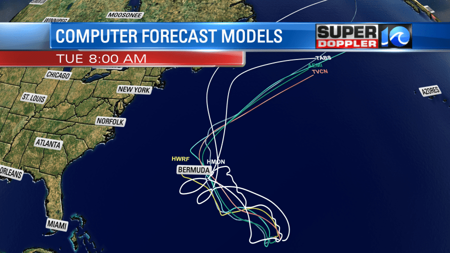
So it’s likely to stay offshore, but it could bring us some waves along the east coast. Stay tuned for updates on that.
Meteorologist: Jeremy Wheeler