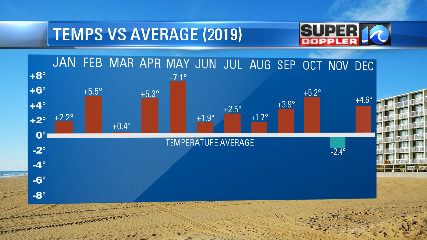
According to the National Weather Service, March 2020 was the 4th warmest on record.

This continues a long-term trend of above average average temperatures that go back now to about a year and a half.
Going forward, we’ll be below average for a few days, but it looks like we’ll warm up to the 70s by next week.
Today we have low pressure far offshore. It’s actually closer to the Canadian Maritimes. High pressure is off to our west.
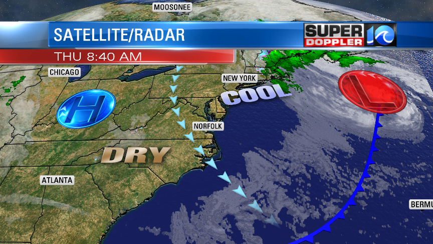
This is creating a persistent northwest breeze that will stay with us for the next couple of days. The low has gained some size and strength since yesterday. Today we’ll have a northwest wind running at 10-15mph with gusts to 25mph. There is some super dry air that is sinking into the region. Dew points have dropped to the 20s and 30s. This dry air will also aid in bringing us lots of sunshine today. High temps will be in the low 60s with some cooler temps near the shore.
Tomorrow the low will slip west just a little bit. Meanwhile, the high pressure zone will stay in place. This will increase the wind a little bit compared to today. Some of the gusts will be up to 30mph. Plus, the clouds will build a little from the northeast. So high temps will be in the upper 50s to low 60s. We’ll be cool and dry on Saturday. Highs will be in the upper 50s. There may be some minor tidal flooding returning to the region. Though I don’t think it will be as much as we had yesterday in the early morning. We’ll be dry and a bit warmer on Sunday. Highs will be in the mid 60s. Then we’ll warm up next week into the 70s. However, there will be some scattered showers forming next week as well.
Meteorologist: Jeremy Wheeler