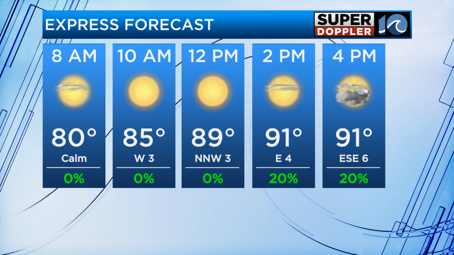
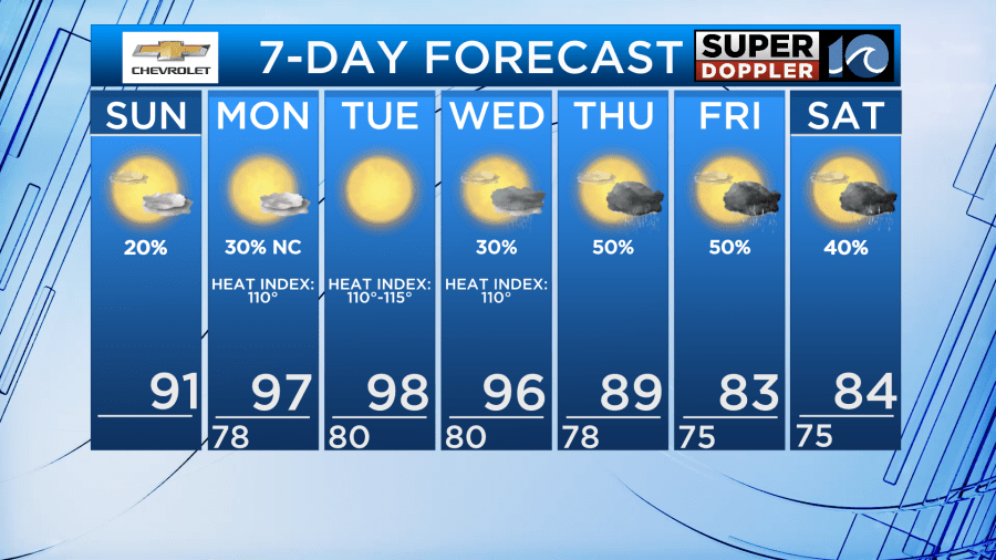
On Sunday the front that’s been bringing us rain over the past few days looks to fall apart, finally bringing our wet pattern to an end. We’ll have more sunshine and less of a rain chance. Not zero, but not as high and widespread as the past few days. The best chance for any storms will be in the late afternoon.
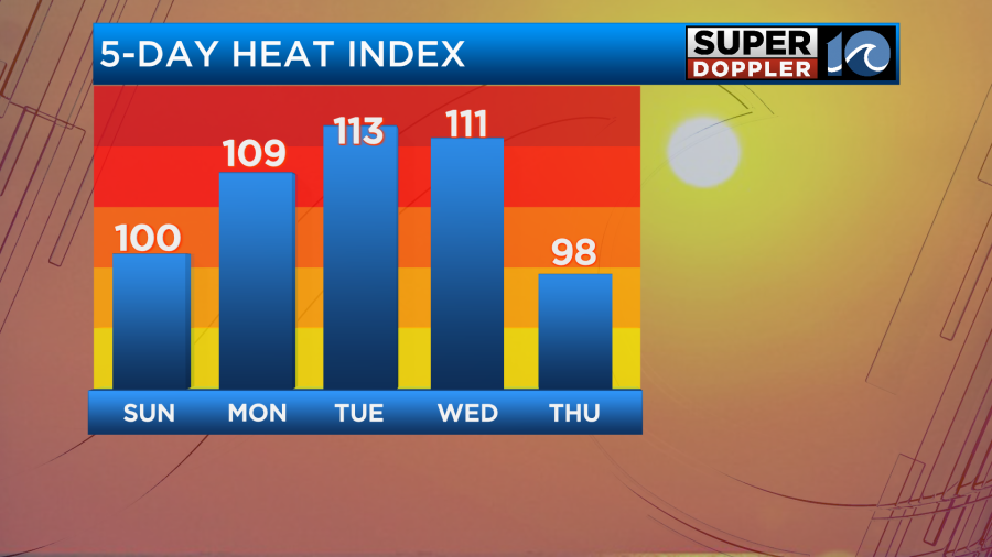
High temps will push back up to the low to mid 90s. Feeling like 100. A little hotter inland across NE NC, where heat index values could climb to 105°F.
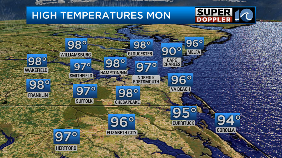
The heat builds again this week, with Monday and Tuesday temperatures in the upper 90s. A few spots could hit 100 on Tuesday, even in the metro. Heat index values of 105-115 will be expected again.
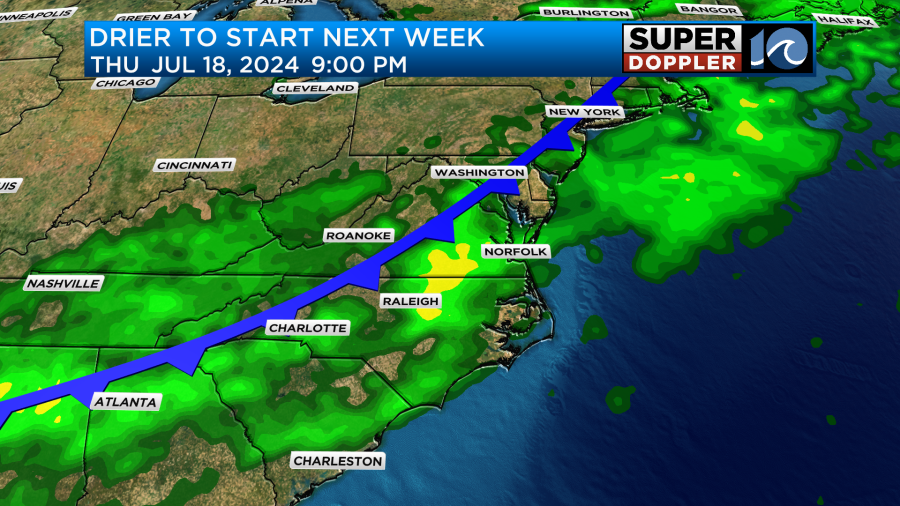
Rain chances return to the region late into the week as a front approaches again.
Hope you have a great weekend!
Meteorologist Ricky Matthews
Follow Ricky on Facebook and Twitter