Locally, we are going to have some wet weather for a while. No washouts (rain all day) are headed our way, but the chance for rain is decent for a few days. We have a stationary front overhead today that will create a bunch of scattered showers and a few thunderstorms.
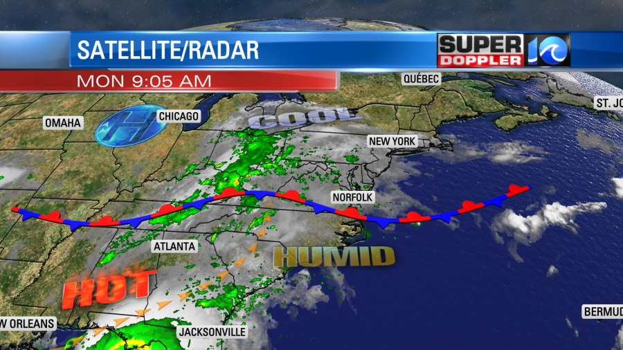
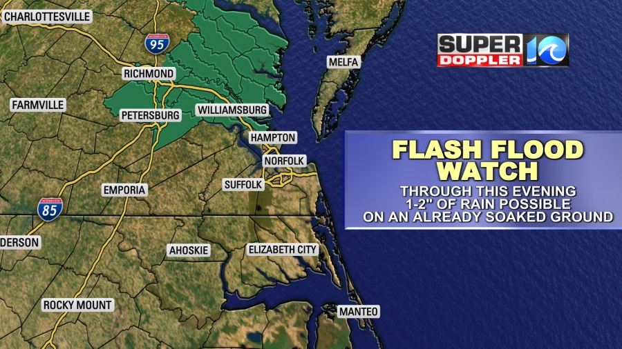
We could have a few heavy downpours. There is a Flash Flood Watch now for the Peninsula, Middle Peninsula, and Northern Neck until this evening.
Outside of that, we’ll be mostly cloudy with a few occasional peeks of sun. High temps will be in the low-mid 80s. Tomorrow the front will lift to our north as a warm front. High temps will be in the mid 80s with some upper 80s inland. We’ll be partly cloudy. There will be less of a chance for rain tomorrow. Though isolated showers and storms will be possible. I’d like to cut my grass today, but I may have to hold off until tomorrow. The chance for rain will increase from Wednesday into next weekend. Some of that will be from some indirect moisture from tropical storm Fred.
So yes the tropics are busy again. Over the weekend the number of tropical systems jumped to 3.
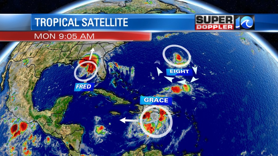
Tropical storm Fred is the one that is likely to hit the U.S. It is south of the Florida panhandle this morning. It is moving northward. It made a comeback from a couple of days ago when it pretty much fell apart. It had sustained winds of 60mph with higher gusts. It could strengthen some more before landfall this evening. It’s not out of the question that it could briefly become a hurricane. The latest path takes it very close to Panama City.
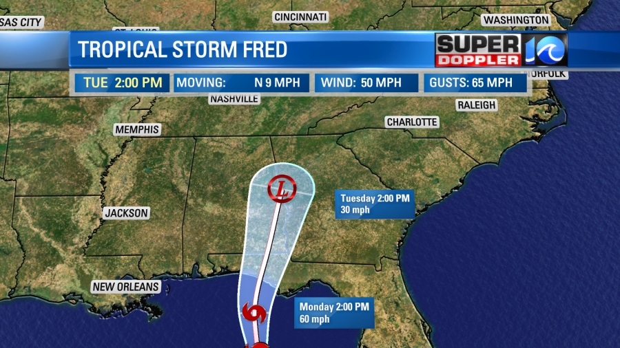
After landfall it will move north and weaken to a depression in the next 24-48 hours. It should fall apart from Tuesday into Wednesday. However, it will still bring a lot of rain to the southeast.
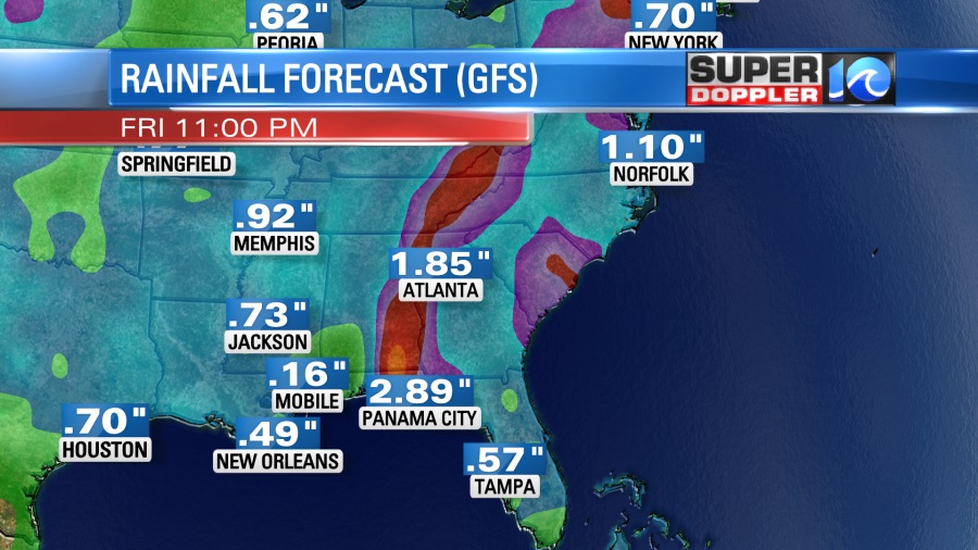
Some locations could pick up 5-6″ of rainfall. From Wednesday into Friday the deep moisture from the remnants of Fred will slide over our region. So we’ll have some scattered to occasional showers from that. The rain could possibly be heavy at times. So we’ll be on the lookout for some localized flooding later this week.
Meanwhile Haiti is having a rough time. They are recovering from a big earthquake that happened over the weekend. Unfortunately, they will be dealing with some heavy rain from tropical depression Grace and possibly some flooding/mudslides.
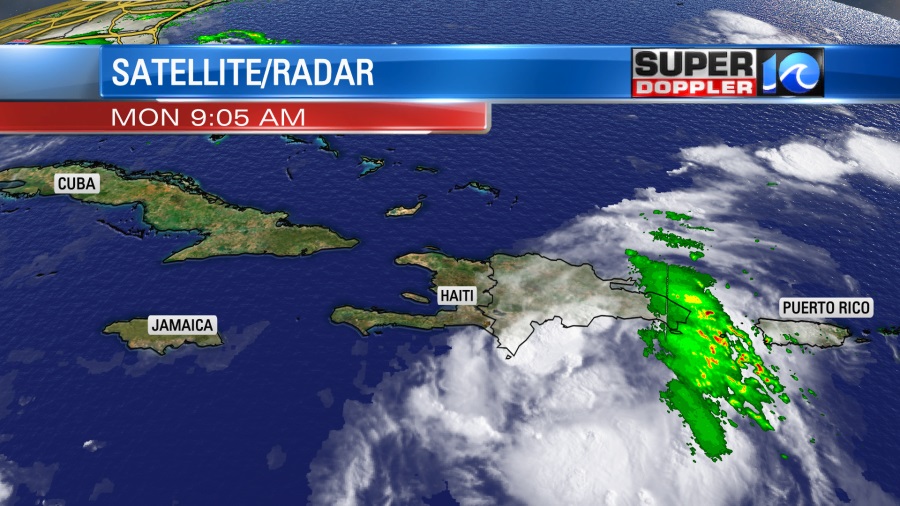
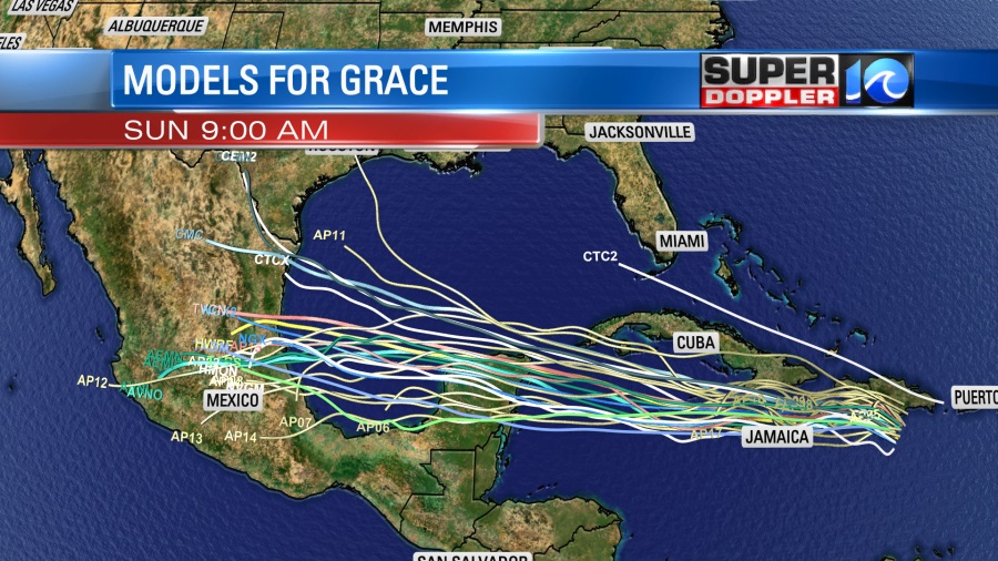
At least the system doesn’t have much wind. The strongest winds are offshore right now, and Grace is moving to the west. So after nearing Haiti the system will keep moving on a westerly track. It will likely pass south of Cuba. Over the next couple of days it is forecast to become a tropical storm again. It will head towards the Yucatan Peninsula, then into the Bay of Campeche. If it holds together, then it will likely move into eastern Mexico.
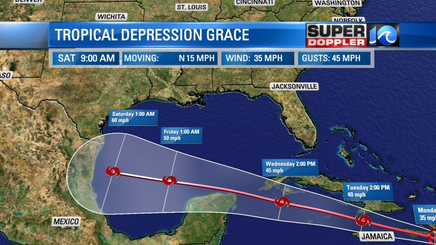
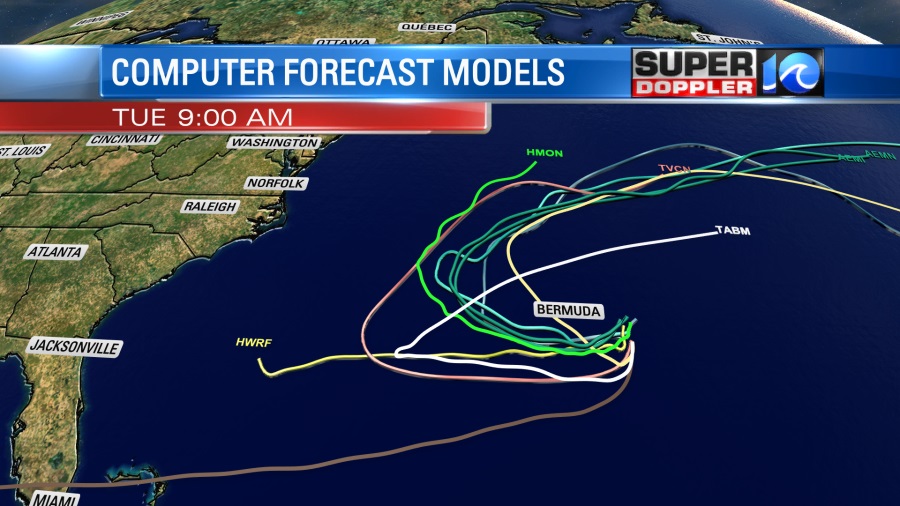
The models are pretty clustered around that scenario.
Even the National Hurricane Center mentioned in their discussion this morning that they will likely shift the track to the south in a later update.
Then there’s the newest system in the club. That is tropical depression 8. It is near Bermuda. It is forecast to drift around Bermuda over the next few days. (Literally).
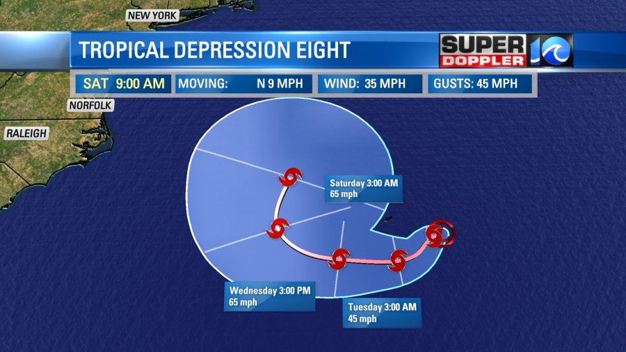
So it should stay out to sea. The models are in pretty good agreement about this.
It will likely become a tropical storm through that time. The next name on the hurricane list is Henri. If it follows this track, then it shouldn’t bother the East Coast. However, it will probably send us some nice waves. That will be good for surf next weekend, but not good news for swimmers. The rip current threat will likely increase.
So stay tuned for updates on all of this.
Meteorologist: Jeremy Wheeler


