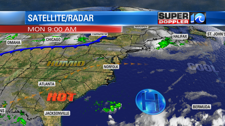
Locally, we will have more quiet weather today. However we will also start heating up the temps. Yesterday, we had highs in the 80s with some low-moderate humidity. Today we’ll be closer to 90 degrees with moderate humidity.

We have a large/strong area of high pressure to our southeast. There is a cool front over the Midwest that is almost stalling out.
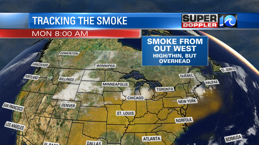
Locally, we’ll see a lot of sunshine today. You may notice that it looks like there is a thin veil of clouds. There is some ash/dust coming over from the western U.S. wildfires, but it will stay up thousands of feet in the air. So it won’t impact air quality.
We’ll have a west/southwest wind at 5-10mph. Tomorrow we’ll start and end the day a couple of degrees higher. High temps will be in the low 90s. However, the humidity will also increase. So the heat index tomorrow will be more in the mid-upper 90s. We’ll be mostly to partly sunny, and no rain is in the forecast. We’ll be in the upper 80s on Wednesday with a little more clouds. There will be some isolated showers or storms. We’ll cool down some more Thursday and Friday as a cool front moves towards our region. However, the front will probably stall out just to our north. This will increase the rain chances and the clouds. That’s what will probably keep the temps down. Not the front itself. The humidity will stay up through at least Friday.
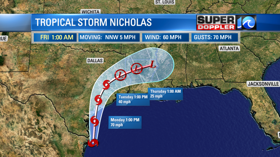
One tropical system fell apart over the weekend (Larry), and a new one has formed (Nicholas). Nicholas is a tropical storm that is to the southeast of Brownsville, Texas. It’s wobbling northward.

The track of Nicholas takes it northward today. The National Hurricane Center has it making landfall sometime tonight somewhere near Victoria, Texas. It could be a strong tropical storm at the time. It may even briefly become a hurricane before landfall depending on the track.
After landfall it will weaken and move north. Then it is forecast to move northeast as a tropical depression.
This system will bring some gusty winds to the coast. There will be some storm surge as well. However, heavy rain and flooding could be the biggest threat to the area. Here is the forecast from the GFS model through Friday.
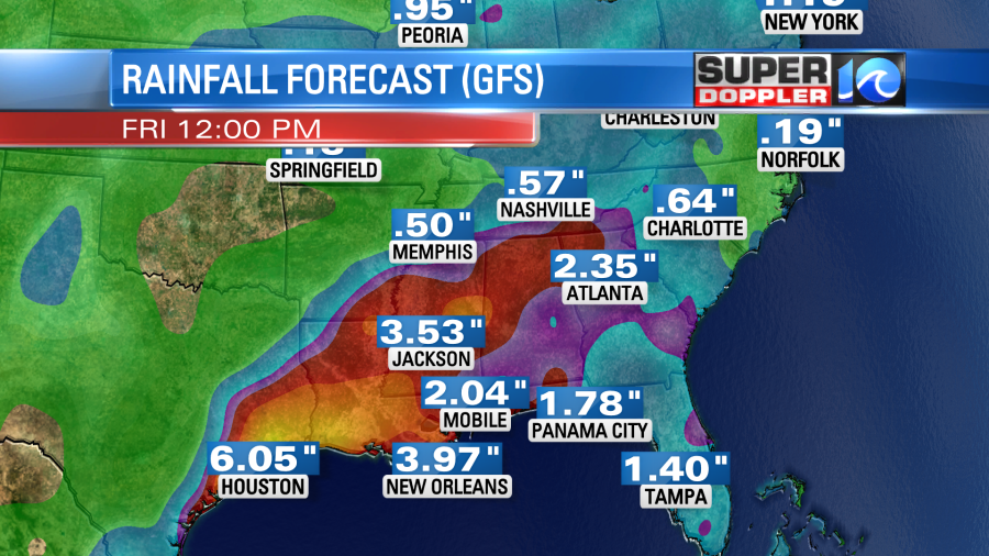
The yellow area could see 6-10 inches of rain. A few local spots could see 10-15 inches. This is bad news for that whole region. The eastern part of Louisiana into Mississippi is still recovering from Ida. The western part of Louisiana is still recovering from last year’s storms like Laura and Delta. So we’ll see how the folks down there fare the storm.
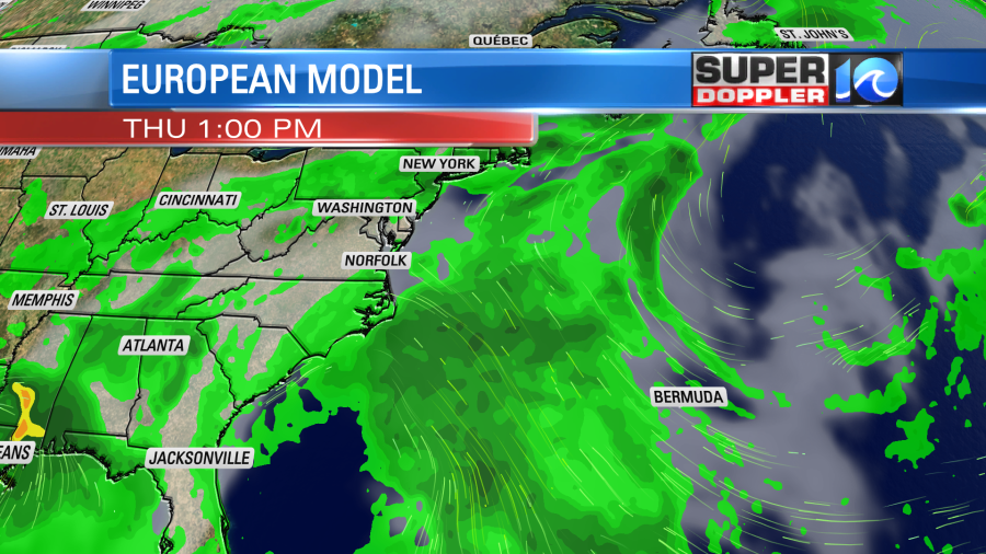
There is also a tropical disturbance in the western Atlantic that we are watching. This is north of Haiti.
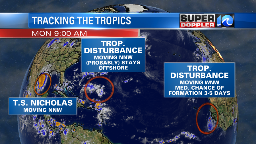
It’s just a cluster of thunderstorms right now, but it could turn into a tropical system in the next 2-4 days. The good news is that it looks like it would stay offshore whether it forms or not. The European model does have it moving northward, but it doesn’t have it doing much. Here is the Thursday forecast from that model:
If this were to become a tropical storm and track a bit more west, then we will have to increase our rain chances here later this week. Stay tuned. There is one more disturbance coming off of Africa that has a medium to high chance of formation over the next few days as it moves to the west/northwest.
Meteorologist: Jeremy Wheeler


