This is not going to be a typical Halloween. It is going to be warm, humid, breezy, and there will be some strong storms later tonight. (Most likely after trick-or-treat time). Let’s talk about it. Today we are in the warm zone which covers the eastern third of the country. However, there is a strong cold front to the west, and it feels like Winter west of that front.
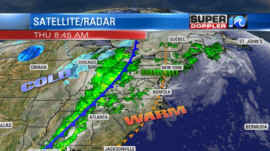
There has been snow falling over parts of the Midwest since last night. (Blue area on map above). Now look at the temperature map from this morning:
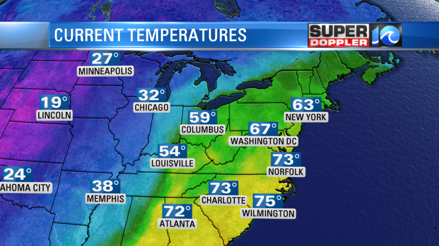
We started the day near 70 degrees. Meanwhile, it was in the 20s and 30s over parts of the Rockies and Midwest.
During the day we’ll have a few scattered showers. We’ll have a 20-30% chance between the morning and the mid-afternoon. High temps will rise to the low 80s. We’ll have a strong wind increasing out of the south. They’ll run at 10-20mph with gusts to 30mph. Dew points will be in the upper 60s to low 70s. That’s muggy for this time of year.
By the evening most of the showers should lie to our west. I’m still optimistic for the trick-or-treat forecast between 5-8pm.
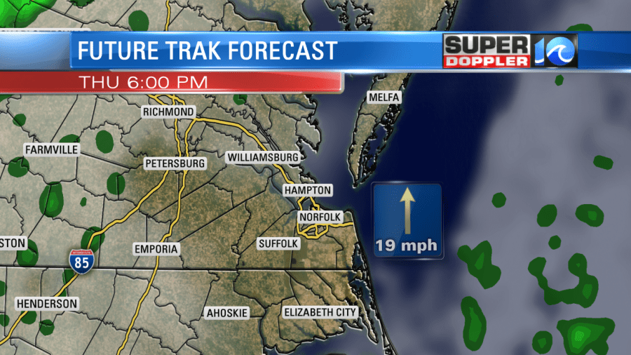
By 8-9pm a line of showers and storms will form over in western/central Virginia and North Carolina. They are forecast to move into our region between 10pm until 2am.

The timing of the storms may change a little. So if you are in the western part of the viewing area, then keep an eye to the sky by 9pm just in case things speed up. There is a risk for severe weather tonight with the highest risk just to our west, and the lower threat (marginal) near the coast.

Strong gusty winds to over 55mph are possible, but an isolated tornado is also not out of the question. A few showers may linger into early tomorrow morning, but then we’ll be dry for the rest of the day. It will be much cooler. You could even say colder. High temps will only rise in the low 60s. Plus we’ll have a northwest breeze through the early afternoon. We’ll be cooler and drier for the weekend with high temps in the upper 50s to low 60s. Low temps will be in the 40s, and possibly in the 30s inland. We’ll stay cool and dry on Monday.
There is a subtropical storm over in the eastern Atlantic. Rebekah had winds of 45mph this morning. It was west of the Azores moving generally east.
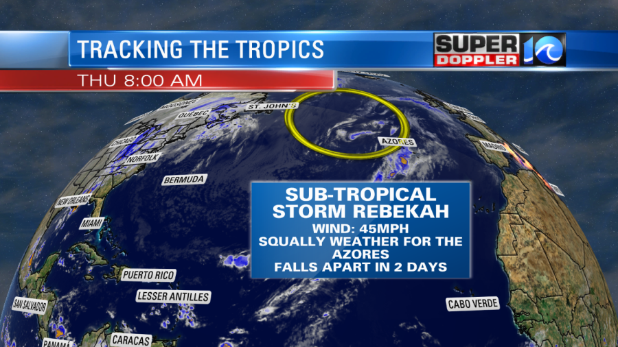
It will bring some squally weather to the Azores islands for the next day or two. Then it will fall apart as it moves east. The only impact here is some higher waves along the coast, and that is more from the bigger non-tropical low pressure system that Rebekah is rotating around.
Meteorologist: Jeremy Wheeler