See updates in bold below.
Tropical storm Isaias has remained offshore from Florida since yesterday. There were several models which took it inland to Florida over the past 2 days, and those have not verified. Therefore the storm is now forecast to become a category 1 hurricane before making landfall late tonight or early tomorrow morning. Wind shear is also decreasing in the short-term.
This morning the bulk of the rain was on the east side of the storm. Most of the rain has stayed offshore from Florida as did the stronger winds

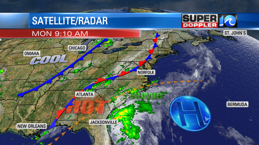
The storm is on a northerly track. It will start to turn a little more north/northeast later today. There is an unseasonably large dip in the jetsream over the central U.S. It is wrapping around a pocket of cooler temps over the central U.S.
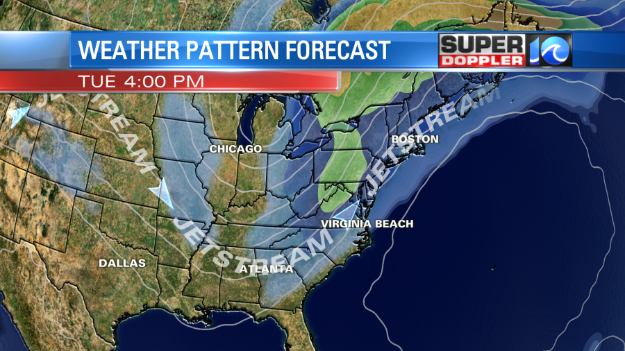
This feature is going to pick up the storm later today. As Isaias moves more northward, then the upper level winds will really start to move this system. It will jet the storm quickly to the northeast tomorrow possibly moving it at 20-30mph by the afternoon.
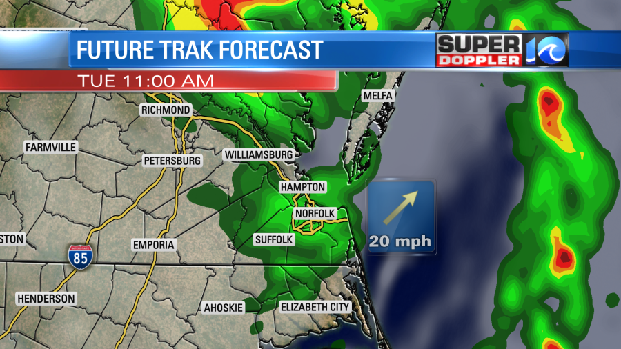
So after landfall near Wilmington tonight, the storm will head towards our region. It is forecast to be near the state line by early tomorrow morning around 3-5am. Then into the metro between about 5-8am.
UPDATE: Isaias is now forecast to remain a hurricane up to about the state line between Virginia and North Carolina as of the 11am update. The National Hurricane Center then has it turning into a tropical storm between about 5am until 8/9am.

By about 8-11am it will be moving northeast of the metro. Then by the midday and early afternoon the storm will be zipping through the Delmarva region.
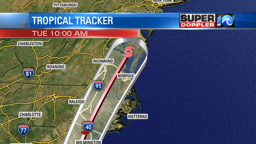
The models are in very good agreement with the track. So there is a pretty high confidence in the path now.
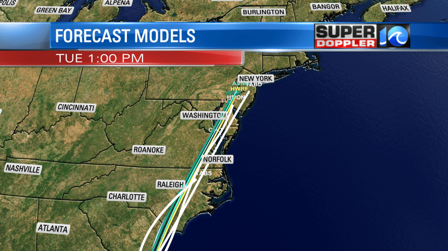
However, they are still in a little disagreement about the timing. I think the storm will move so quickly that it’s hard for many of the models to accurately predict its speed. One problem with the fast motion is that I don’t think it will have a lot of time for land interaction to weaken the storm. So now it looks like this will be a moderate to strong tropical storm as it moves through. Update: it may remain a minimal hurricane up until the VA/NC state line. It could have similar strength to tropical storm Michael from 2018. At least in terms of wind.
The max wind speeds will be running about 30-45mph. The gusts will be up to 65mph. There may even be a few isolated gusts up to 70mph. These types of winds will be most likely during the morning hours.
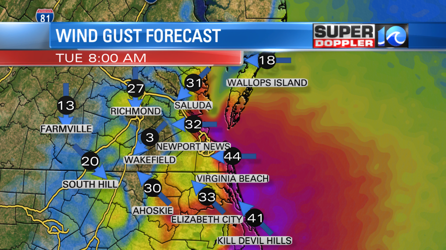
Those types of winds also won’t be just for the coastal areas. We will have some of those winds possible anywhere in the viewing area.

This will create scattered to numerous power outages in the region. Some could lose power for several hours. It’s possible that some areas could lose power for a day or two. However, the system should move out fast. So crews should be able to start working right away.
The strong winds should move through fast. Plus, they won’t have a long fetch. So I don’t think tidal flooding will be an issue for the bulk of the region. Having said that…There may be some minor tidal flooding along the southern Outer Banks. Also, I think we’ll have the wind-tide effect happen from Knotts Island up into southern Virginia Beach. Luckily the heaviest rain shouldn’t fall in that area. There also may be some minor (possibly up to moderate) tidal flooding later in the day up on the Bay side of the Eastern Shore.
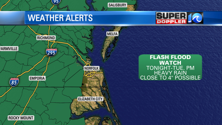
There is a Flash Flood Watch in effect for some inland/western locations.
Isaias is expected to interact with a stationary front that is inland today and tomorrow.
So the models are in pretty good agreement in putting the heaviest rain west of Hampton Roads.
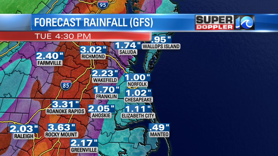
However, some are showing the metro on the edge of the heavy rain. Here is our Future Trak model
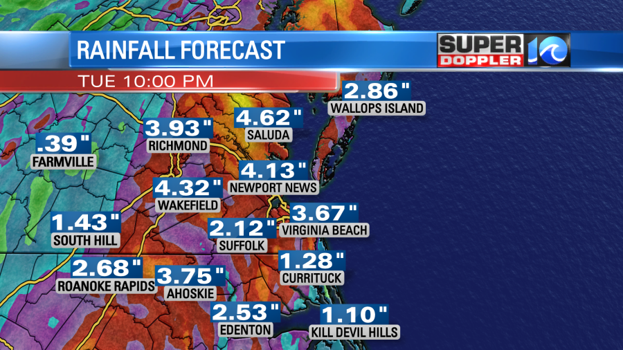
The rainfall will be heaviest from the early morning through the midday hours.

There will be a threat for a few tornadoes in the region. I guarantee that there will be a couple of warnings. There may be a watch ahead of time, but that could be overlooked by the other alerts in the region. Remember, a warning means that a tornado has been spotted or is evident on radar. So take action in that case. The overall wind gusts may be strong enough that they will feel like a tornado is in your area anyway.
So today…Secure all of your lawn furniture. Charge up your mobile devices. Gas up your generators. Get your batteries and flashlights in-check.
We will have updates on this throughout the day. Stay tuned for updates. Be safe!
Meteorologist: Jeremy Wheeler


