
Isaias was only a tropical storm when it moved through most of the eastern United States yesterday. However, it left an amount of destruction equal to a hurricane.
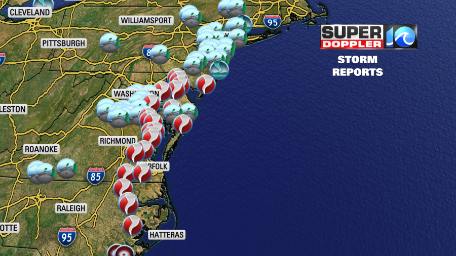
There were about a dozen reports of tornadoes in our region.
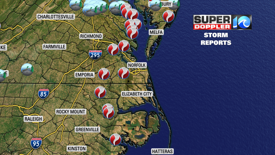
As I write this, there are 4 tornadoes confirmed by survey so far. There was an EF-2 tornado near Courtland Virginia. It caused damage to numerous homes and businesses. Estimated maximum winds were between 120 and 125mph.
There were 2 tornadoes in Suffolk. There was an EF-1 that hit the downtown area. We showed a lot of footage of this in our newscasts. Maximum estimated winds were estimated to be around 100mph. There was also an EF-0 in the city of Suffolk. Though that one looks like it passed to the west of downtown. That one left some snapped and uprooted trees.
The 4th report that I have is for western James City County. It was near “Governers Land at Two Rivers”. This one was estimated to be an EF-1 with maximum winds of 85-90mph. Numerous trees were snapped, and there was some roof damage. You can see the latest reports from the National Weather Service in Wakefield here: NWS storm surveys.
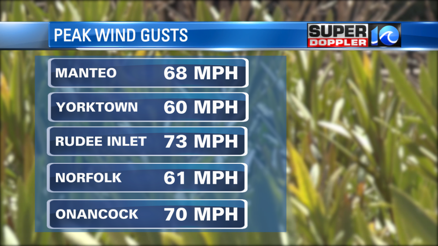
I mentioned in yesterday’s blog that these tornadoes were all spawned along a large/slow-moving rain band. However, the center of the storm came through the region later in the morning, and it also caused a lot of straight-lined wind damage. Some of the gusts were close to hurricane force (74mph).
The rainfall was pretty close to the forecast. We had about 0.5″ up to 1.5″ of rain along the coast. The rest of the region had 2-4″. There was one location near Williamsburg that had about 5-6″.
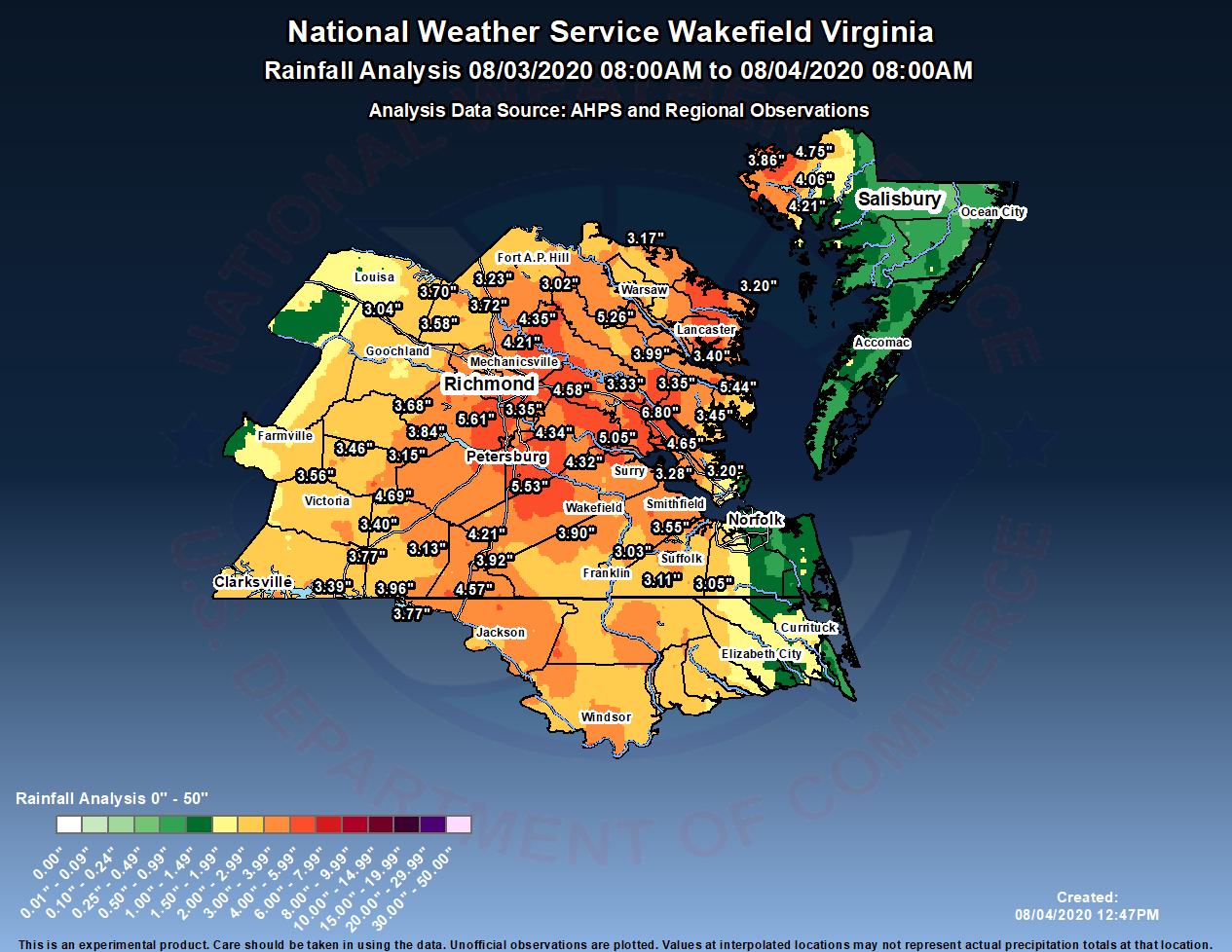
There was some flooding reported yesterday around Williamsburg.
The storm is now up all the way into eastern Canada. It has become a remnant low. We have a cool front moving towards us today, but it will stall out to our west. High pressure is offshore.
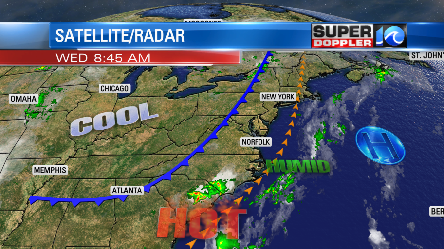
We will be seasonably hot and humid here. However, it will be much cooler in the Midwest. Take a look at the afternoon temperature forecast:
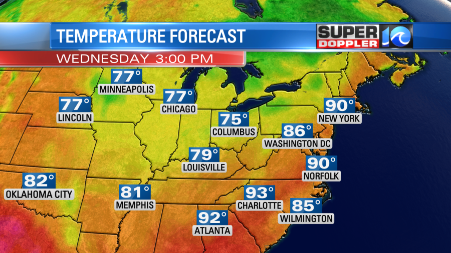
They will only have high temps in the 70s there (which is very rare). Meanwhile we’ll be in the 90s with a heat index above 95 degrees up to near 100. We’ll be partly cloudy today with some isolated pm showers and storms. Tomorrow, the front will edge closer to Hampton Roads. We’ll have a mix of sun and clouds. There will be scattered showers and storms form the mid morning into the afternoon.
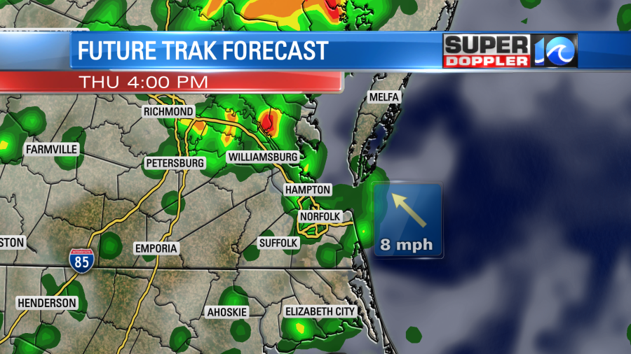
There may be some strong storms with heavy downpours and gusty winds. This is not good news for cleanup efforts, but at least we have some time before then. At least we’ll be slightly cooler tomorrow with high temps more in the 80s. We’ll have a few afternoon showers and storms Friday and Saturday. High temps will be near 90.
Everyone be safe during cleanup! Stay tuned for more damage surveys from the National Weather Service.
Meteorologist: Jeremy Wheeler


