It was after yesterday’s weather blog when I checked out the national “departure from average temperature” map. I first thought the map was broken. Then I realized that it wasn’t.

Basically the entire country will be either above or near average today with a huge section of the country 15-25 degrees above average. I can’t remember a time when I saw it that pronounced. We will have some warming here today, but it will actually be close to average. High temps will rise to the upper 50s with a couple of 60s south. This is after starting in the 30s and 40s.
High pressure is to our south with a stationary front to our northwest.
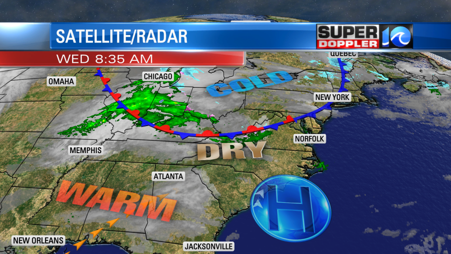
We’ll have a light southeast wind develop, but the wind will be much weaker than yesterday. There will be a lot of strong sunshine for the first half of the day. Then clouds will build into the afternoon and evening. No rain is expected today.
Tomorrow the front will lift north as a warm front. High pressure will be to our south. Winds will increase out of the southwest, and we’ll have fair skies. This will push our high temperatures up to the upper 60s. It’s possible that we may hit a couple of 70s over northeast North Carolina.
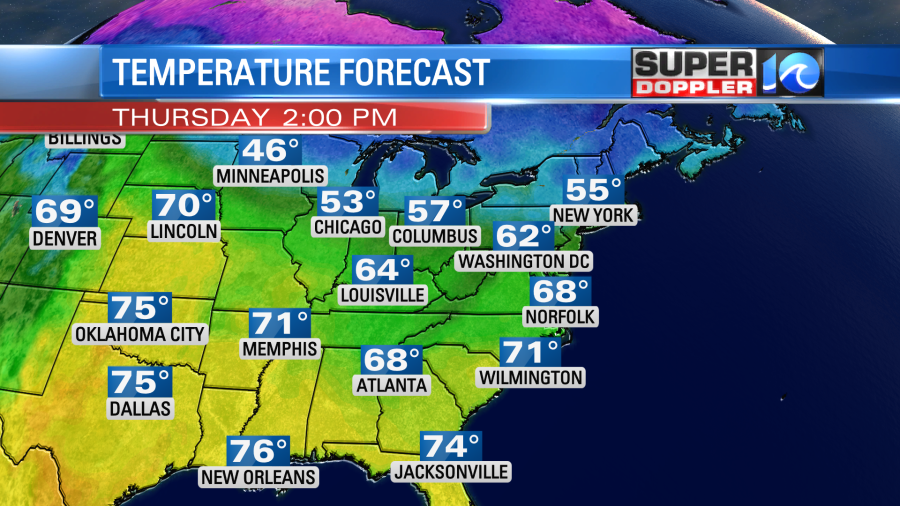
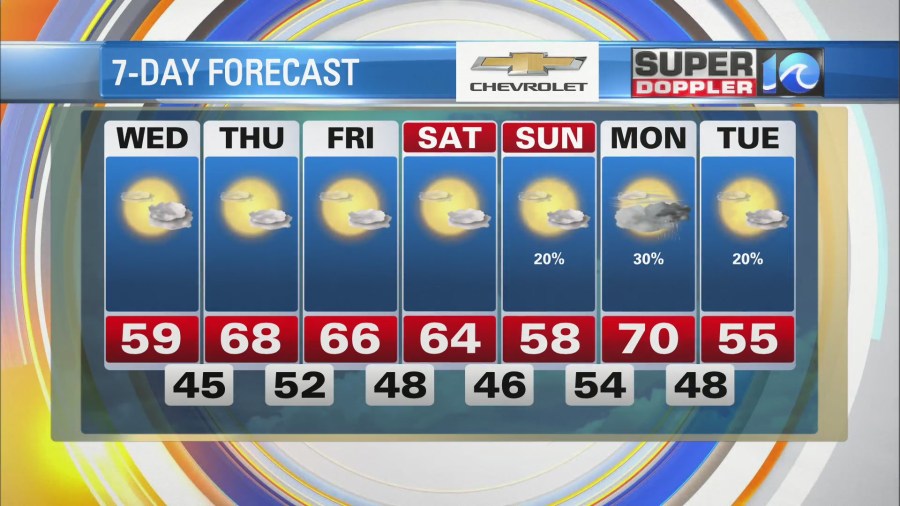
Many locations over the central U.S. will be near or over a record high temperature. Locally, we’ll stay warm and dry on Friday and Saturday with highs in the mid 60s. Then we’ll cool down on Sunday to the upper 50s. There will be a mix of sun and clouds with some isolated showers. There’s a little better chance for rain on Monday as temps shoot back up, but it will just be a few scattered showers. We are aiming for 70 degrees on Monday with a strong southwest breeze.
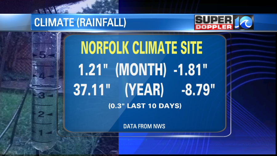
I’ve been talking about the dry air lately. We actually finished November with only 1.21″ of rainfall. This was 1.81″ below the average. We are down a whopping 8.79″ for the year!
There is a large portion of the region in a moderate drought (level 2 out of 5). Almost our entire viewing area is in a moderate drought according to the U.S. Drought Monitor.
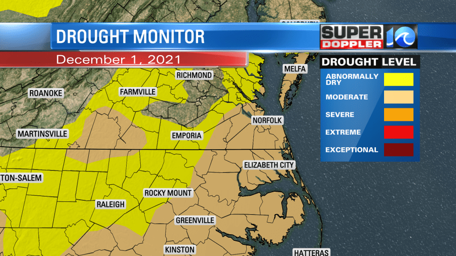
The growing season is pretty much over, but there are a couple of Winter crops (Winter wheat, broccoli, carrots). Also, the trees need some rain. Plus, it helps to keep things clean. So for now I don’t see much rain here over the next few days. The GFS model is advertising some decent rain next Wednesday, but we’ll see if it holds on to that forecast. Finally, the state of North Carolina has an open burn ban in effect until further notice. Another, problem that could get much worse without rain.
Meteorologist: Jeremy Wheeler
