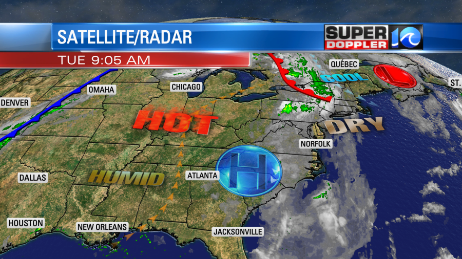
Yesterday ended up being another nice day in the region. We had highs in the upper 70s to low 80s with dry conditions. Today will still be nice, but there will be some small differences. First off, we’ll have a little more clouds than yesterday. Skies will be partly cloudy. High pressure is still in the region. There is a warm front that is stalling out to our north, and a strong cold front moving from the Rockies to the Plains states.
I’m not expecting rain for most of the day, but an isolated shower may drop into the region late in the afternoon into the evening. It’s a low chance. High temps will rise to the low-mid 80s this afternoon. The humidity will creep up slightly, but overall it will still be a dry day.
Tomorrow we’ll have a stalled out front just to the north with a cold front off to the west. We’ll be partly to mostly cloudy through the day. There could be some isolated showers in the morning, but there will be some scattered showers and storms developing in the afternoon.
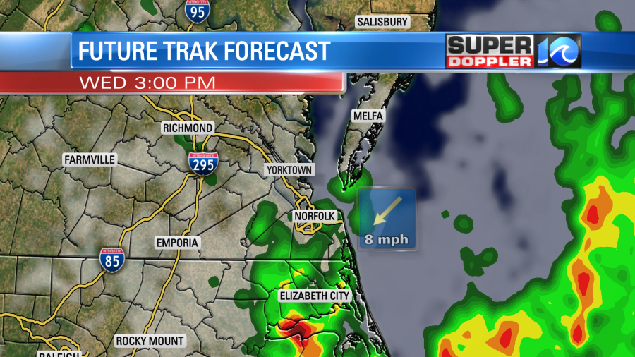
It will be warmer and more humid with high temps in the upper 80s (a couple of 90s inland/south). So there will be some fuel for the storms. Winds will be more consistent out of the southwest. We’ll have another round of showers and storms in the evening. Some of those could pack a punch. We’ll see. The timing on the showers and storms could still change. So stay tuned for updates.
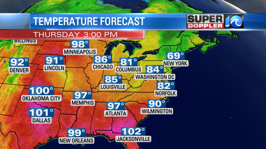
After some isolated showers Thursday morning we’ll dry out by Thursday afternoon. High temps will drop to the low 80s. So we won’t continue to build the heat. Instead we’ll cool down a bit.
We’ll stay dry and mild over the weekend. The latest models have us generally dry with high temps generally in the 80s.
There’s one other thing to talk about. There are a couple of brush fires that are burning that may impact you. There is one (relatively) small one in eastern Chesapeake near Elbow road. That one was billowing yesterday, but it was just smoldering this morning.
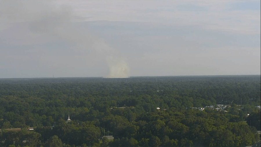
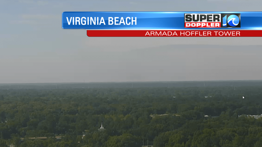
Some residents in eastern Chesapeake or western Virginia Beach may smell smoke from this. However, there is a bigger wildfire down in Hyde County, N.C. This one has grown to 800 acres.
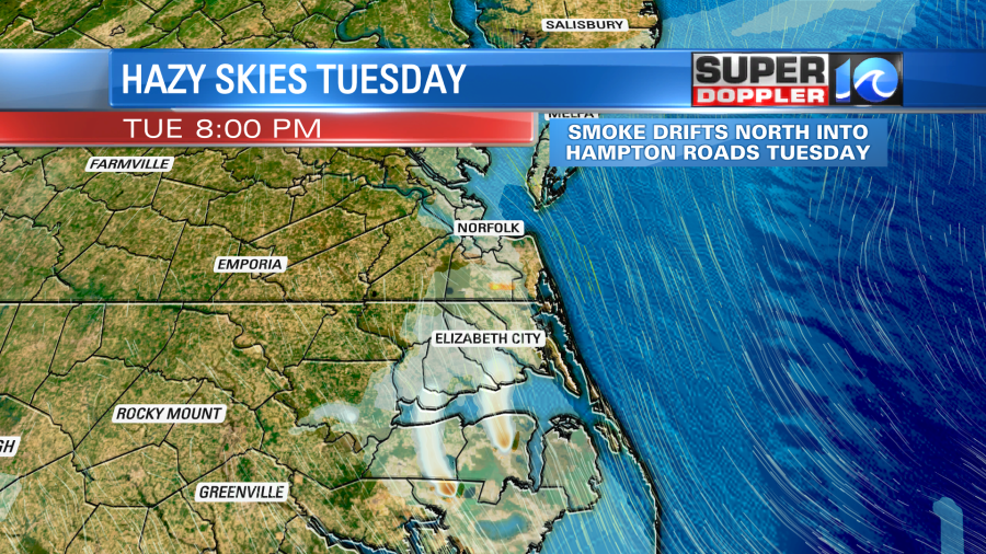
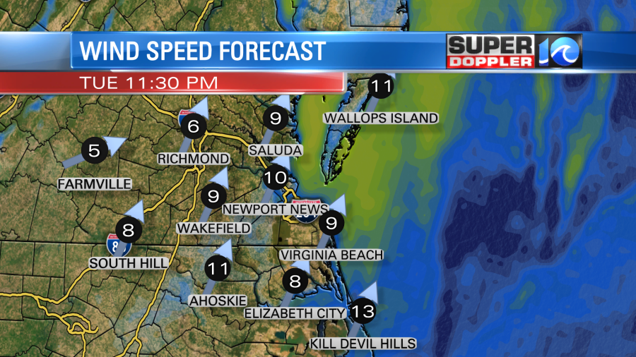
Some of this smoke may move up into Hampton Roads later today into tonight. Most of that smoke should be elevated. However, you may smell it in some places over northeast North Carolina up to the state line. It’s possible that it could settle overnight over part of Hampton Roads. The winds will be light and variable today. However, it will be more out of the south/southwest tonight and tomorrow.
Check back for updates on both of these fires. Hopefully, we’ll get some rain on them between Wednesday and Thursday.
Meteorologist: Jeremy Wheeler
