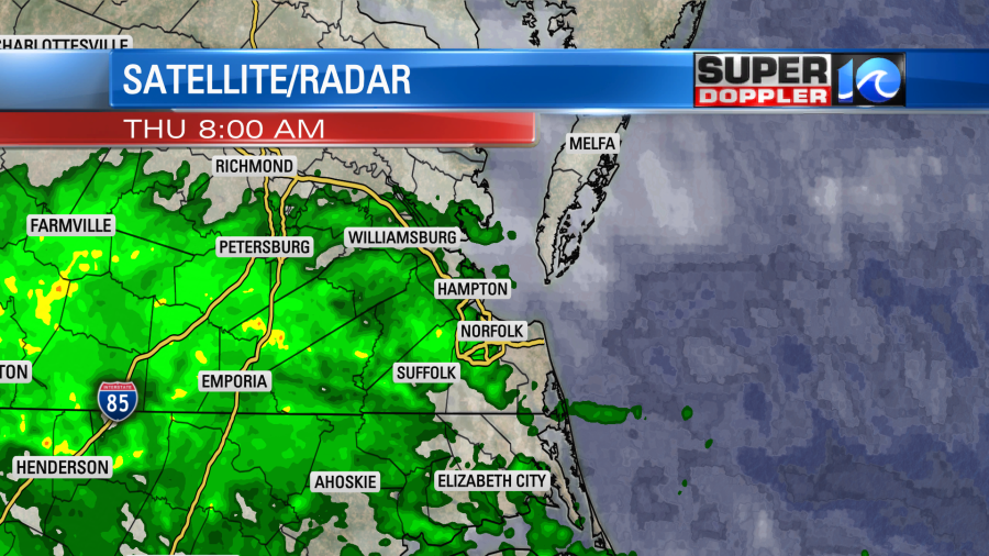
While tropical depression Sally is rolling into Georgia today, the moisture from it has made a strong push all the way up into our region. We already had a lot of clouds since yesterday, but this morning some scattered rain showers moved in for the 2nd half of the morning commute.
Sally will continue to move east/northeast today. It is pretty much just a rainmaker at this point.
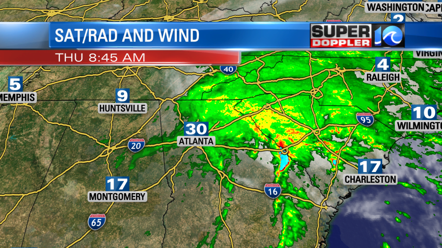
As it tracks across the Southeast today it will start to interact with a cold and warm front to its north.
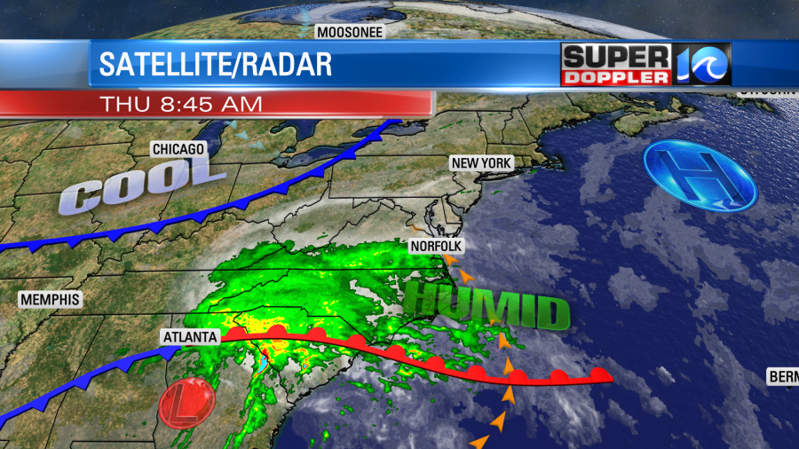
This will allow it to gradually lose its tropical characteristics. So by tomorrow it should be a post-tropical low to our south. However, the warm front attached to the low will push north. It will run into a cold front dropping in from the north.
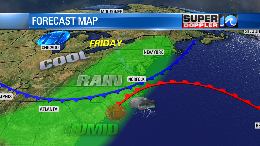
This will set up a band of heavy rain over our region late tonight into tomorrow morning. After the front passes, then we’ll dry out a bit. So we’ll have more scattered showers into Friday afternoon. The rain should end by tomorrow night. Then we’ll dry out over the weekend. The breeze will stay up though. Before it ends we could pick up a solid 3-5″ of rainfall in our area.

There is a Flash Flood Watch in effect for the region from this afternoon into Friday evening.
Here’s some more specific details about the rain. By this afternoon rain should be pretty widespread. It may be heavy in a few spots.
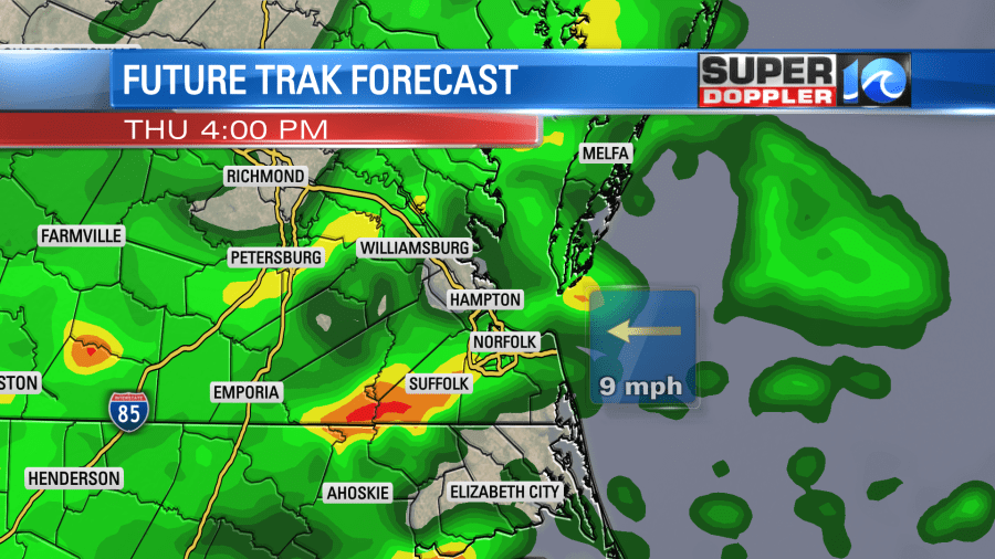
Overnight as both fronts get closer we’ll have a big clusters of heavy downpours.
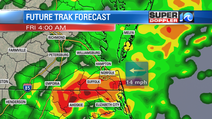
There could be an isolated tornado to the south as the warm front lifts as far north as Corolla and Elizabeth City. It will be more unstable south of (and near) the front. The heavy rain will continue into tomorrow morning until about 5-7am. Then the rain will taper off through the afternoon.

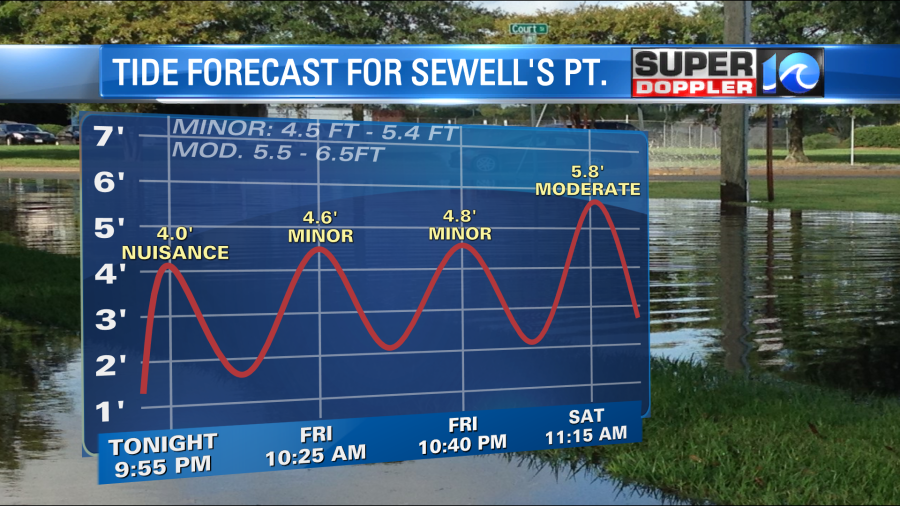
We will dry out for the weekend, but an isolated shower could linger into early Saturday morning. High temps will be in the mid-upper 70s today. We’ll have a light southeast wind. Tomorrow we’ll cool down with highs in the low 70s. Winds will increase out of the north. It will run at 10-20mph with gusts up to 30mph. The front will drop to our south over the weekend. We’ll be seasonably cool for sure. High temps will be in the upper 60s to low 70s Saturday and Sunday. The breeze will continue out of the northeast for a couple of days. On top of that we are in the “New Moon” phase. Plus, seas are already rough from all of the tropical systems that have recently been in the Atlantic. So we will have some minor to moderate tidal flooding as we go through the weekend.
Speaking of the tropics. Tropical storm Vicky is continuing its weakening trend. It should fall apart in the next couple of days over the central Atlantic. Meanwhile hurricane Teddy is regaining strength. It is forecast to keep moving northwest over the next 3-4 days. Then it will turn more to the north.
The most likely path of Teddy (center line) takes it just east of Bermuda in a few days. However, it might get pretty close. It is forecast to be a category 2 storm at the time.
There are 2 tropical disturbances that have a fairly high chance of formation. They are highlighted by yellow circles on the pic below.
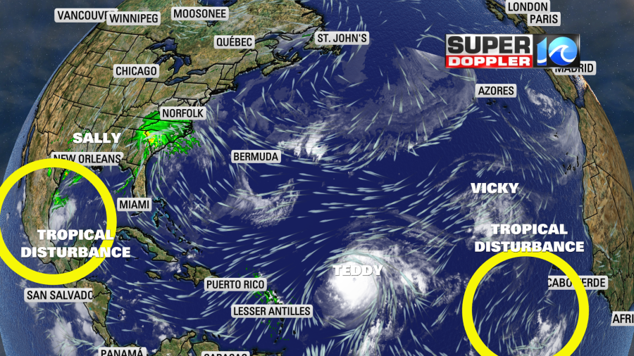
The one in the Bay of Campeche is likely to become an official system later today. Stay tuned for updates to all of this active weather.
Meteorologist: Jeremy Wheeler


