
Some very dry air has made it into our region (as expected). It felt great yesterday with high temps hitting around 80 degrees. Today we are still going to be dry, but the temperatures will warm up. High pressure is shifting around a bit. So we’ll lose the cooling north breeze. It will be replaced with a light southwest wind.
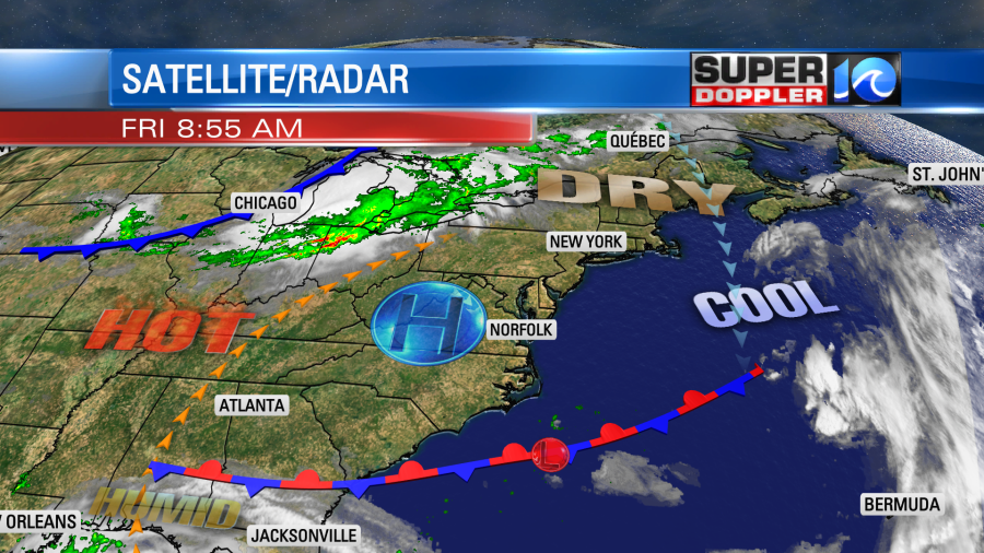
Between that and the strong sunshine temps will rise fast through the day. We started in the 50s and 60s, but afternoon temperatures will jump up to the upper 80s. There may even be one or two 90s in some inland spots.
Tomorrow the heat that has been occurring to our west will slide east some more. So our local high temps will hit the mid 90s.
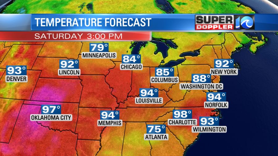
The heat index tomorrow will be in the upper 90s to near 100. It will still be hotter over the central and western U.S. The record heat out there will last for a little bit longer. We’ll be partly cloudy here with dew points rising into the 60s. Be sure to stay hydrated if you are at any outdoor Juneteenth events or if you are outside for a decent stretch of time.
We’ll still be pretty hot and humid on Sunday for Father’s Day. We’ll be a bit more humid. So there will be a few more clouds. There could also be some isolated showers or storms in the region. This should drop temperatures slightly (low 90s), but the heat index will still be in the mid 90s. The models backed off of the rain on Monday. We will still have a lot of moisture, but the area of low pressure from the Gulf of Mexico (more on that in a moment) looks slower and more broad now. So a few showers are possible on Monday with a mix of sun and clouds. Highs will be near 90. Then the thicker moisture from that system will focus on our region. A cold front will also be moving in from the north. So Tuesday looks like it will be the better chance for rain.
As of this writing the National Hurricane Center still has the feature in the Gulf of Mexico as a “Potential Tropical Cyclone”. It is still a spinning/brewing mass of thunderstorms, but the center hasn’t really come together yet.
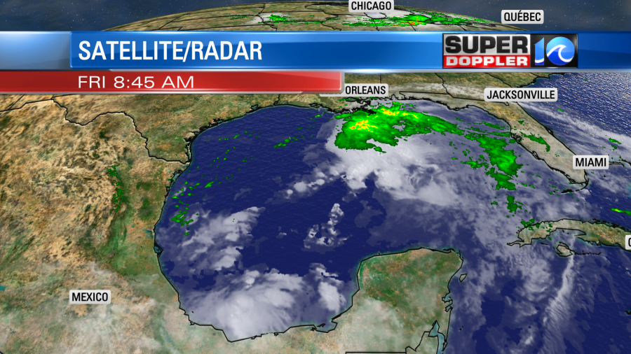
The forecast calls for this feature to become tropical storm Claudette later today. The track then takes it into eastern Louisiana by early tomorrow as a tropical storm.
The storm may contain some strong gusty winds, but it is definitely going to have some heavy rain extending to the northeast of the center.
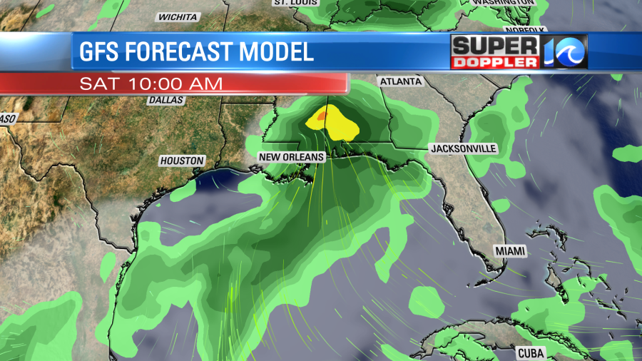
The system will then move northeast over land and weaken. It will probably fall apart by Sunday. However, the moisture will keep streaming northeast towards our region. Again, we may have a few showers on Monday, but the chance for rain looks higher on Tuesday. This will depend on whether or not the system completely falls apart, or if it will become a weak/broad area of low pressure. There will likely be some flooding over the Gulf Coast. Some locations there could get about 5-7″ of rain. At least!

The models are highly variable as to how much rain we will get here. So I’ll let the weekend meteorologists update that part of the forecast.
Meteorologist: Jeremy Wheeler


