The current heat wave is still ongoing here. It will run through the weekend as high temps stay in the 90s. It was in the 90s yesterday, but I will say that Thursday’s temps were a bust. Yes! We were all calling for upper 90s and dangerous heat. We ended up in the low 90s over most areas.
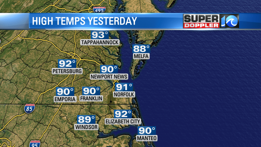
Why? Well, the strong breeze helped out with how things felt anyway. However, a pretty thick deck of clouds rolled in around midday, and that capped the temperature rise. I believe this was from a gravity wave, which is a very subtle feature. The heat index was around 100. We didn’t have hardly any rain until the evening. Then we had scattered showers and thunderstorms.
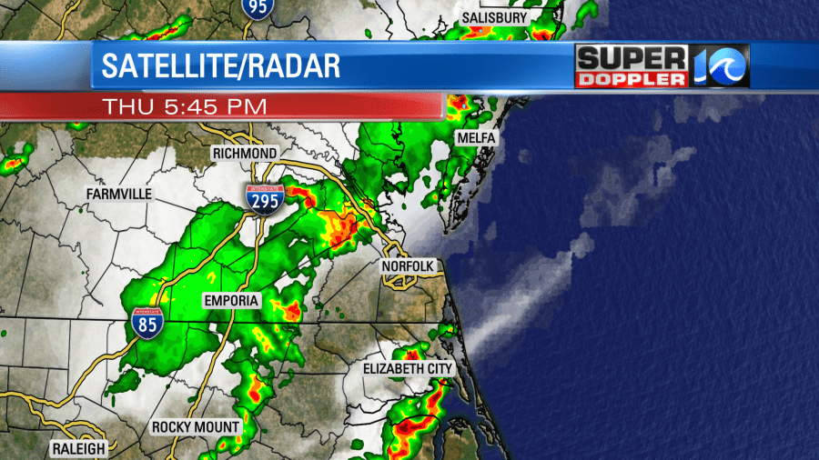
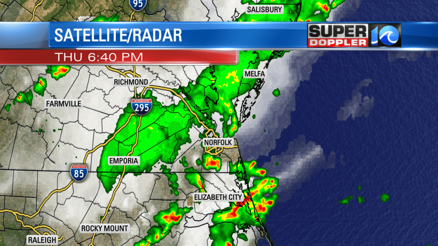
A cool front was closing-in on our region Thursday afternoon. Showers and storms formed ahead of it. Today that front will stall out over the area.
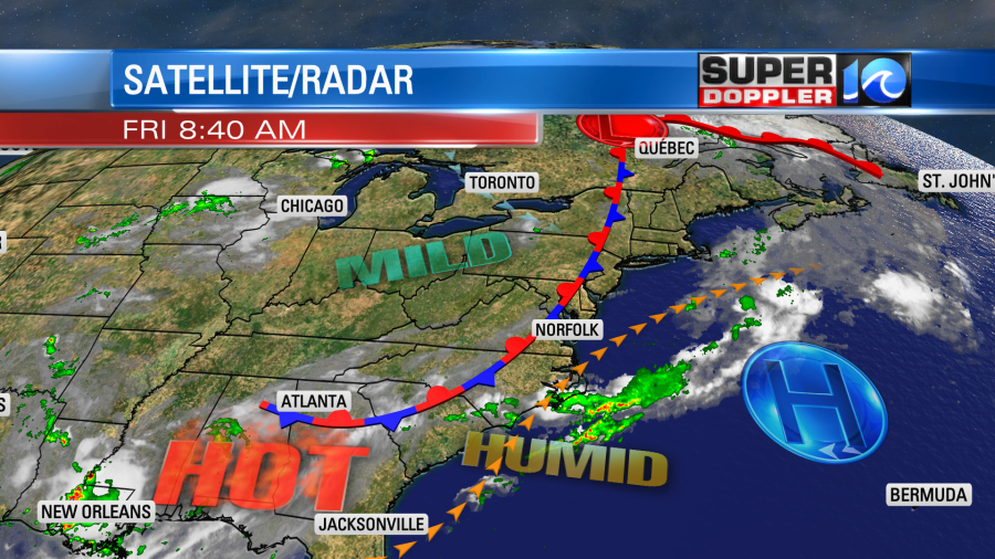
We’ll be on the edge of some milder air, but we aren’t going to have a big cool down. Instead the front will act to keep our temperatures in-check. High temps will be in the low-mid 90s.
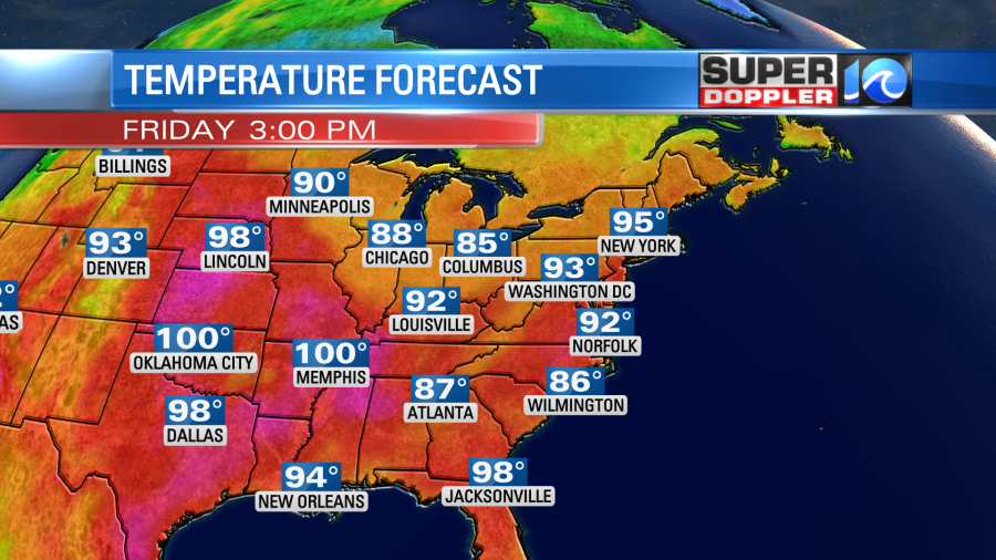
The heat index will be in the upper 90s to near 100. The wind will be variable at 5-10mph. We should have some scattered clouds build back into the area, and there could be some isolated pm showers or storms. The front will fall apart tomorrow, but a little of the leftover energy could kick off some more isolated pm showers or storms. High temps will rise to the mid 90s.
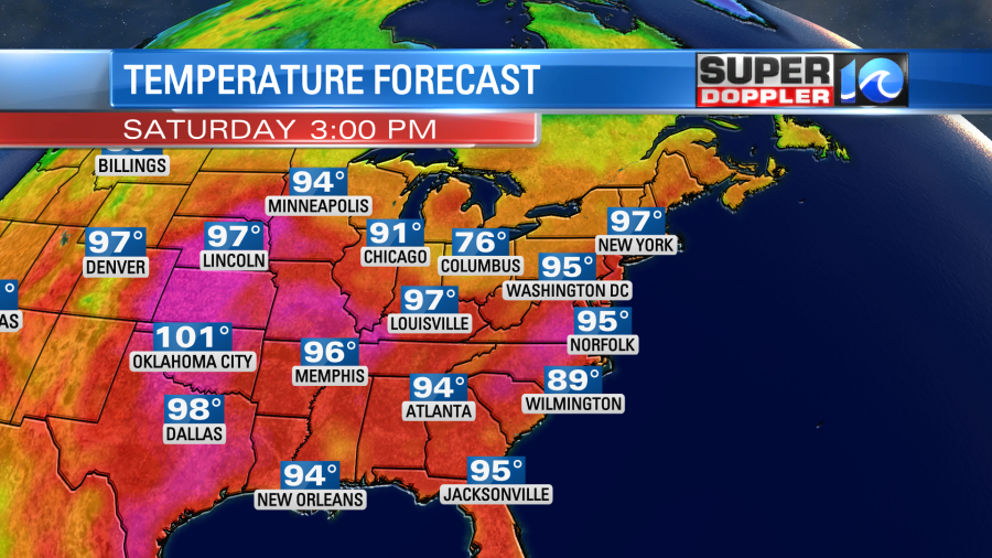
The heat index will be over 100 for many. We’ll be hot and humid on Sunday. High temps will be in the mid-upper 90s. There won’t be much rain. We’ll stay hot and quiet early next week. High temps will still be in the low-mid 90s, and the humidity will stay up as well.
The drought out over in the western U.S. is historic. A new article came out recently about the current low water levels at Lake Mead. They have dropped to their lowest level since it was filled in 1937. Here is the article with the pics and information: Lake Mead historic low levels.
Meteorologist: Jeremy Wheeler
