Heat and humidity is the big story this weekend with air temperatures approaching record values Sunday and heat index values over 105°F!
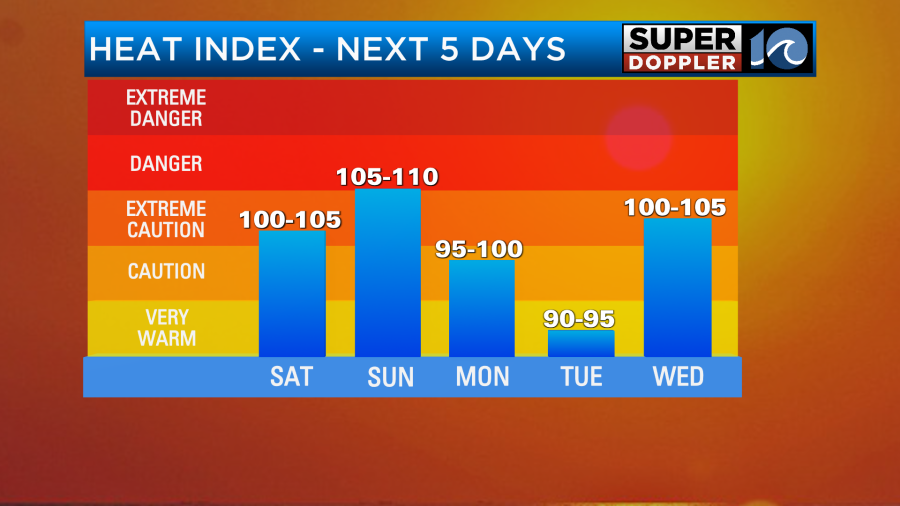
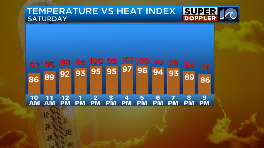
Expect highs in the mid 90s (upper 90s possible for a few spots) on Saturday with heat index values between 95° – 100°. We’ll see mostly sunny skies through the day.
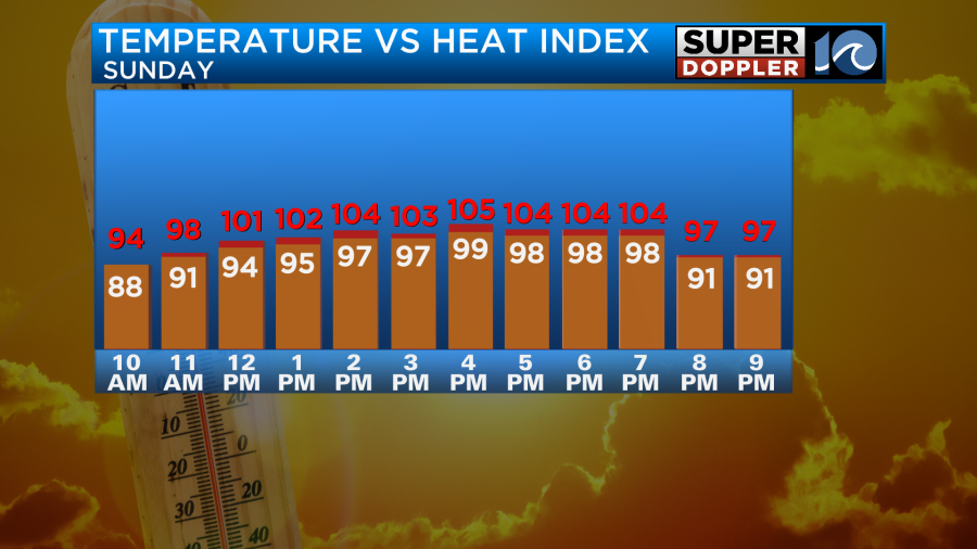
By Sunday, our heat peaks with highs in the mid and upper 90s, challenging a record high of 99° set back in 2015. I would not be shocked if a spot or two hits 100°F on Sunday. Heat index values Sunday will feel around 105° – 108°. Even in the morning, it will be in the upper 70s to low 80s and feel muggy. So not much heat relief in the morning or evening. Sunshine for much of the day, with just a small chance of a late day shower.
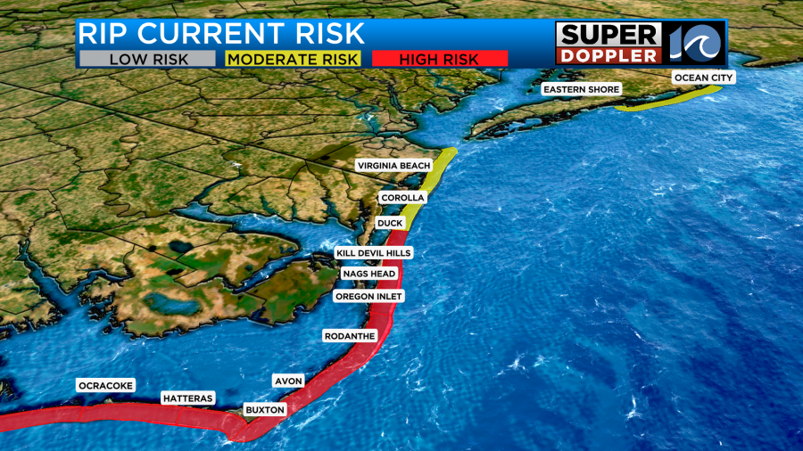
If you’re heading to the beach to cool off, keep in mind there is a risk for rip currents at area beaches. Especially in the southern OBX today.
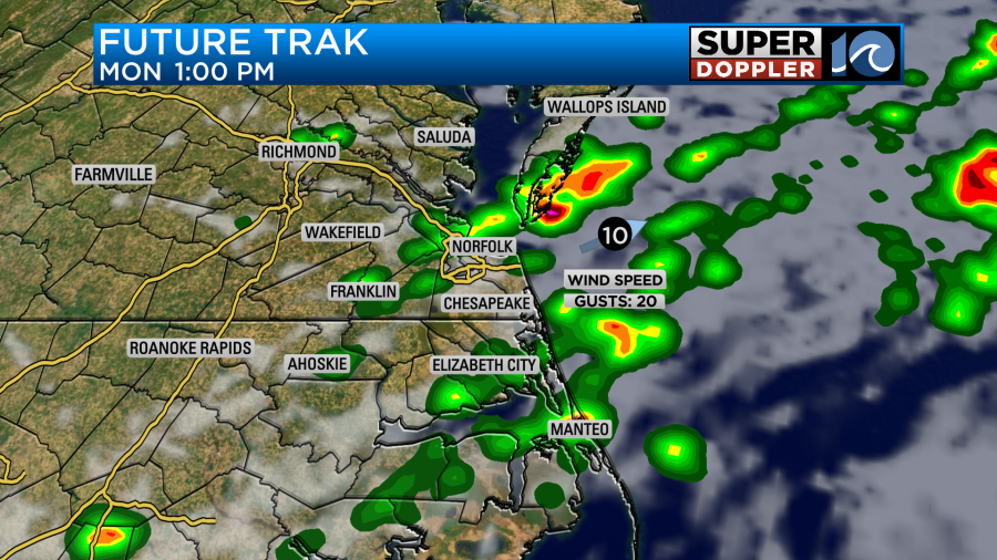
Highs will stay in the 90s for the majority of next week. The best chance for rain is coming Monday. Around 10-11am, showers will start to pop up. These will then move SE during the afternoon. Downpours and some gusty winds will be possible in the strongest storms. A half an inch of rain to 1″ will be possible, with higher amounts on the southside and NE NC than northern spots.
We need 2 inches of rain just to catch up where we need to be this June. Drought conditions have developed across much of Virginia and NC, with abnormally dry conditions being reported on the drought monitor this week.
Stay cool this weekend!
Meteorologist Ricky Matthews
Follow Ricky on Facebook and Twitter