Yesterday, high temperatures hit the upper 90s to around 100 degrees.
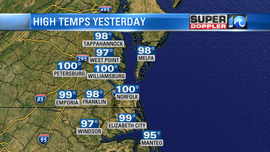
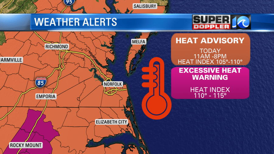
We didn’t tie nor break the record in Norfolk. It was 102 degrees. There was an Excessive Heat Warning for our region on Monday. Today we will chip away a couple of degrees from yesterday’s high temperatures. So we’ll be in the upper 90s with just a couple of 100s. However, the heat index will still be between 105-110. That’s also a slight improvement from yesterday, but it is still enough to give us a Heat Advisory.
High pressure is still offshore, but today there is a stationary front just to our north.
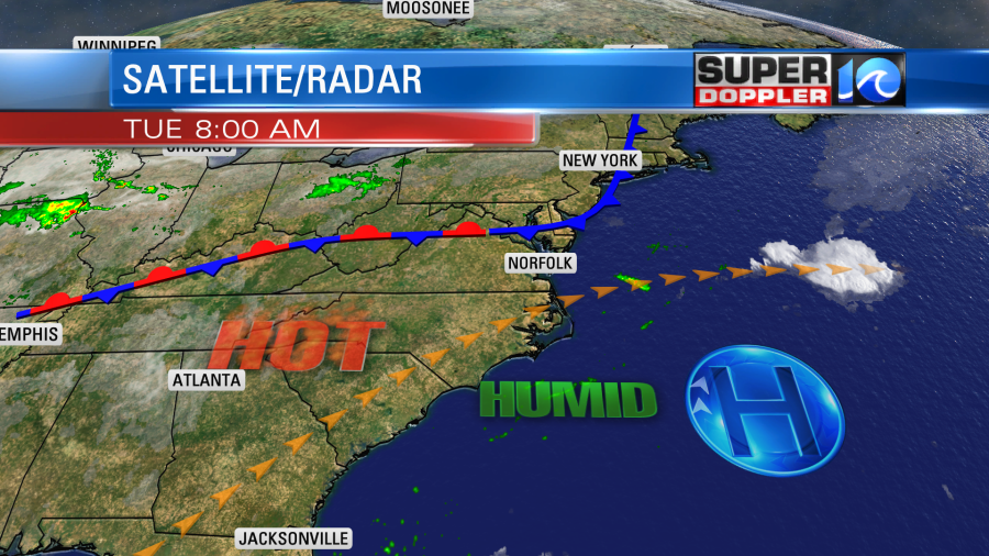
This feature will hopefully create some scattered showers and storms later today. We do need the rain, but that would also help to keep the temps down slightly. Unfortunately, I don’t think we are looking at as big of an area of rain as yesterday’s models were advertising, but I do think there will be a few downpours.
Tomorrow the front will lift back north as a warm front. We’ll heat back up a couple of degrees. So high temps will be in the upper 90s to near 100. The heat index will be up to about 111 degrees. We’ll be partly cloudy with some isolated showers and storms in the afternoon. There will be a few scattered storms during the evening. The area of rain could potentially be large if our Future Trak model is right.
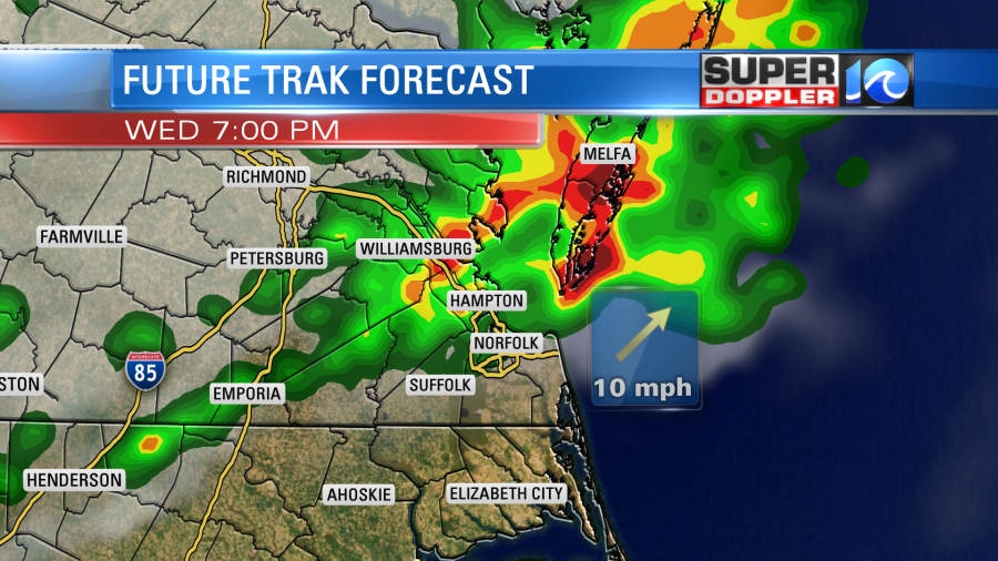
We’ll stay pretty hot and humid on Thursday. Maybe down a couple of degrees. However, we’ll be closer to 90 by Friday. Then we’ll be in the upper 80s on Saturday. While no day has a “high” rain chance. I think we’ll have a decent chance for getting at least some rain between now and Saturday.
Things are picking up a bit in the tropics. There are two disturbances that we are tracking. One is over the south/central Atlantic. The other is near Cuba.
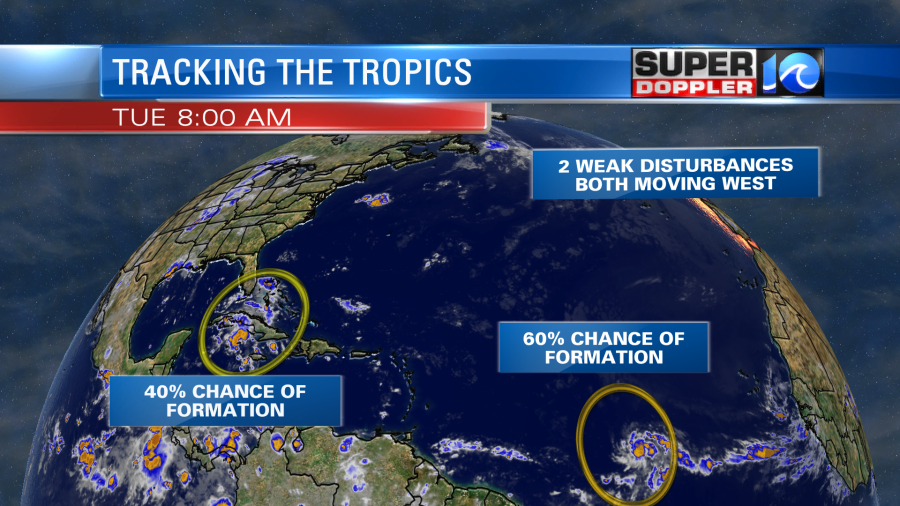
These features are both moving generally to the west for now. The one near Cuba has a 40% chance of formation over the next few days. That one will be moving over some very hot water in the Gulf of Mexico. The one that is over the central Atlantic looks like it’s already getting a little organized. So it has a 60% chance of formation in the short and long term. Stay tuned for updates!
Meteorologist: Jeremy Wheeler

