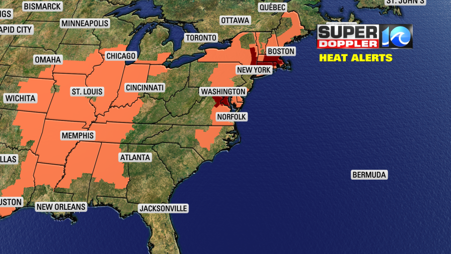
Not just locally, but regionally and nationally the heat is going to be rough today. There are multiple heat alerts over the Midwest, the Southeast, the Mid-Atlantic, and the Northeast.
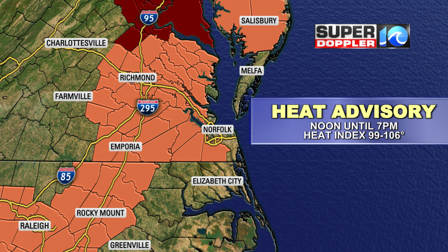
Locally we have a heat advisory for most of southeast Virginia. This goes from noon today until 7 p.m. this evening.
High pressure is centered off to the southeast over the Atlantic. We’ll have lots of sunshine here today.
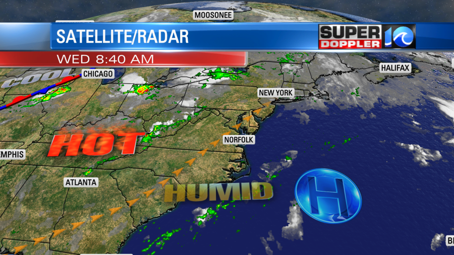
Winds will be out of the south/southwest at 8-12mph. We’ll take any breeze we can get. By the mid afternoon high temps will rise to the low-mid 90s. The heat index will be in the upper 90s up to 105 degrees.
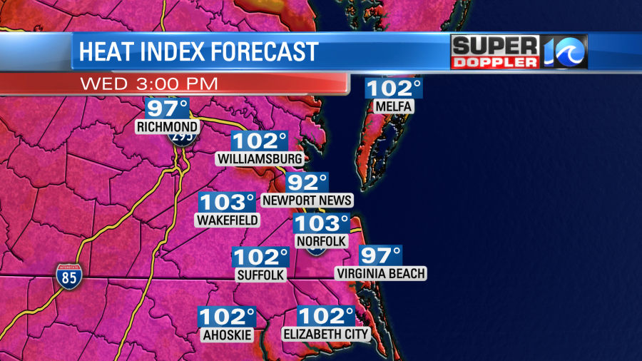
We’ll be mostly to partly sunny. There may be a stray shower or storm near the end of the day. Tomorrow we’ll have similar weather. High temps will be in the mid 90s. The heat index will be over 100. There may be some isolated showers or storms.
Friday’s weather won’t be much different. (Still very hot and humid). However, by the weekend a cool front is expected to move into the area. We’ll be in the upper 80s to near 90 on Saturday. We’ll have a mix of sun and clouds with some scattered showers and storms moving in. High temps will be in the mid 80s. Then we’ll have a higher chance for rain and more clouds on Sunday. High temps will be drop to the low-mid 80s.
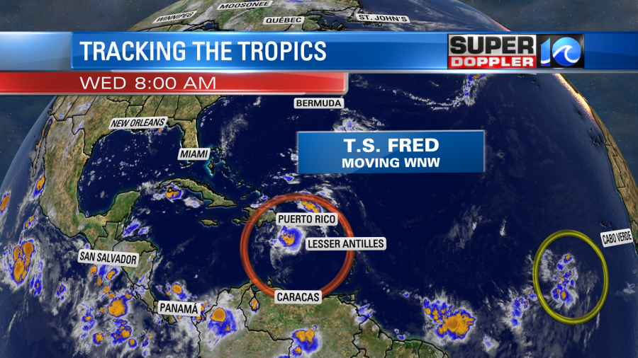
Last night tropical storm Fred formed over the Atlantic basin. It moved over Puerto Rico. Now the center is moving onto the Dominican Republic.
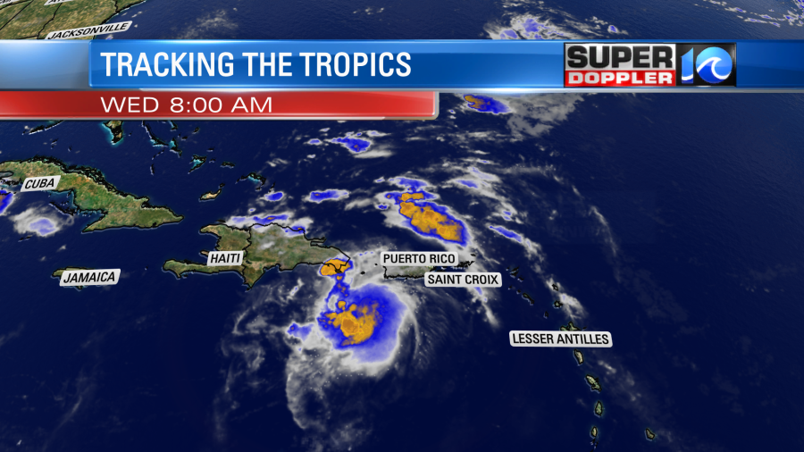
The satellite this morning seemed to show a breaking up of the clouds and thunderstorms around Fred. This is a good sign of some possible weakening. Regardless, it will weaken as it moves over land today. Hopefully, some of the terrain will chew up the storm. If it survives then it will resume moving to the west/northwest over the water. This will likely allow it to restrengthen back into a tropical storm. The forecast track takes it to near the northern coast of Cuba Thursday into Friday.
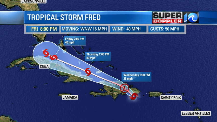
If Fred moves over land, then it could possibly fall apart over Cuba. At least for a time. If it hugs the coast or stays over water, then it will probably maintain some strength. Due to that uncertainty it is tough to say what will happen after that point. The official forecast takes it up towards the Florida Keys and then near Tampa, FL through the weekend.
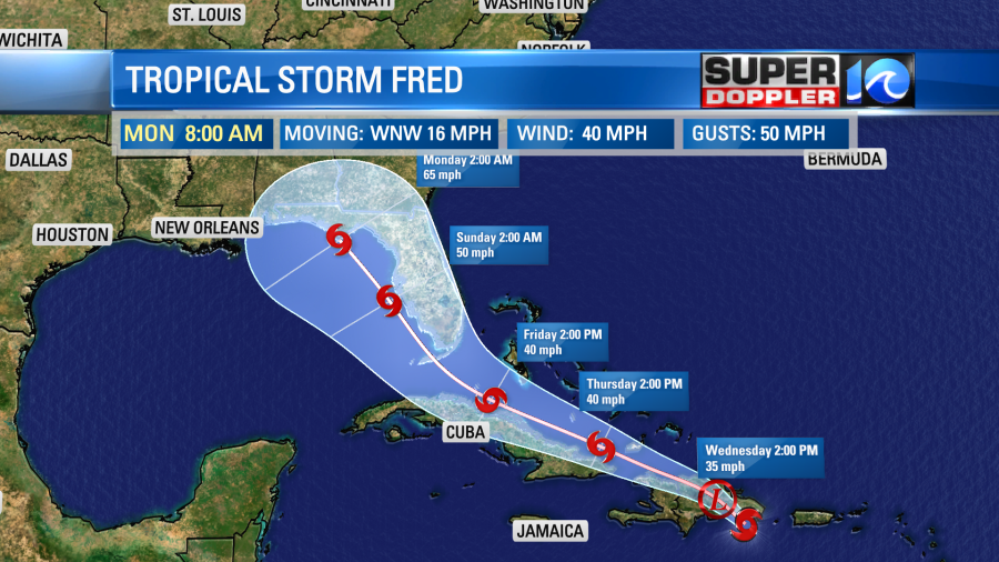
However, the models are VERY split after interacting with Cuba:
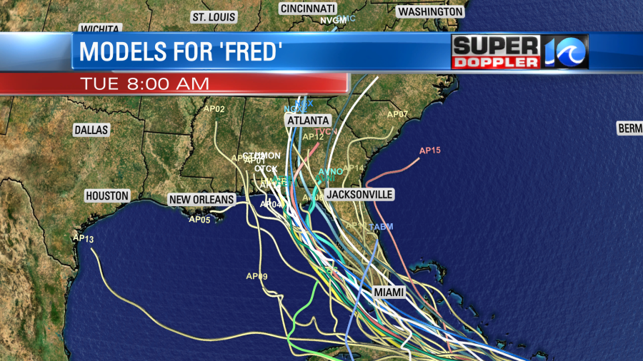
The European model’s track takes it very close to the most likely path from the National Hurricane Center (center line above on “track”).
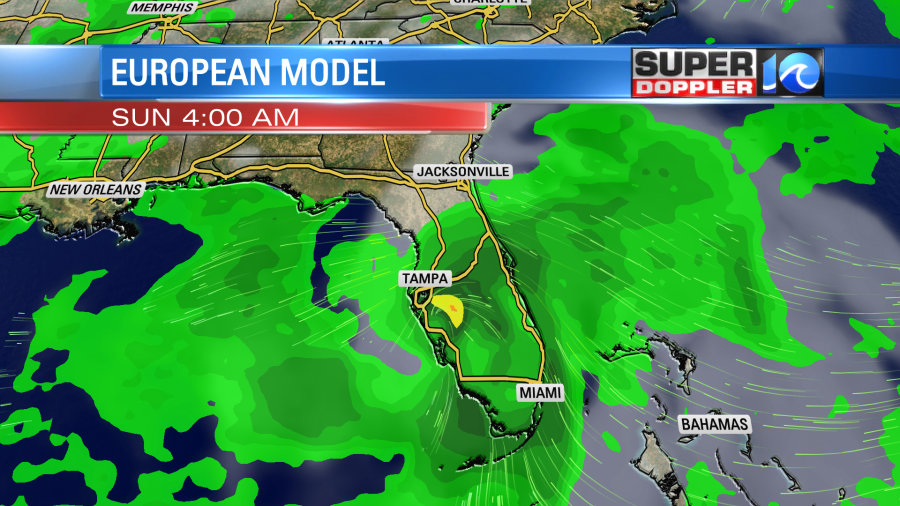
It does take it over Tampa this weekend. Then it has Fred south of Atlanta by next Tuesday.
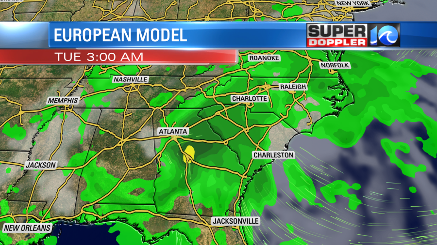
So for now this is one to watch. Luckily for us it looks like this will be more of a storm for the Gulf states if it survives. However, there will be a lot more systems forming over the next few weeks. There is one tropical disturbance in the eastern Atlantic. It is moving generally westward. For now it has a low chance of formation.
Stay tuned for updates on all of this.
Meteorologist: Jeremy Wheeler
