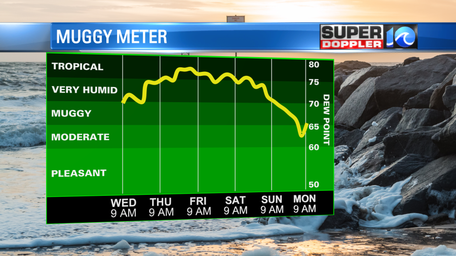
It’s that time of year, when I can say and sing “The Heat Is On”! Yesterday morning wasn’t too bad, but by the time we hit the afternoon the mugginess had increased. Dew points are already near 70, and they are increasing.
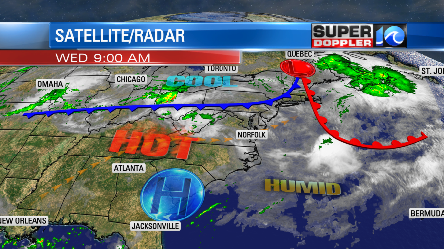
A warm front is working it’s way into the Northeast today. A cool front is to our northwest. It is slowly moving closer to our area, but it is forecast to stall out just to our north.
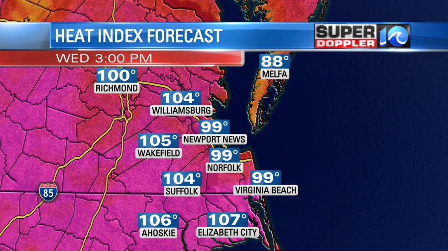
As mentioned the heat and humidity are pouring into the region. We’ll have a mix of sun and clouds through the day, but there will be enough sun to heat us up to the low-mid 90s this afternoon. When you combine the heat and humidity it will feel like it’s between 99 and 105 degrees.
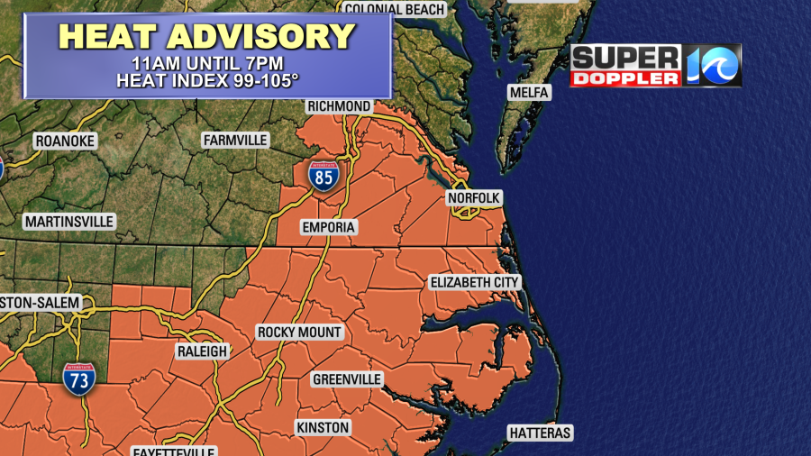
There is a Heat Advisory in effect for most of the region from 11 a.m. until 7 p.m.
There won’t be much rain through the mid-afternoon. There will be a few pop-up showers and storms between noon and 4pm. Then a bigger cluster of showers and storms will form between 4 and 9 p.m.
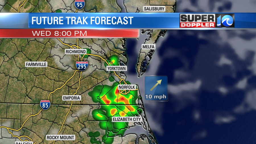
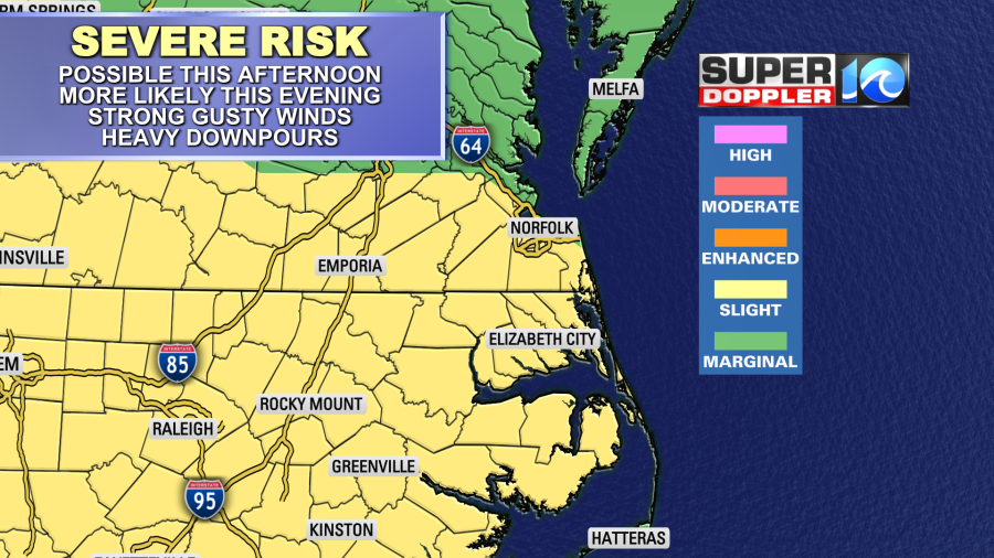
These storms will feed off of the high heat and humidity in the region. This will create a lot of instability. However, I don’t think we’ll have a lot of strong upper level winds. So there may be some heavy rain and downbursts, but I think there’s less of a chance for hail. Either way a lot of our viewing area is in a slight risk for severe weather.
The showers and storms will taper off overnight. Low temps will be in the 70s. Then tomorrow we’ll have mostly cloudy skies with highs in the upper 80s to near 90. It will still be very humid. So the heat index will be in the mid-upper 90s. There will be a few showers in the morning. Then more scattered showers and storms in the afternoon.

We could have some more gusty winds and heavy downpours. There is a slight risk for severe storms again tomorrow, and it is for the whole area. The front will stay to our north tomorrow and Friday, but the extra clouds and higher rain chances should keep the temps down a bit. Highs will be in the 80s. It will stay MUGGY!
We’ll cool down on Saturday, but we won’t really dry out until Sunday.
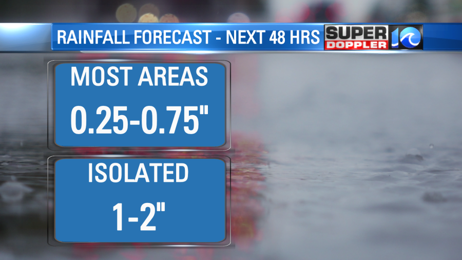
Over the next 48 hours we’ll have varying amounts of rain. Most locations could see about a quarter to three quarters of an inch. However, some lucky locations could see 1-2″.
We really need the rain, and especially over northeast North Carolina.

I know we need the rain, but luckily it’s still quiet in the tropics.
In National News….The National Oceanic and Atmospheric Administration (NOAA) has recently upgraded their computer systems. This will give a big boost to their computing power for climate and forecast models.
“Each supercomputer operates at a speed of 12.1 petaflops, three times faster than NOAA’s former system. Coupled with NOAA’s research and development supercomputers in West Virginia, Tennessee, Mississippi and Colorado, which have a combined capacity of 18 petaflops, the supercomputing capacity supporting NOAA’s new operational prediction and research is now 42 petaflops”.
This will allow for a big upgrade to the GFS model in the Fall. I’m really looking forward to that. Here is the article where that information comes from: NOAA computer model upgrade.
Meteorologist: Jeremy Wheeler


