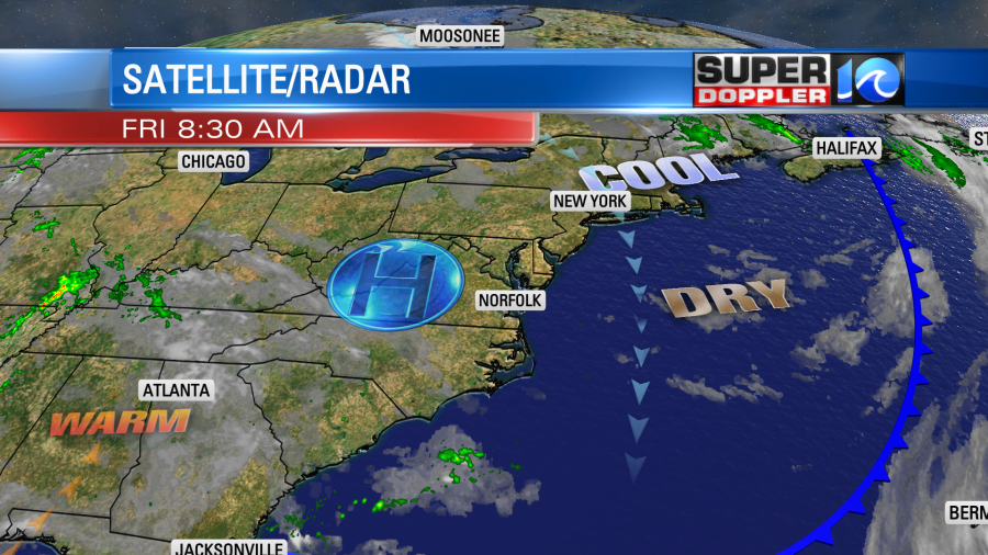
We are looking at some great weather this weekend! It starts with today. High pressure is locked-in overhead. There is a cool front far to our south.
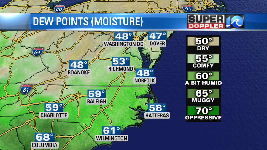
We’ll have a lot of sunshine through the day with a few high/thin clouds. There is a northeast breeze picking up a bit. This will keep the afternoon temps down despite the strong sun. So high temps will be in the low 70s with a few mid 70s inland/south. It is nice and dry today with dew points near 50.
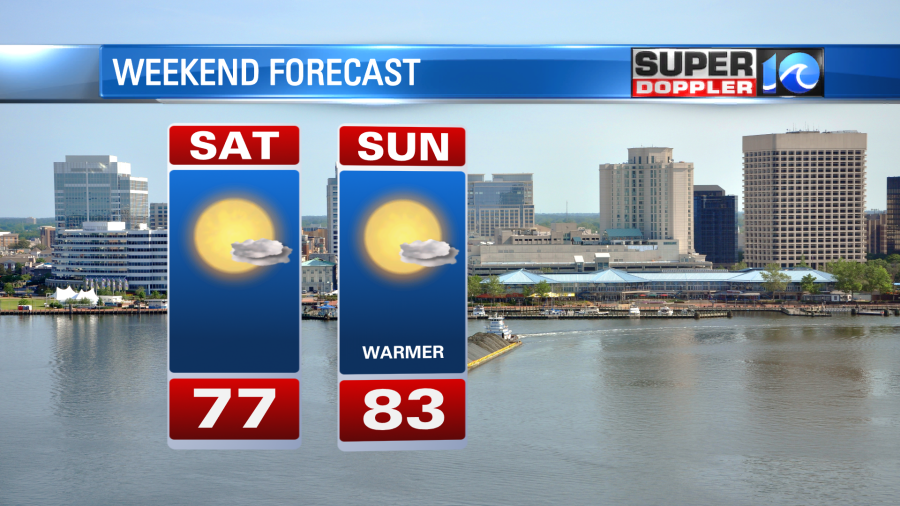
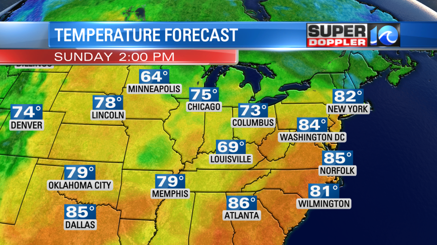
Tomorrow the high pressure area will shift around a bit. So surface winds will be more out of the south. Between that and a lot of sunshine we’ll heat up to the upper 70s. There will be a few 80s inland. Then the warming will continue into Sunday. We’ll be mostly sunny with highs in the low-mid 80s.
The humidity will rise a bit by then. Dew points will be closer to 60.
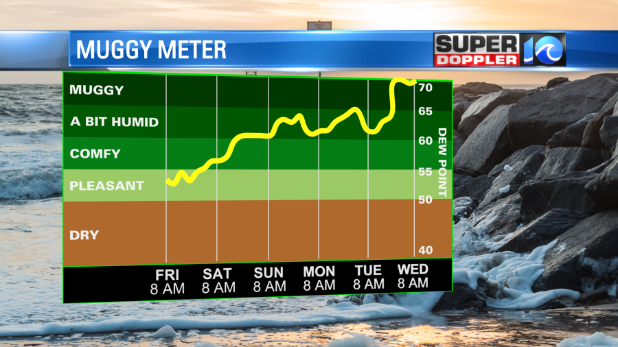
The humidity will rise quite a bit more as we go into next week. A cold front will move in around Tuesday, but there’s not much rain through the middle of next week. Maybe a few isolated to scattered showers if we’re lucky. We need rain.
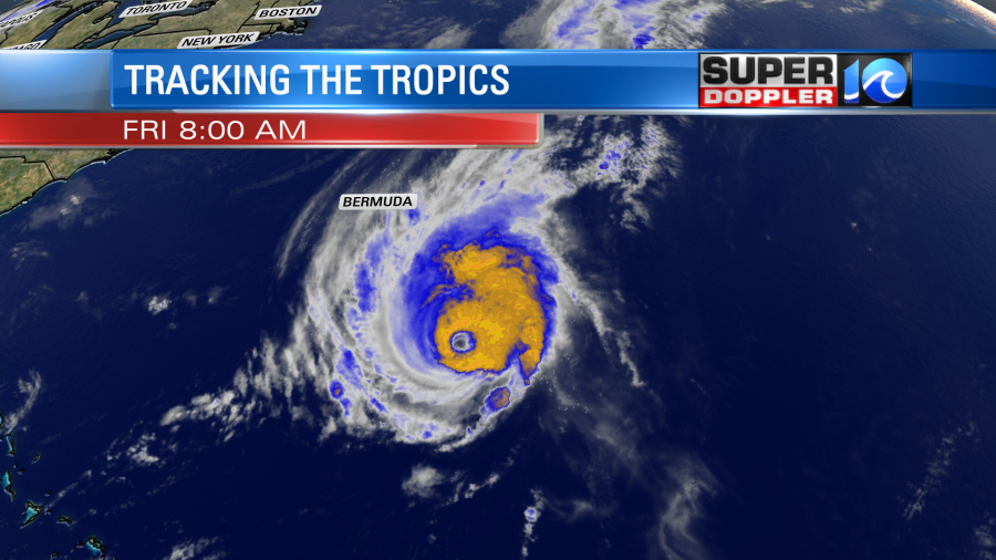
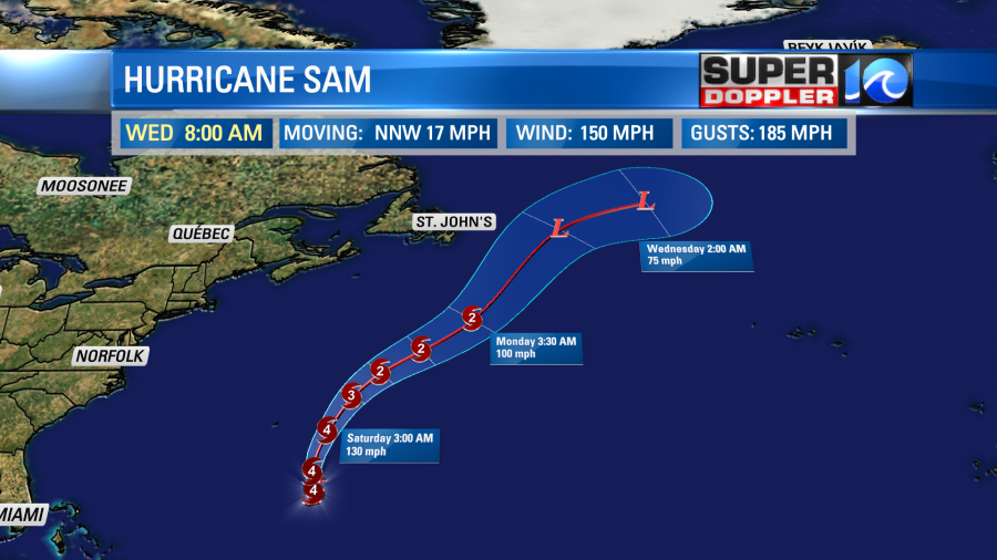
The 2 tropical systems that we are tracking will stay well out to sea. Hurricane Sam is a major hurricane. This morning the sustained winds were around 150mph.
The hurricane will move north/northwest today. It will pass east of Bermuda tomorrow. They will have some large swells, and they will likely have several rain bands. However, the worst of the storm should stay far enough east that the island will be ok. Some tropical storm force gusts could happen there Saturday. The storm will then move north/northeast, and it will fall apart over the north Atlantic in a few days.
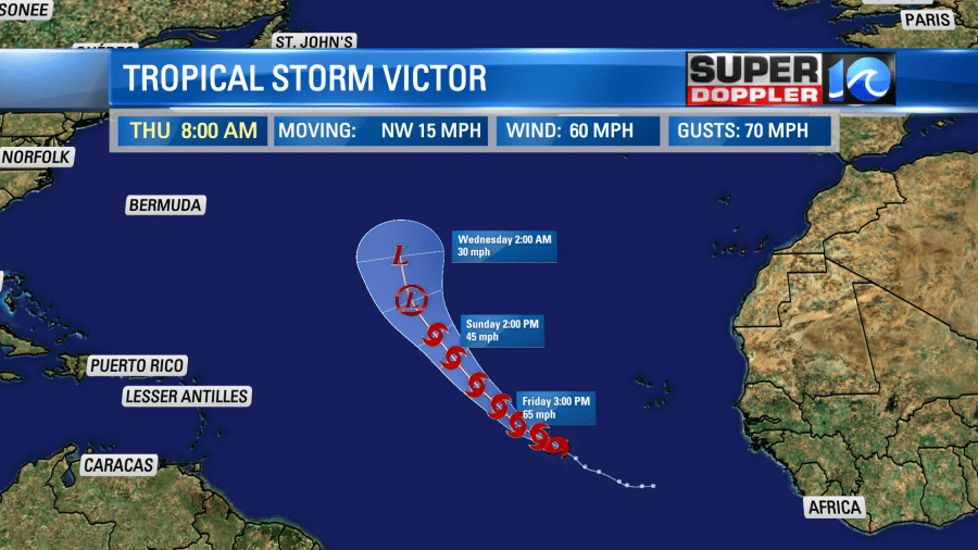
Tropical storm Victor has gained some strength since yesterday. It is moving to the west/northwest. It will turn more northerly over the next few days. While it did strengthen a bit recently, it should encounter drier air and cooler water as it treks north. So eventually the system will fall apart over the eastern Atlantic.
While both systems will stay far from the U.S. We will have one impact here. We are seeing increasing waves along the east coast. They will run about 1-3 feet today. This is increasing the threat for rip currents to moderate. Then tomorrow the offshore waves will be about 7 feet. The waves along the shore will be about 2-4 feet in Virginia Beach and possible 3-5 feet along the Outer Banks.
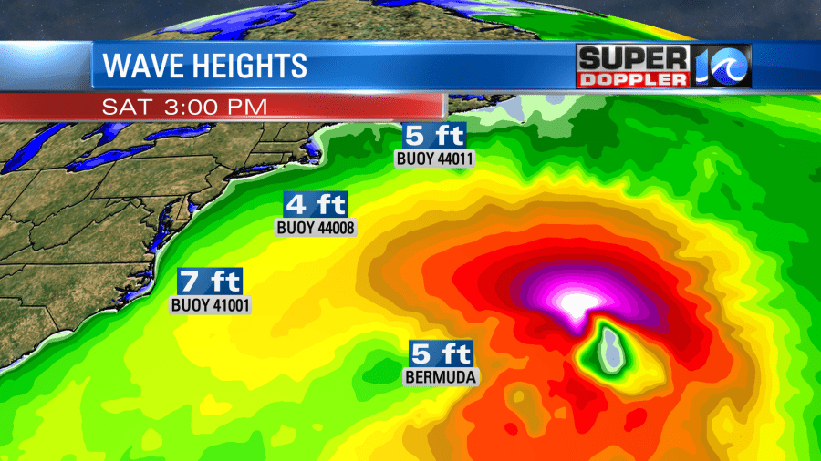
The problem is that the rip current threat will likely go to high tomorrow. So it may be a good day for surfers but not for swimmers. Stay tuned for updates. Otherwise, enjoy the nice weather this weekend!
Meteorologist: Jeremy Wheeler