Over the past week our area has gone from a desert to a tropical rainforest. I’m being a tad dramatic, but not TOO dramatic. Take a look! This is the U.S. Drought Monitor between last week and yesterday:
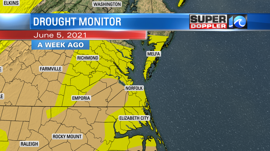
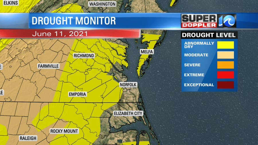
While many have had rain recently, it hasn’t been evenly distributed. Take yesterday for instance. Norfolk International Airport barely picked up a couple tenths of an inch. Meanwhile about 4 to 5 inches of rain fell in Smithfield.
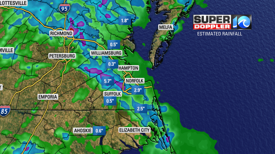
Norfolk has had a little over 3″ so far this month. That is 1.62″ above average. However, I believe parts of Currituck county, NC have had over 7″ since last week.
We have one more day with a potential for heavy rain. There is a Flash Flood Watch in effect from noon today until this evening. It covers a large chunk of the region.
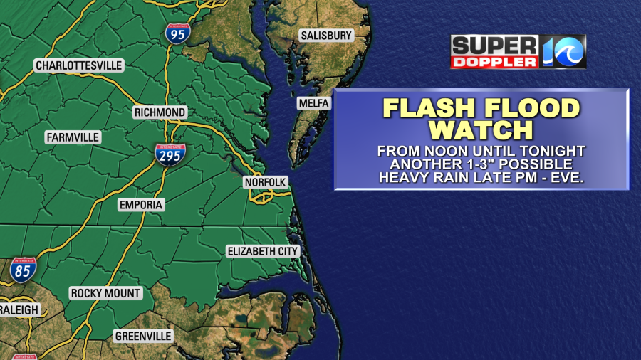
Rainfall amounts will vary widely. Some locations will only see a couple tenths of an inch. Others may see 1-3″ in the next 24 hours.
There is a cool front slowly marching to the south. It isn’t here yet, but it is on our doorstep.
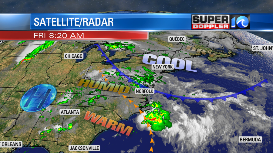
The front has been ultra slow this week. We’ve been on the warm/humid side of it for days. Dew points have been in the 70s. It has felt like a sauna at times. The high humidity will create lots of clouds again in our region today with scattered showers and storms at times. We’ll have lower rain chances around midday, but the heavy rain and storms will fire up again later this afternoon into the evening.
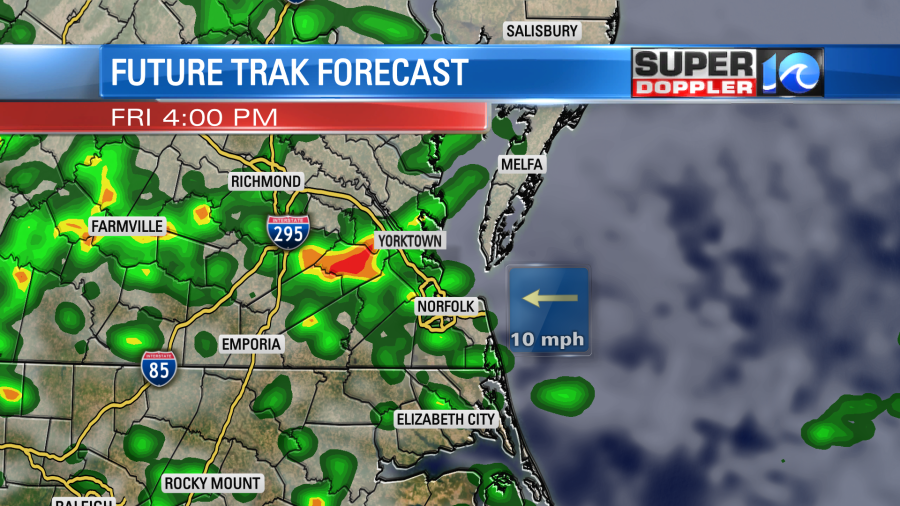
Some scattered showers will continue overnight. A few of these will linger into tomorrow morning.

As the front sinks to the south we’ll finally start pulling in some drier air. The rain showers may continue until midday, but then we’ll start clearing up during the afternoon. High temps will be in the upper 70s. We’ll be dry on Sunday with highs in the low 80s. There may be an isolated shower over the Outer Banks.
Meteorologist: Jeremy Wheeler


