
As expected, a strong punch of cold air has moved into our region. A cold front arrived yesterday afternoon, and it dropped the temps into the 30s and 40s last night. This morning the wind chills were in the low-mid 30s. The breeze was strong out of the northwest. The front is now well offshore. High pressure is building in from the west.

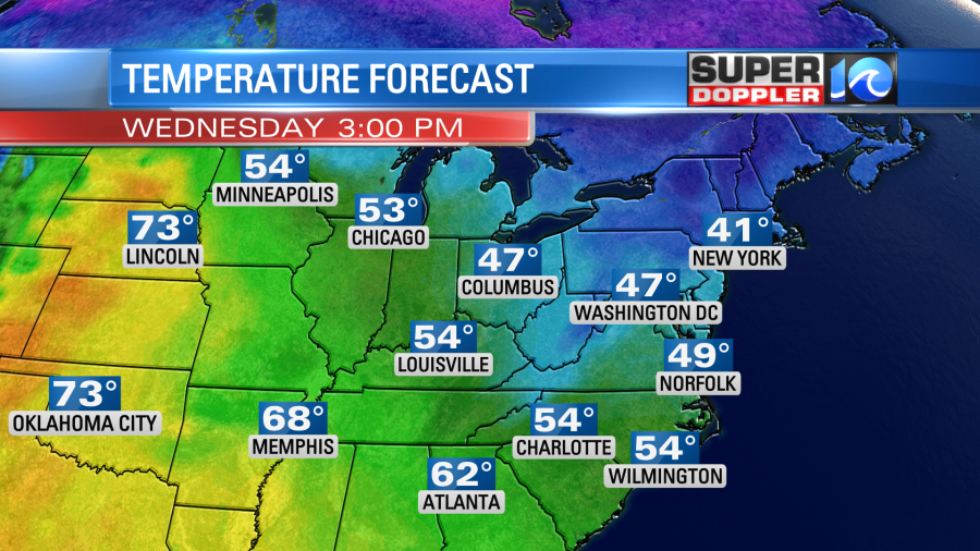
We’ll have a lot of sunshine today, but it will be breezy and chilly. We’ve had a long stretch of mild temperatures lately. So a high temperature of 49 degrees today will be a shock to the system.
Winds will be out of the north/northwest at 10-20mph with gusts to 25mph. While it will create a pretty chilly day, the wind will help in one big way. Combined with dew points in the 20s we’ll really have a chance to dry out the soil. The ground is still very soggy due to recent heavy rain. It will also help some of the local rivers to go down faster.
The wind will die down tonight. In fact it will likely go calm over much of the area. With light winds, clear skies, and very dry air the temperatures will be able to drop like a rock. So we’ll likely bottom out in the upper 20s inland with low-mid 30s even in the metro. Temps will probably be closer to the 40s right near the shore as water temps are in the upper 50s to low 60s. Due to these factors there is a a Freeze Warning in effect for most of the viewing area.
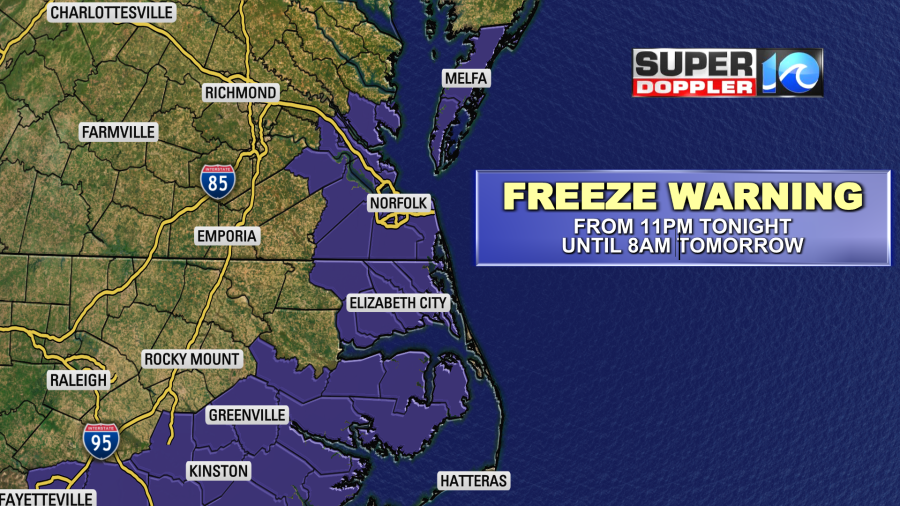
So be sure to bring in the potted plants and pets if you haven’t already.
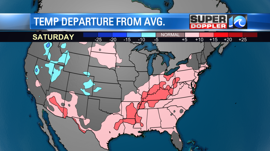
We’ll have a lot of sunshine tomorrow with a light south wind developing. So high temps will bump up to the upper 50s. Warmer temperatures in the central U.S. will migrate east. So we’ll go to above average temps this weekend.
High temps will be in the upper 60s with fair skies. It should be pretty awesome out. Our next chance for rain looks like it will move in on Monday.
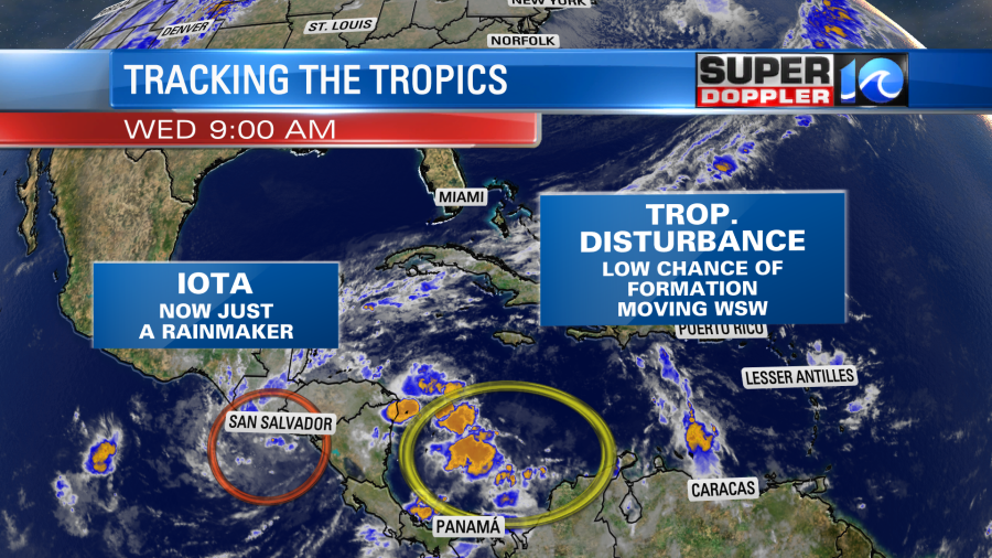
In the tropics Iota has fallen apart. However, it left a lot of historic flooding and damage in it’s wake. There is another weak tropical disturbance east/southeast of Nicaragua, but it only has a low chance of formation. It is moving more to the southwest.
Let’s hope the tropics fizzle out and stay calm for the rest of the season. The season officially ends on November 30th.
One last thing. We all know this was a record year for Atlantic hurricanes. One problem that we will have to face is that it will likely be the first year that a Greek name will be retired. The problem is….What do we do then? It’s something that you’ll be hearing about over the next couple of months. We’ll see what the National Hurricane Center decides.
Meteorologist: Jeremy Wheeler


