This morning we started off with some more patchy fog in the area. Here was a cool pic of it from Virginia Beach Town Center (Armada Hoffler Tower):
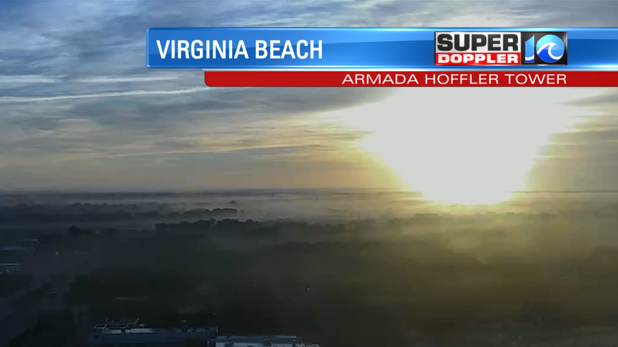
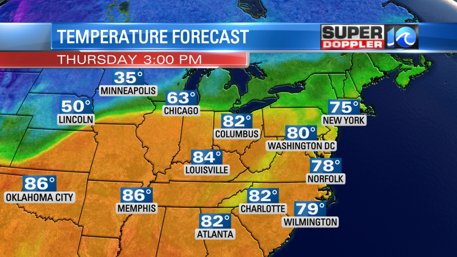
The fog will burn off this morning. Then we’ll have partly cloudy skies for the rest of the day. It will be another nice day, but it will be a bit warm for late October. High temps will be in the upper 70s with a few 80s inland. It is much colder in the north/central U.S. today where snow continues.
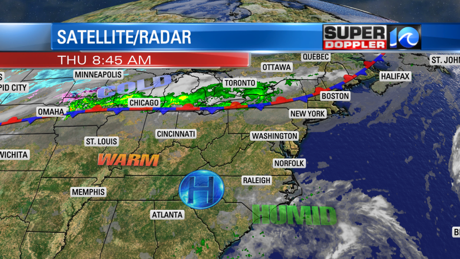
We have high pressure in our region with a stationary front well to the north.
We’ll be fairly warm and humid over the next 2-3 days. At least for this time of year. Average high temps are in the mid-upper 60s. We’ll be in the mid-upper 70s tomorrow through Saturday.
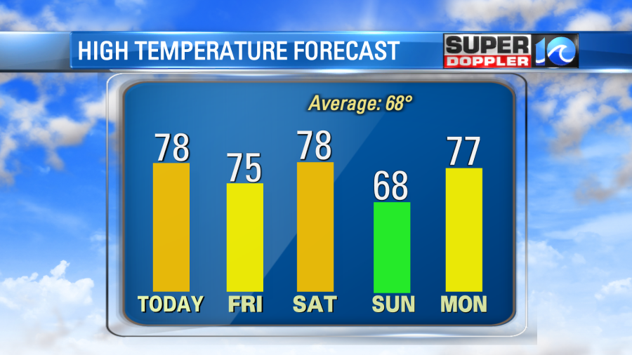
By Sunday we’ll finally have a cool down. (At least for one day). High temps will drop to the 60s. We’ll warm up again Monday into Tuesday with high temps reaching back up into the upper 70s to near 80.
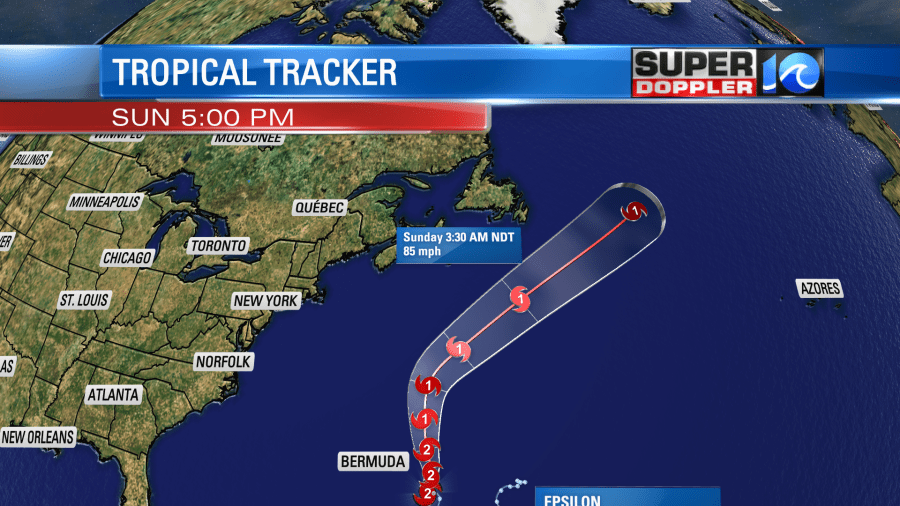
Meanwhile hurricane Epsilon has been churning east of Bermuda. It will pass east enough of the island that they shouldn’t have too many impacts. The eye became very pronounced yesterday. So it gained strength, and it shot up to a category 3 hurricane. Then this morning it weakened slightly as the eye was going through a transition phase.
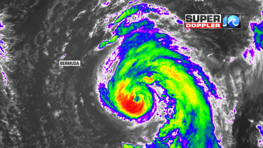
The hurricane will move generally northward today. Then it will turn to the northeast. It will eventually weaken and become extra-tropical over the cooler North Atlantic.
The waves are high out there near the storm. Some waves near the eye are forecast to be up to 20ft or more. Bermuda may see some 15ft waves near the shore.
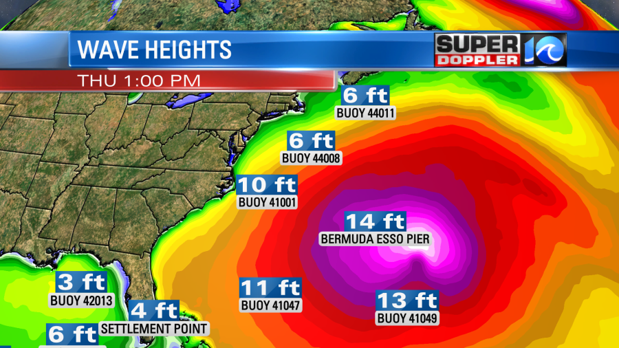
We will have some 10 ft waves near our shore with some 4-7ft onshore waves. This is great for the NSSA surf competition today, and the waves could be even higher there tomorrow.

Waves will gradually decrease Saturday into Sunday. Keep in mind that the rip current threat will be high for a while. So experienced surfers only.
Meteorologist: Jeremy Wheeler


