Last night Nicholas briefly strengthened into a hurricane. It made landfall last night on the eastern part of the Matagorda Peninsula in Texas. That’s a bit southwest of Galveston, TX. It has since moved inland, and now the center is close to the Houston area.

I saw some wind gusts on the above graphic up to 47mph near Houston. There were some gusts to over 90mph near the center as it made landfall. The storm will continue to weaken as it moves to the northeast. However, flooding rains will be falling well east and northeast of the center. Some locations could see 4-8 inches of rainfall over the next few days.

Eventually, Nicholas will fall apart over Louisiana, but some rain may continue into Friday. Meanwhile we are also tracking 2 other tropical features in the Atlantic. there is a tropical disturbance north of Haiti that has a moderate chance of formation as it moves north/northwest.
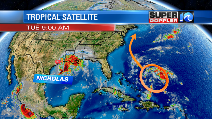
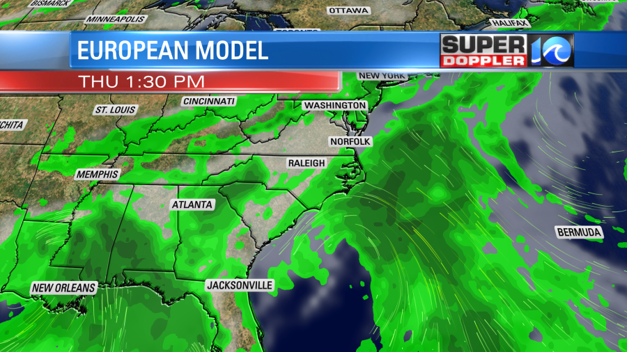
This could get pretty close to the east coast, but A. it should remain pretty broad and week. Also B. The center is forecast to stay offshore. This should keep most of the strong gusty winds offshore, but a few moderate gusts could briefly impact the Outer Banks. Either way during its closest approach on Thursday I do think it will throw some scattered showers onto our local coasts. This is what the European Model shows.
Afterwards it should move off to the northeast during the day Friday.
There is another tropical disturbance in the eastern Atlantic that has a high chance of formation over the next few days.
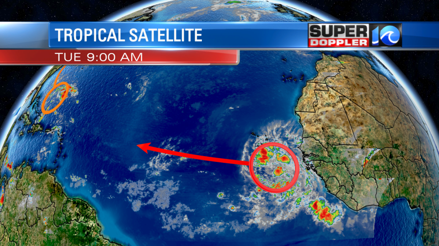
This will move to the west/northwest over the next couple of days. Then it should turn a bit more to the north. That track would likely keep it out to sea, but we’ll see.
Locally today we have a big area of high pressure in the region. It is centered to our southeast. There is a stationary front to the north with a cool front to the northwest.
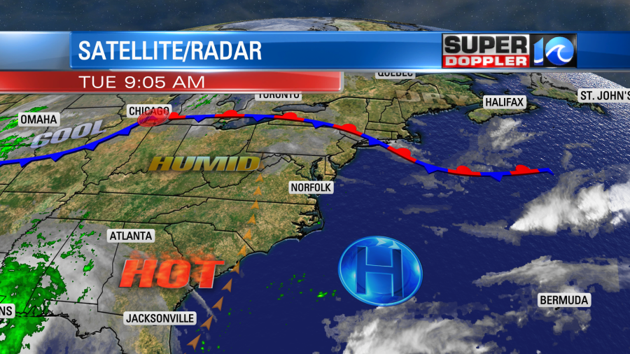
We’ll be hot and humid today. High temps will be near 90, but the heat index will be in the mid 90s.
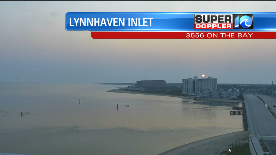
Skies will be mostly sunny. We have some haziness out there, but there is also that thin veil of clouds overhead. I mentioned yesterday that it is some of the ash and dust from the wildfire out west. It is very high up, and it won’t affect our air quality. However, it did make for an interesting sunrise this morning. Look how tiny the sun looked over Lynnhaven Inlet.
Tomorrow we’ll be partly cloudy with some isolated showers or storms. High temps will be in the upper 80s, but it will feel like the low 90s during the afternoon with the heat index.
Then on Thursday we’ll have more clouds with some scattered rain showers and a few storms. Again this could be from that offshore area of low pressure (possible tropical depression). The GFS model has less rain than the Euro.
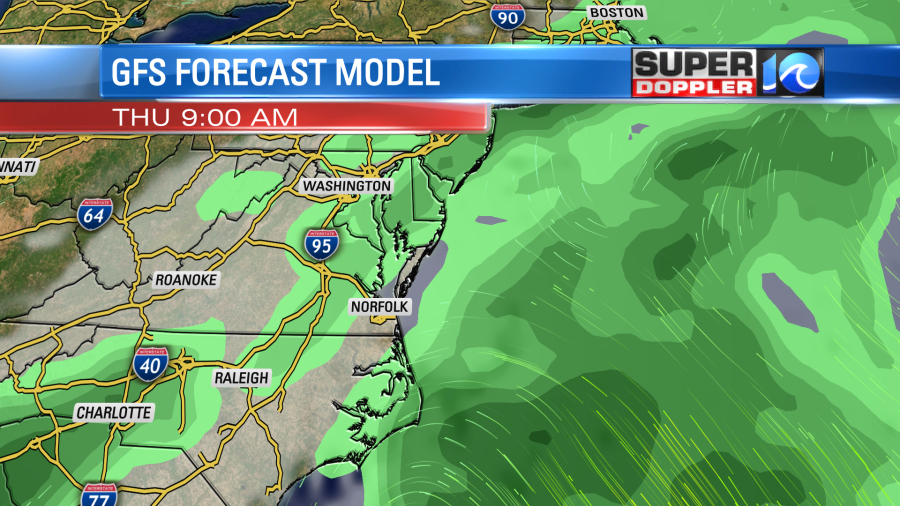
So we’ll see how much rain we actually get. Either way we should increasingly dry out next weekend.
Meteorologist: Jeremy Wheeler


