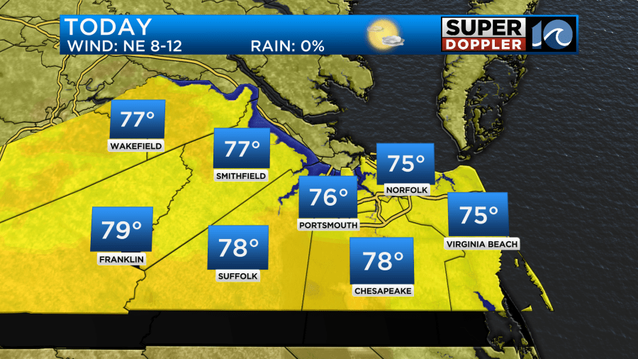
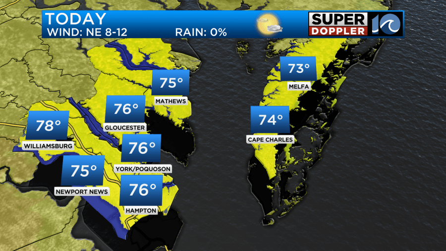
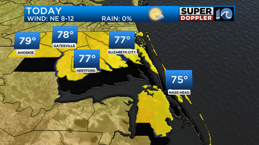
September has been a pretty impressive month of temperatures, feeling cool and like fall for nearly the entire month, and that trend continues through the next few days.
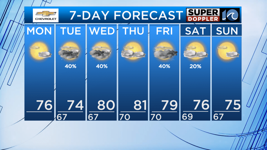
There have only been five days this month where our afternoon highs were at or above 80°…. nearly all of September has sat comfortably in the 70s. We’ll see that again today with a mix of sun and clouds, pleasant start to the workweek.
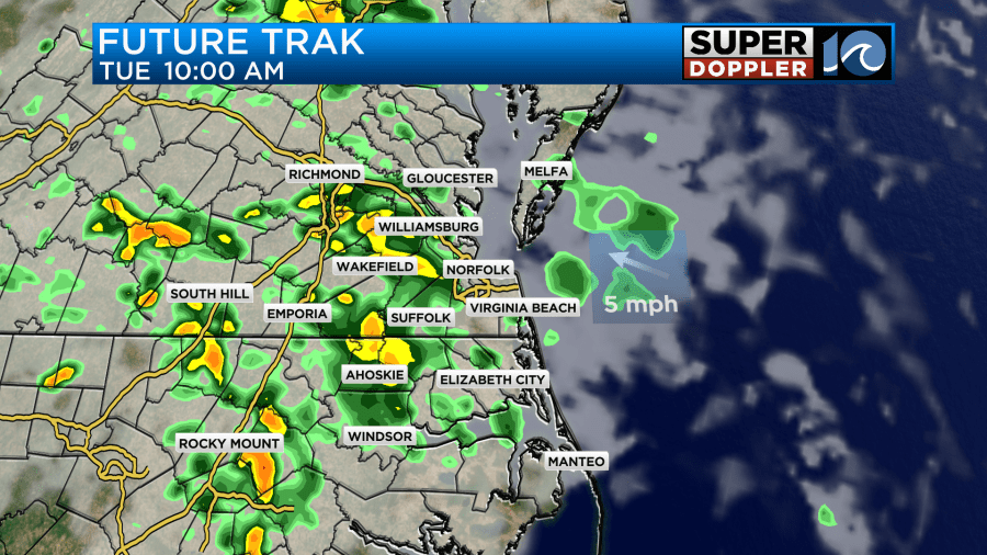
It should be even cooler tomorrow with high temperatures in the low 70s! However, this is when we’ll bring in some rain chances. Scattered showers are likely in the first half of the day tomorrow before mostly cloudy skies prevail into the afternoon. We could see a repeat of that on Wednesday with another batch of scattered showers sliding into the region through the morning hours. Wednesday, however, should be warmer.
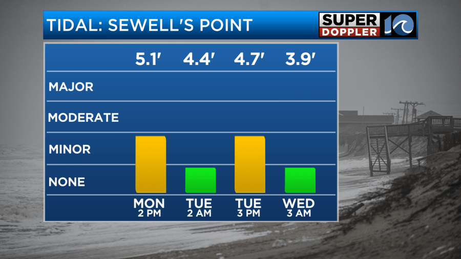
Over the next few days, our high tide cycles will continue to run higher than normal as the big storm at sea sits far off our coastline. Nuisance to minor tidal flooding is possible in some low lying areas for the afternoon high tide today and tomorrow (around 2/3pm).
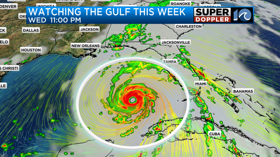
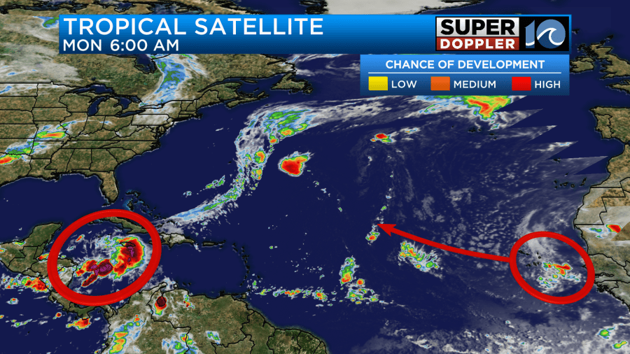
We’ll also watching the tropics closely over the next few days as two systems will likely develop this week. Soon to be Isaac will develop off into the Atlantic, and should stay out in the Atlantic. But before that forms, down in the Gulf soon to be Helene will form as early as tonight or tomorrow. From there, it’ll quickly intensify as it migrates north into the Gulf of Mexico.
The Gulf Coast states are closely monitoring this forecast as impacts could arrive as early as Thursday for some. Depending on the strength and track, the remnants could throw some rain chances our way by the end of the week.
We may also notice the humidity creep up mid-late week!
Enjoy the flavors of fall today and tomorrow!
-Steve
