It’s official! Fall is here! Now you can feel a bit less guilty about drinking those pumpkin spiced lattes. We had a major change of the seasons over the last 24 hours. Yesterday, afternoon high temperatures hit the low-mid 90s.
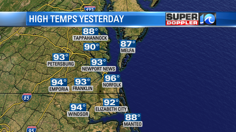
The heat index was in the mid 90s. It was rough before the cold front arrived. When it came through we had some scattered rain showers. Unfortunately, it didn’t add up to much. It was a couple tenths of an inch at the most. Today the front is dropping to our south. Cool/dry air is rushing in.
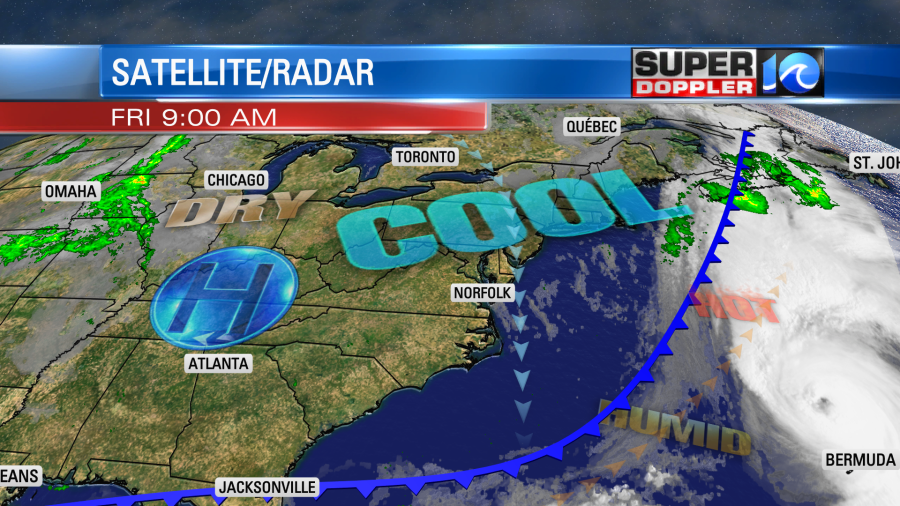
We’ll have a lot of sunshine today, but the wind will stay strong out of the north. It will run at 10-20mph with gusts up to 30mph in the metro and near the shore. This will keep the temperatures down. So expect highs only to be in the upper 60s to near 70 degrees this afternoon.
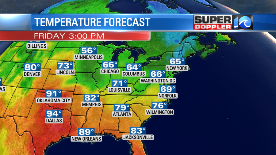
The wind will taper off later this afternoon into the evening. It should be pretty nice if you like fall weather. It will finally be some nice football weather for this evening for the high school games and Friday Night Flights.

Overnight we’ll have clear skies and lighter winds. So low temps will drop down to the low-mid 50s with some 40s inland.
On Saturday we’ll have some great weather! After the cool start we’ll warm up to the low-mid 70s. We’ll have lots of sunshine. There will be a light west wind. We will heat up on Sunday as the winds turn out of the south for a bit. We’ll be partly cloudy. There may be some spotty showers by the evening into the overnight, but there probably won’t be much. An isolated shower could continue on Monday, but there are no drought-busters expected over the next few days. We’ll be in the 80s again Monday, but we’ll drop to the low 70s once more Tuesday into Wednesday.
Meanwhile, the tropics are becoming even busier. I’m tracking 3 tropical systems, and there could be a 4th in the next 24 hours.
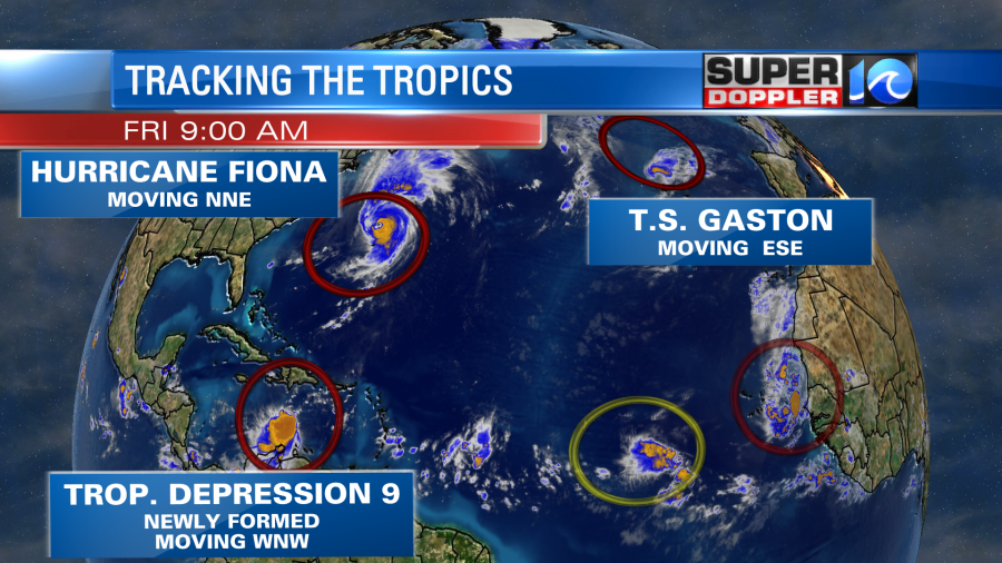
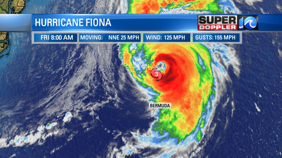
We have been following the latest on Hurricane Fiona. We recently talked about the damage that it has left in its wake. The center did miss Bermuda, but they were still lashed with some strong winds, heavy rain, and high waves.
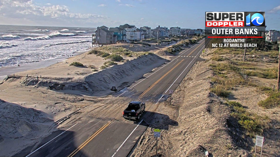
We did have an impact here as well. There was some ocean overwash over the Outer Banks earlier along parts of Highway 12.
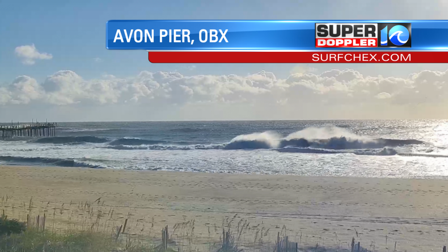
There were also some high waves. Over the Outer Banks surf was high and rough this morning. This was the view from around Avon Pier over the Outer Banks on Surfchex.com
There is dangerous surf and a high threat for rip currents at all our local beaches today.
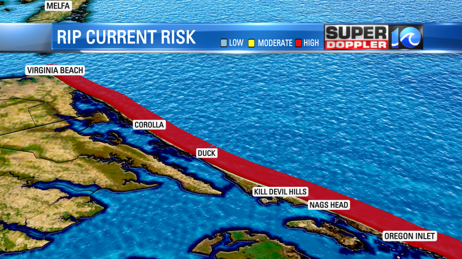
Again, it is mainly from Fiona, but Gaston may have contributed some too. Today Fiona will move north away from Bermuda. It will next move towards the Canadian Maritimes. The forecast is not good for Nova Scotia, Canada. Fiona is now forecast to be major category 3 hurricane as it makes landfall over the eastern part of the island.
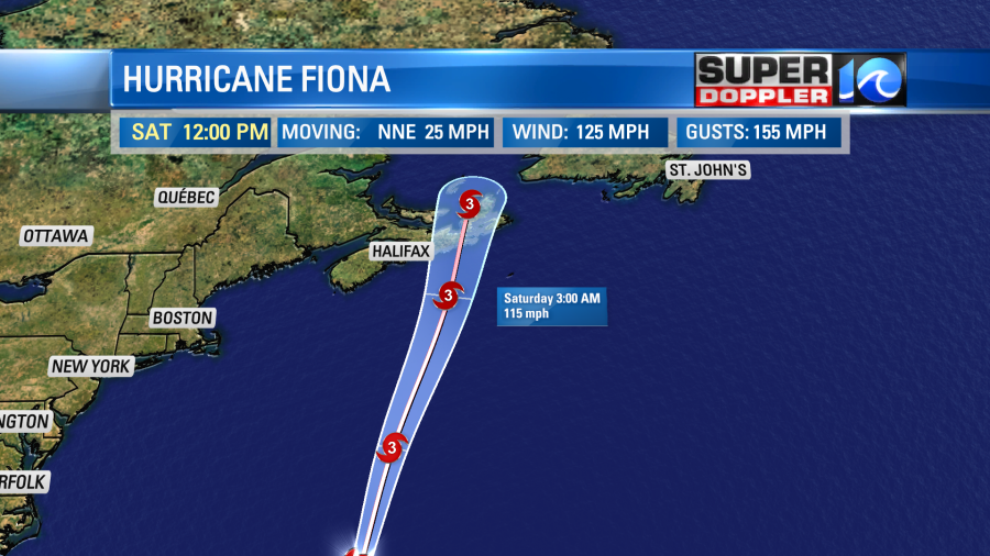
Hurricane force winds will extend out away from the center for miles, but the tropical storm force winds will extend out to Newfoundland and possibly eastern Maine.
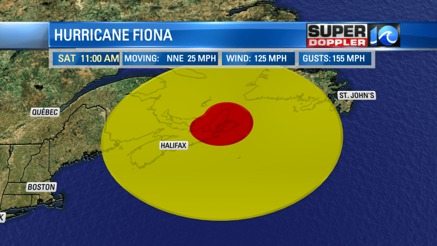
It should slowly weaken over the 2-3 days following landfall as it continues to move north.
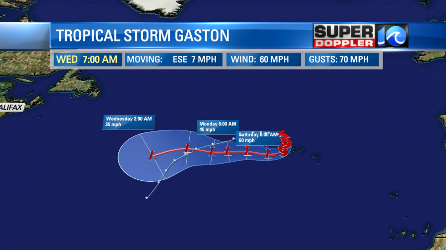
I won’t cover much about Gaston. It is bringing tropical storm force winds to the western Azores islands. However, it will be moving to the south then west over the next 12-24 hours. So the winds should decrease there shortly.
At 5 a.m. this morning National Hurricane Center posted that that tropical disturbance in the eastern Caribbean had become Tropical Depression 9. This system will move over the warm waters of the Caribbean Sea over the weekend. The wind shear should also lighten up. So T.D. 9 is forecast to become tropical storm Hermine. Then it is expected to become a hurricane as it aims for western Cuba.
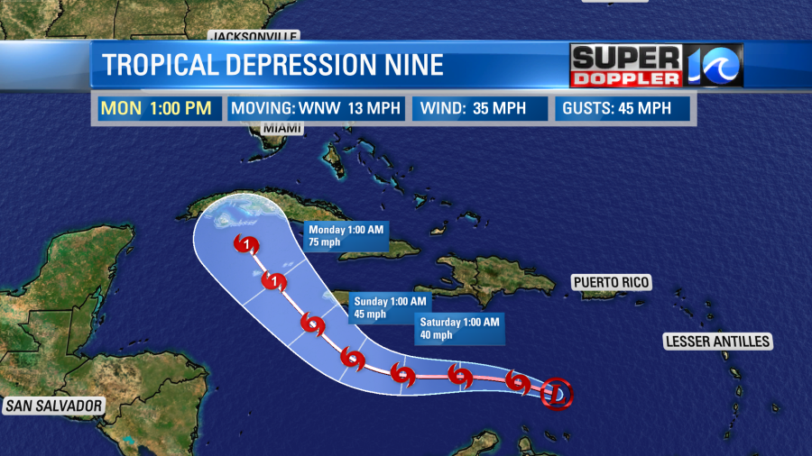
After that point it is expected to move north/northeast and towards Florida
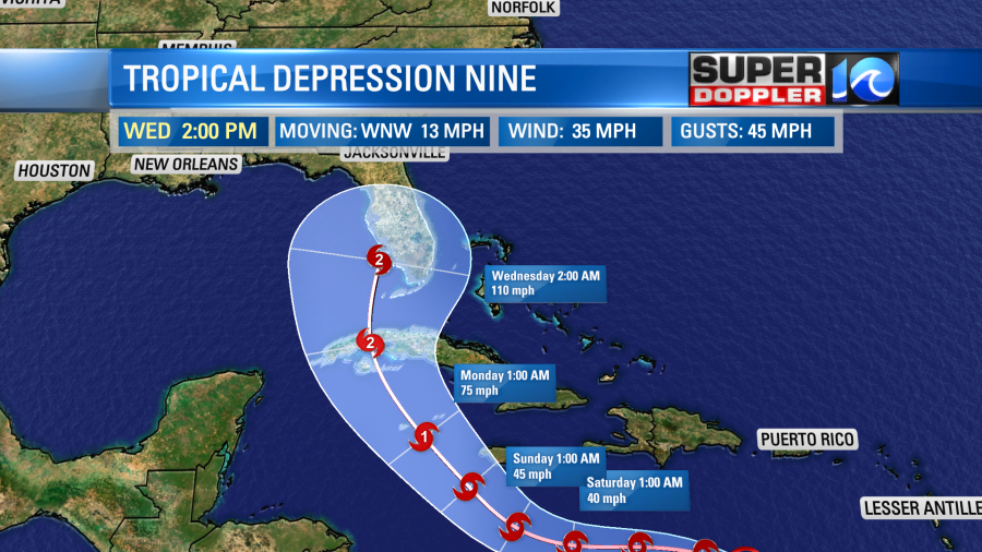
If it were to stay on the most likely path (center line) then it would move up along the east coast or just a bit inland.
Yesterday, the models were starting to trend west. The European model was more to the east. Since then the models have made a strong shift to the east.
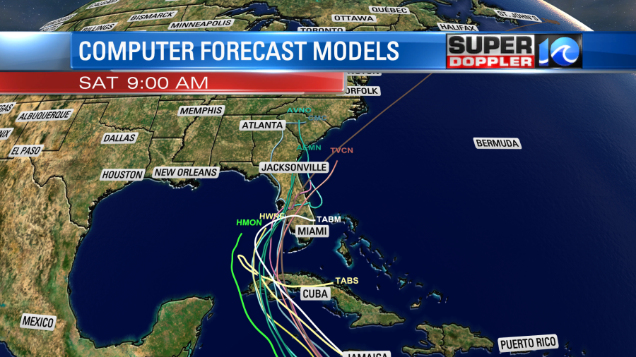
The GFS model was trending west yesterday. Now it has swung back to the east as well.
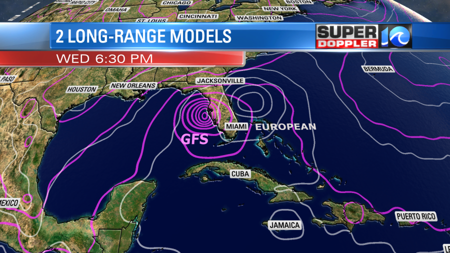
As you can tell they do run the system northeast along the east coast. HOWEVER, there is still a lot of uncertainty that far out. This will depend on the large troughs that will impact the eastern U.S. over the next 7-8 days. So stay tuned for updates over the weekend.
Meteorologist: Jeremy Wheeler


