Yesterday’s temperatures were great! We ended up in the upper 70s to near 80 degrees as forecast.
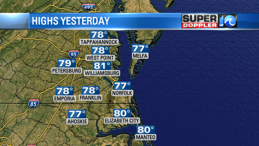
After some morning clouds we ended up clearing our skies between the afternoon and evening. The air became really dry by the evening as well.
The cool front that moved into the area has now dropped to our south. A large area of high pressure is centered off to our west.
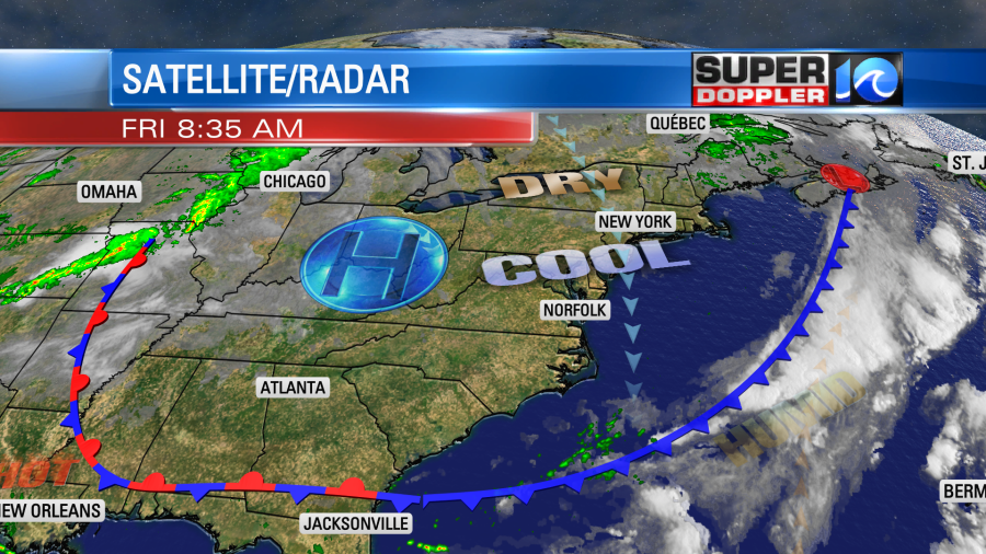
This is a large/strong area of high pressure. So it is going to give us some nice weather for most of the weekend. Today we’ll be mostly sunny with high temps in the upper 70s. There will be a few 80s inland. It will be so nice out! There will be a light north wind. One issue will be a moderate threat for rip currents at the local beaches. Though that is better than yesterday’s high risk.
Tomorrow we’ll be partly sunny with high temps near 80. We’ll be dry both days with dew points in the mid-upper 50s.
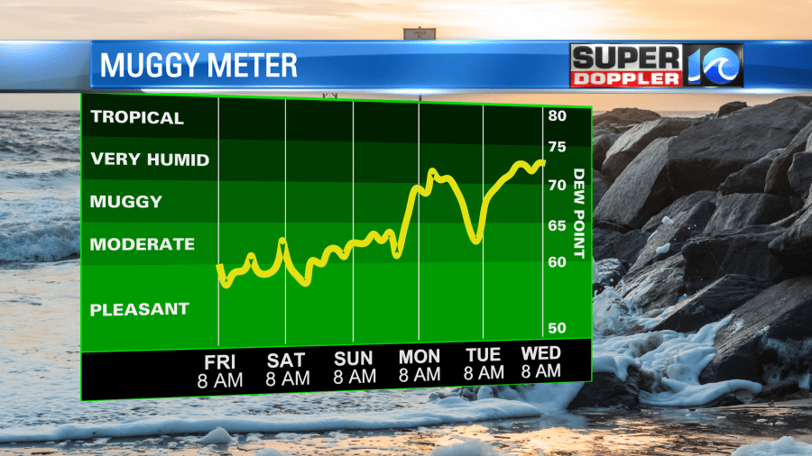
The humidity climbs slightly Sunday into Monday, but it still shouldn’t be as muggy as last week. We’ll be partly cloudy both days with only a stray shower or storm in the region.
Our next decent chance for rain will be around next Wednesday.
The picture is pretty grim in many of the northeast states after Ida’s aftermath. The reports and video coming from all locations in Ida’s path are disheartening.
Unfortunately, the tropics are still fairly active. There is a tropical disturbance over central America that has a low chance of formation as it moves to the west/northwest.
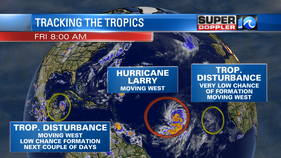
It may get into the western Gulf Of Mexico over the next few days, but the environment won’t be too favorable for development. The tropical disturbance in the eastern Atlantic is very weak and has a low chance of formation in the short and long term.
However, hurricane Larry is a different story. It has been gaining some strength over the last 24 hours.
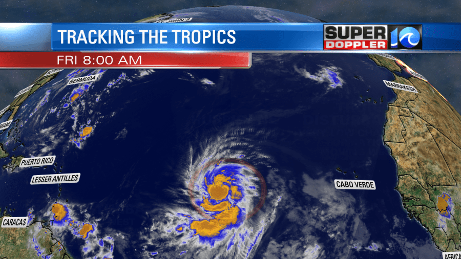
It is forecast to turn into a category 4 hurricane in a few days as it moves to the northwest.
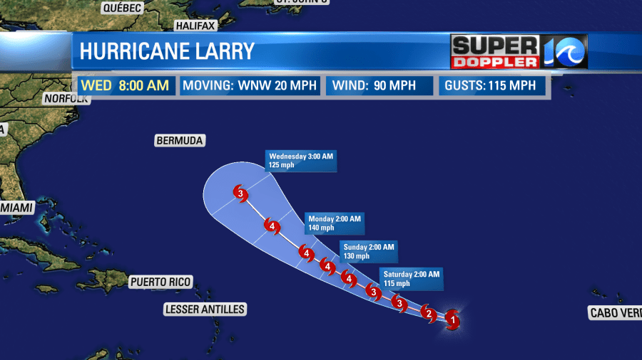
There may be some weakening as it gets closer to Bermuda in 5 days. Many of the models still keep it east of Bermuda in 6-7 days. However, they have trended a little more to the west.
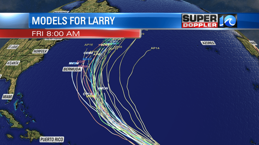
This is good news for the U.S. However, Bermuda will have to watch this storm closely over the weekend. Even if it misses Bermuda they may still get a significant storm surge. We could get some nice waves along the east coast for surfers. This would be mid to late week. Stay tuned for updates!
Meteorologist: Jeremy Wheeler


