The forecast for Elsa was pretty good for our area. It behaved just about as expected. We did have a lot of rain in the region yesterday. It was mostly light in the early afternoon with a few pockets of heavy rain.
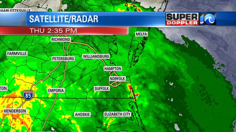
By the evening there were strong clusters of showers and storms. There were numerous tornado warnings.
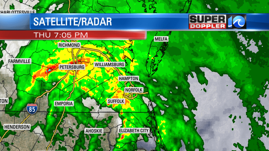
At that time the center of Elsa was near Richmond. There was heavy rain and flooding in that area.
We did have numerous wind gusts to over 40mph.

However, I didn’t see a lot of damage reports. At least not officially. There was one official report of a tornado in Suffolk. This was near the King’s Grant area. There was also a report of damage in Camden County, but that was deemed straight-lined winds. (so far).

Around mid-morning there was another tornado report that came in from in Isle of Wight County. The National Weather Service will likely do a survey today on these and possible more. There may have been more tornadoes on the ground. A lot of the warnings happened in rural areas. So more reports may come in this afternoon. There were a lot of ingredients for rotation and tornadoes yesterday. There was a lot of deep moisture and broad spin in the region. There was a high amount of low level wind shear. Plus, there was a little bit of instability. So tornadoes were no surprise.
Rainfall varied, but a lot of us got 1-2″ of rain. There were a few higher totals.

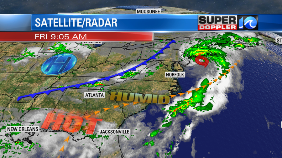
Things calmed down after midnight, and the last of the rain moved out early this morning. Now Elsa is impacting the northeast states. It moved over southern New Jersey before Dawn. Then it quickly jetted off to the northeast.
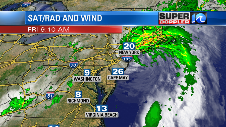
Heavy rain was impacting New York where they also had some flooding recently. During the afternoon Elsa will move over eastern Massachusetts. It will have some strong winds and heavy rain.
After that it will roll quickly to the northeast, and it will become an extra-tropical low over the Canadian Maritimes.
Today we will have high pressure in the region with a cool front to our northwest.
We’ll be partly sunny for most of the day, but some isolated showers or storms may pop in the afternoon. There will be a little higher chance for rain and storms this evening as the front approaches from the northwest.

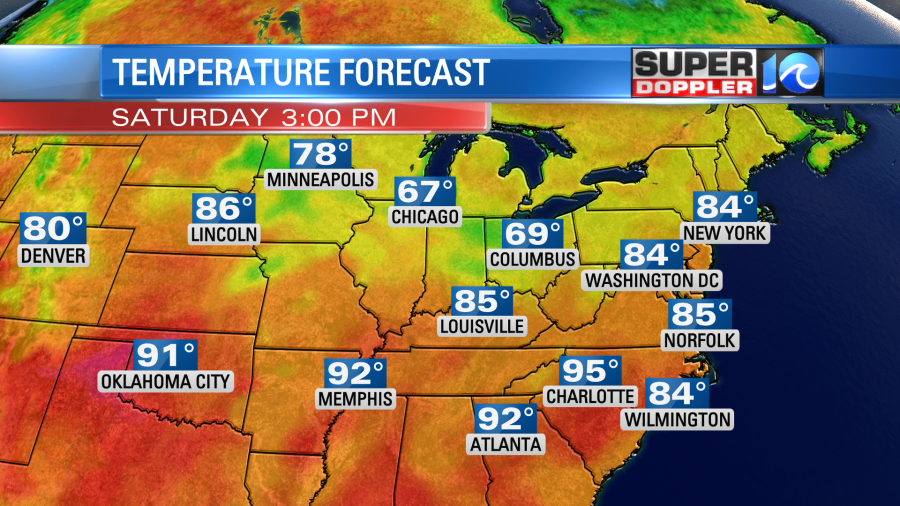
The showers and storms will move out after about 9pm. Then the front will drop to our south on Saturday. We’ll have some pretty nice weather. Skies will be partly cloudy. There may be an isolated shower or storm over North Carolina closer to the front. Highs will be in the mid 80s.
Humidity will drop a bit. We’ll heat up again on Sunday with highs in the low 90s. There will be a few scattered afternoon storms. Then we’ll have some pretty typical Summer weather early next week.
Meanwhile there will be more record heat in the west again today and into the weekend. Death Valley may get close to the all-time record high.
Meteorologist: Jeremy Wheeler