Locally we will have some great weather for this Election Day. It was a bit chilly this morning, but we’ll warm up nicely through the day. A very large area of high pressure is centered off to our west, but it is actually affecting a huge part of the country. So locally we’ll have a lot of sunshine.
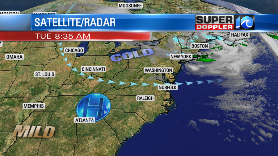
The wind won’t be anywhere near as strong as yesterday. They will run out of the west/southwest at 5-10mph. High temps will aim for the low 60s. It will be warm in the strong sun. Tomorrow we’ll have similar weather, but the wind will be a little more southerly. So high temps will be in the upper 60s. A few spots may hit 70. We’ll have a mix of sun and clouds Thursday into the weekend. High temps will be in the low 70s. Now there will be a persistent easterly breeze developing Thursday through the weekend. Sometimes that allows a marine layer to set up and move in. This could allow for some low clouds to come in off of the ocean along with some stray showers or drizzle. The models hint at this. More so for the Outer Banks. So stay tuned for updates.
Meanwhile down to our south hurricane Eta is slamming the northeast coast of Nicaragua. It was a category 4 hurricane this morning.
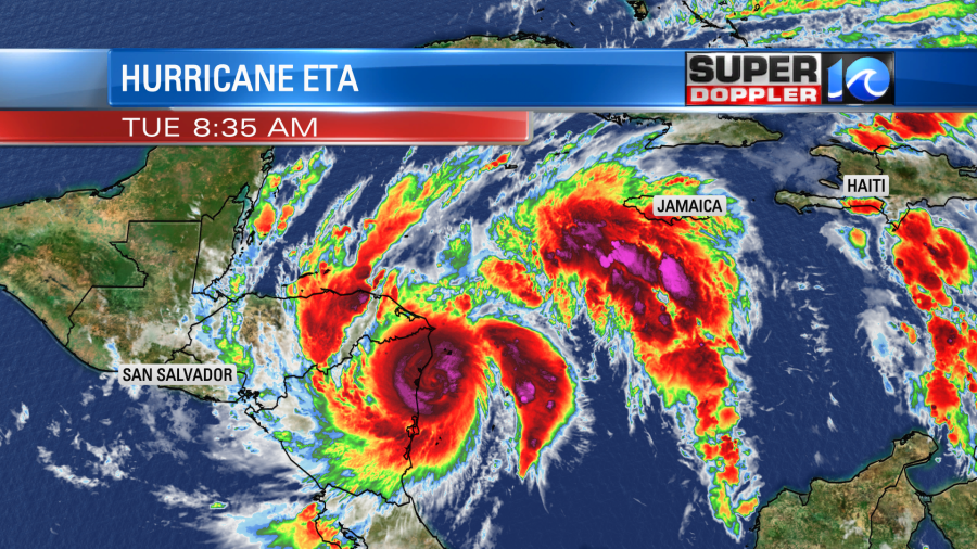
At one point it had winds of 150mph (sustained). Then it came down slightly to 145mph. Either way they will get hit with those types of winds for a while. There is a potential storm surge of 15-20ft along the coast. Eta will move west/inland and gradually weaken. This will produce large amounts of rainfall over that region. After that it could turn to the north and northeast. The forecast takes it back over the water, but there is some uncertainty in this scenario.
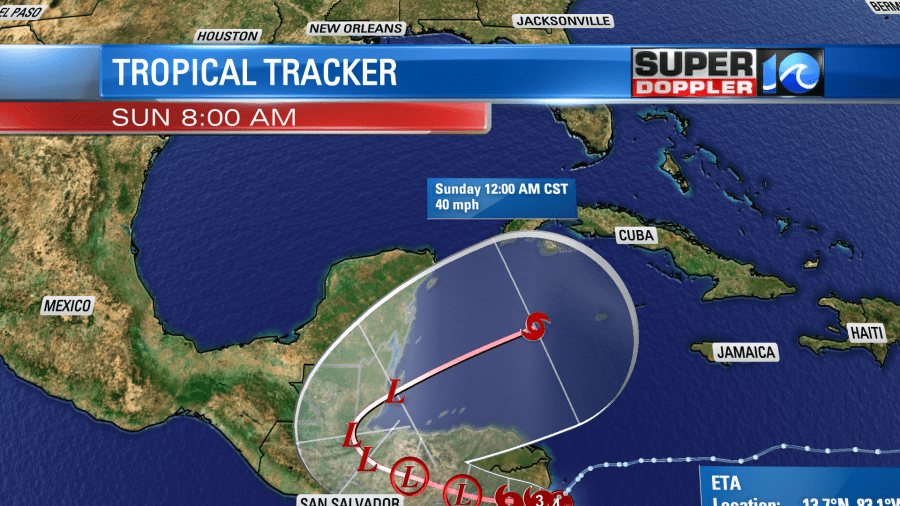
The models still have some disagreement as to the long-range track. Some have it going west and falling apart like the UK met. However, the GFS has been showing the system moving back to to the northeast since yesterday. It has it moving back over the Caribbean Sea, and it even brings it up into Cuba. Many other models are starting to do this. However, they also curve it back to the southwest in the long term.
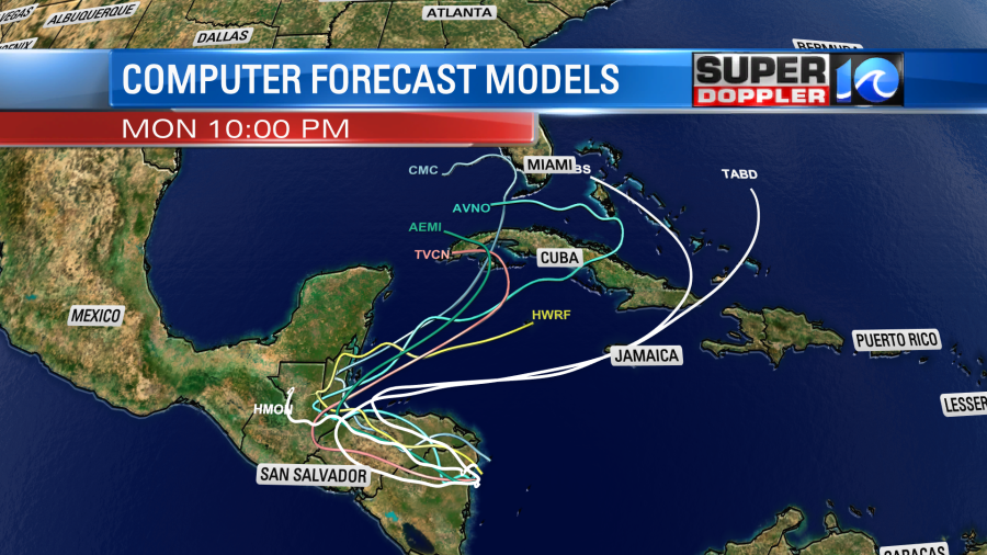
This is likely due to the strong ridge that will persist over the U.S. through that time.
Check back for updates on this! The models will have a better handle on things once it moves more inland. Pray for the folks down in central America.
Meteorologist: Jeremy Wheeler

