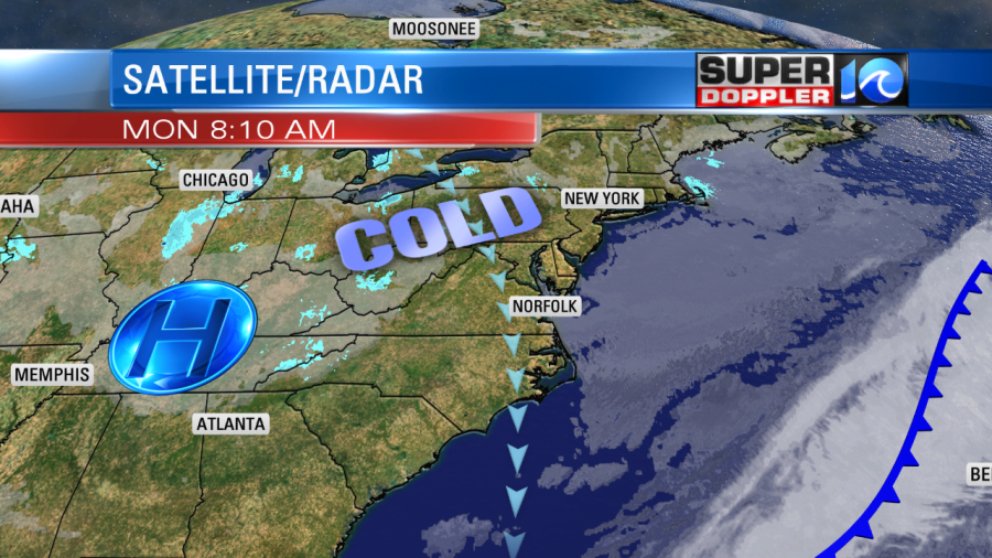
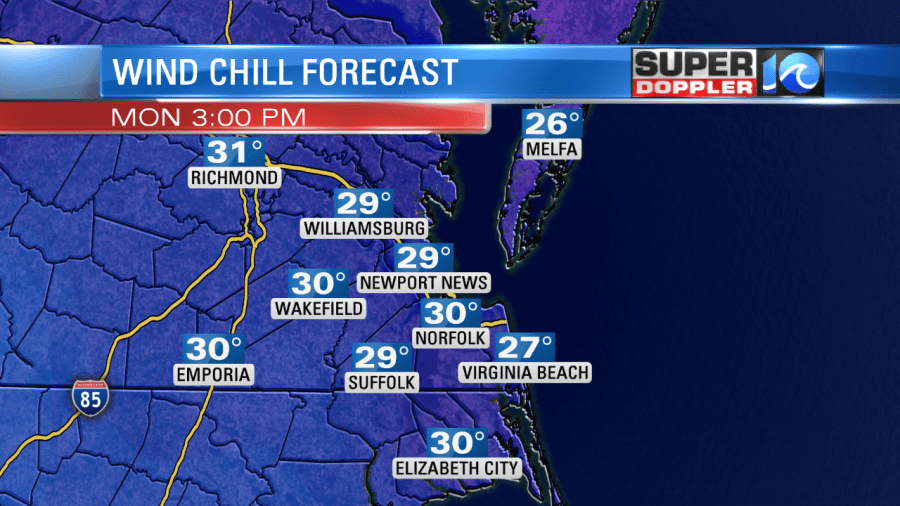
This morning we started about 20-30 degrees colder than yesterday morning. Temps were in the 20s and 30s. However, the wind chills were in the teens and 20s. Youch! The winds were out of the north at 10-15 mph with gusts to 25 mph. These winds will stay up through the day. They are coming around a large area of high pressure that is locked-in to our west.

We have a lot of dry air moving in from the north along with the colder air pushing south. However, we are also having that cold/north wind running down along the Bay. So there will be some bay-effect clouds along the shore for a while. There were even a couple of reports of flurries this morning over parts of the Southside and in Kill Devil Hills.
Eventually, the dry air will win. So most of the region should be mostly sunny this afternoon. High temps will only be in the upper 30s to near 40 this afternoon. Wind chills will be in the 20s.

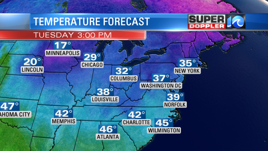
Tomorrow we’ll have the same weather pattern as high pressure holds over the Midwest. There will be a weak system offshore. The majority of the area will be mostly sunny on Tuesday. However, there may be some isolated showers or even flurries over the Outer Banks. Effects will be minimal. High temps will be in the upper 30s again.

We’ll warm up slightly on Wednesday as the winds decrease. High temps will be in the 40s. We’ll be near 50 and dry on Thursday. We’ll be in the 50s with more clouds on Friday. The next chance for rain will be on Saturday as high temps warm to near 60 degrees.
I found this article for the snow lovers. Our recent cold air will likely help some of the regional ski resorts. However, there is one ski resort out west that recently recorded over 11 (feet) of snow on the ground. That is Jackson Hole Mountain Resort, Wyoming. According to the article this could be the snowiest reading of all-time there. Here is the article: Record Snow Jackson Hole Wyoming.
We’ll see about any local snow. At least it’s getting colder.
Meteorologist: Jeremy Wheeler


