We have some great weather in the region, and it is going to stick around for a while.
There’s a cool front to our south with high pressure edging in from the west.

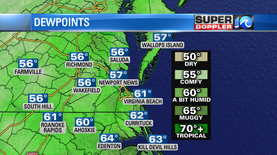
The drier air has finally settled into the area. You probably felt some of it last night. Well, it’s firmly in place today.
We have a nice northerly breeze, and that will stay steady through the day. This should keep the high temperatures near 80 degrees with some low-mid 80s inland. we’ll be mostly sunny.

We’ll continue with this same type of weather for the next few days.

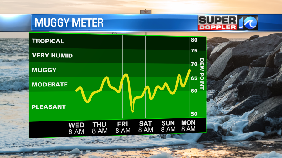
It’s great that we will have dry conditions for the next several days, but it’s bad that there won’t be any rain. Take a look at the latest climate for the region.
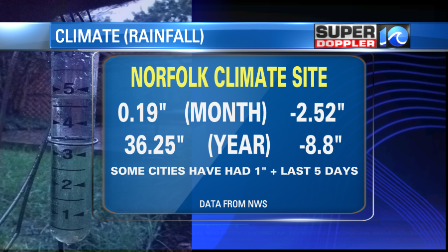
The driest year on record was in 1986. That year we only had 19.86″ of rainfall. Wow!
While the local weather is quiet, there is one feature in the tropics that is gaining some strength. The tropical disturbance in the middle of the Atlantic has gotten a little more organized on satellite.
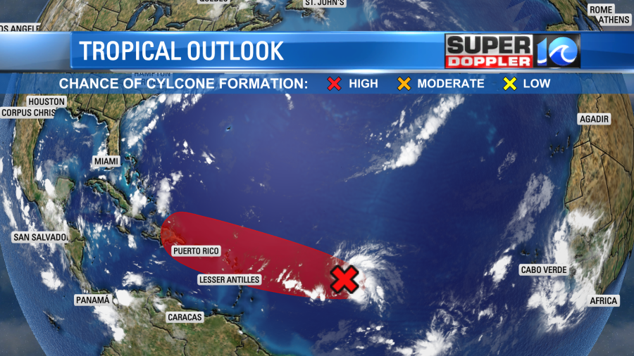
This feature is moving to the west/northwest. It is forecast to keep tracking that way by many of the models.
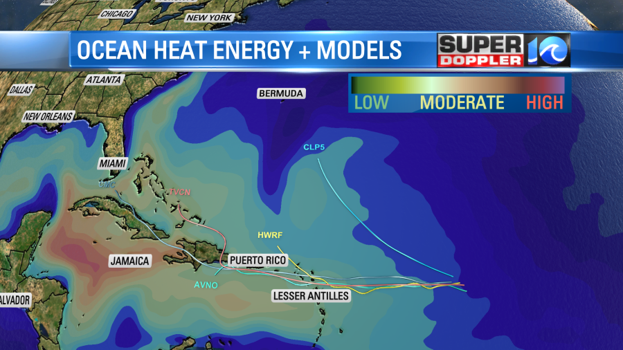
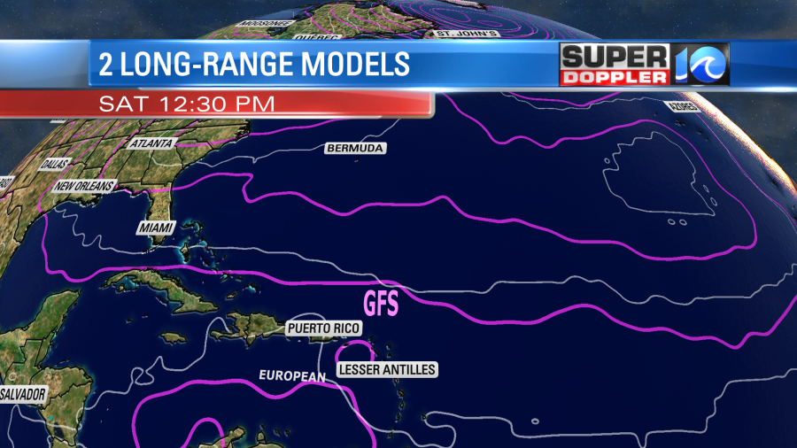
The Hurricane WRF has trended more to the north of Puerto Rico. However, the GFS and Euro models keep it weak and track it basically to the west over the next few days.
We’ll watch it closely over the next few days.
Meteorologist: Jeremy Wheeler