The region did get some much needed rain yesterday, but the amounts were not impressive.
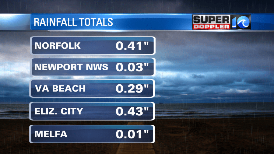
Some locations from Newport News northward barely had anything. Amounts were higher to the south. Overall this was literally a drop in the bucket compared to what we need in the long-term. We do have some more shots at rain over the next 4 days. Temps will bounce around for a while.
Today high pressure is in the region. We’ll have a light north wind with increasing clouds.
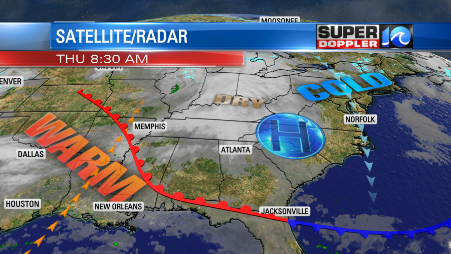
High temps will only rise to the upper 40s to near 50 degrees. This is going to be in stark contrast to some incredible warmth that will develop over the deep south.
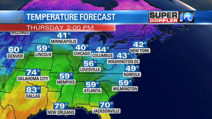
High temps over parts of Texas and Louisiana will rise to the 70s and 80s this afternoon. It will increase even more tomorrow with some of the heat starting to slide east into our region.
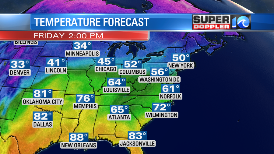
High temps locally will rise into the low 60s. We’ll have a light south wind. We’ll also have a mix of sun and clouds through the day. There may be enough moisture coming up from the south to produce some isolated showers, but it won’t be enough for any measurable rainfall. Temps will continue their climb to the low 70s by Saturday.
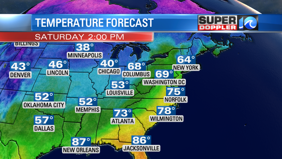
Some models are suggesting that we’ll get into the mid 70s. The record high for that day is 75 degrees set back in 1971. Ironically, we are likely to have a lot of clouds in the region. We’ll also have some isolated showers during the day. However, a strong cold front will move in Saturday night. This will bring us a broken line of rain showers, and possibly a couple of thunderstorms.
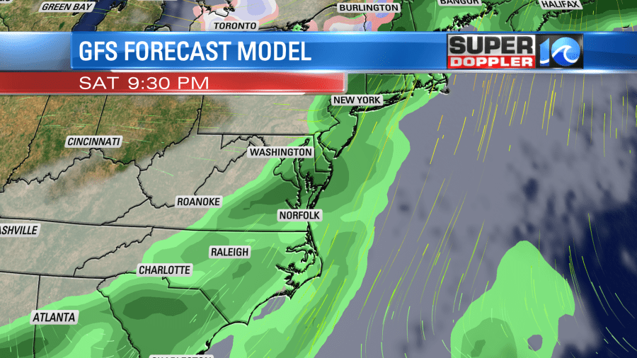
The latest models do have a few showers lingering into Sunday morning, but then they dry us out during the afternoon. The high temps will get knocked down to the mid 50s. We’ll be dry and mild early next week. High temps will return back to the 60s by Tuesday. There will be more record warmth over the central U.S.
Meteorologist: Jeremy wheeler
