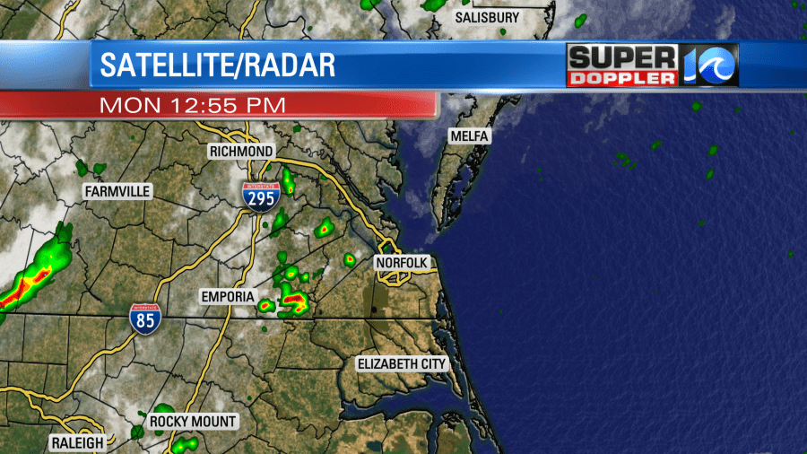
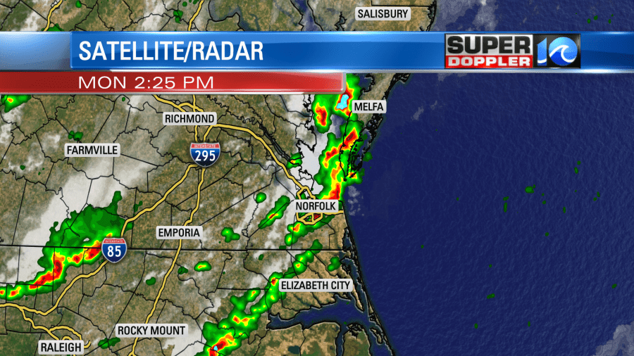
The storms packed a punch yesterday as they rolled through the area. Storms formed along a weak boundary that was out ahead of a cool front. They started off as some isolated showers, but they quickly grew into a big cluster of strong storms.
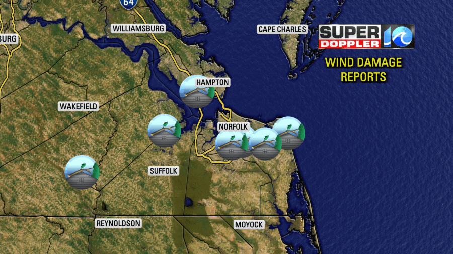
We have several reports of trees down over the region. Some of them fell on homes. A couple of them even knocked down some power lines.
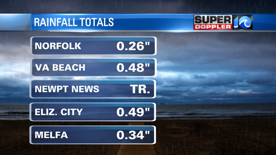
Rainfall varied quite a bit. Most locations had a quarter to a half an inch. However, some places like Newport News barely had a trace of rain.
My weather watcher Scott in Yorktown had 0.14″.
All of this was ahead of a cool front that swiped through the metro in the evening. Now that front is sliding to our south.
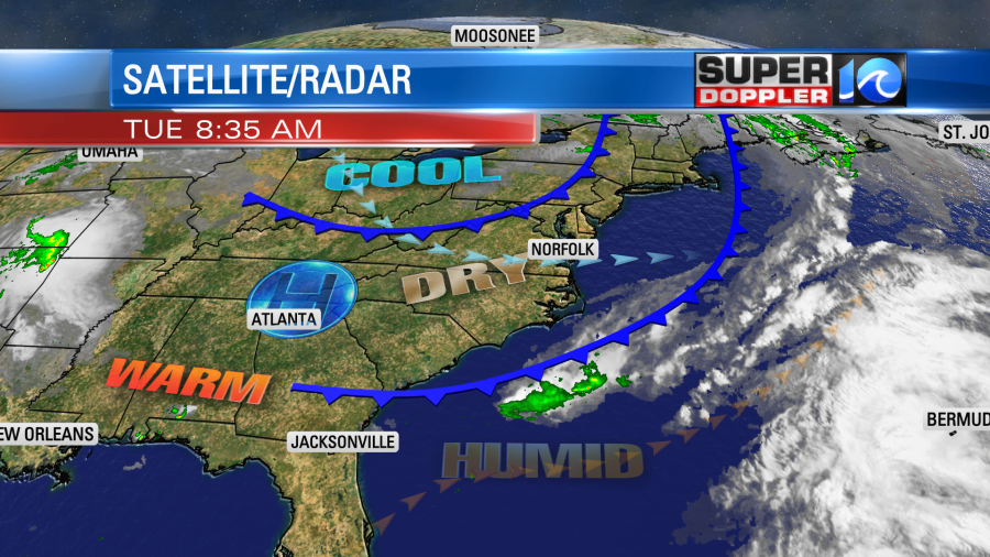
This first cool front won’t cool us down much today, but it has dried us out. Yesterday was like a steam batch outside. Today the dew points have dropped into the low-mid 50s.
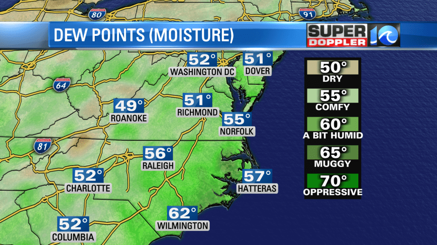
So while our high temperatures will only be a couple of degrees below yesterday (we’ll be in the low-mid 80s). It will feel more comfortable with that lower humidity and a light west breeze. We’ll have lots of sunshine through the day.
Tonight a second cool front will move through the area. It will pass through dry. So no rain is expected. We’ll be cooler and even drier tomorrow with lots of sunshine. High temps will be in the low-mid 70s.
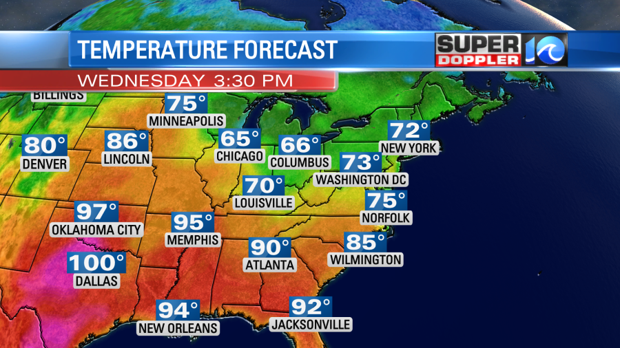
This will be some awesome weather! Enjoy it while you can because the heat and humidity will bounce back Thursday into the weekend. High temps will rise to the 80s and 90s. The humidity will climb to “muggy” levels.
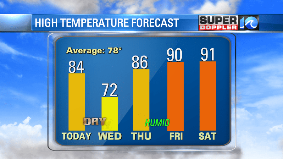
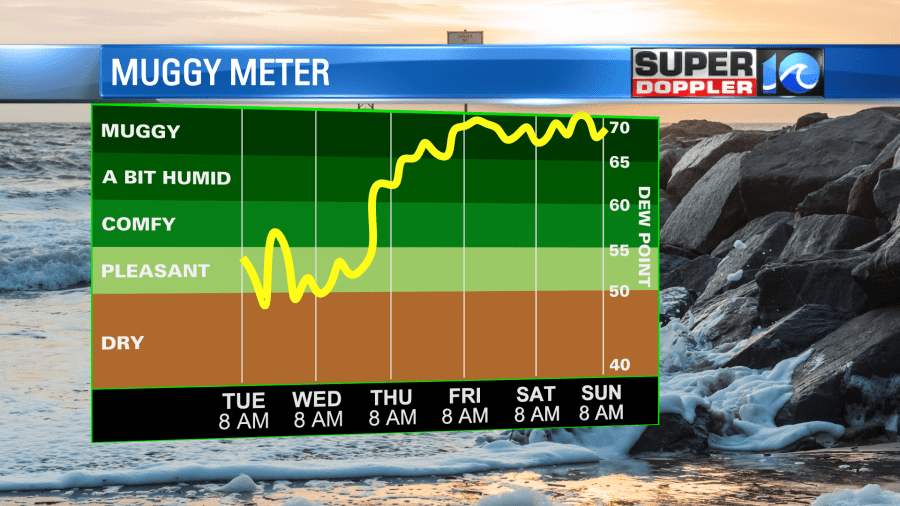
The heat index Friday and Saturday will probably be in the mid 90s. There may be a few showers and storms, but the chance is fairly low. We’ll cool down Sunday into Monday.
Some of the long range models are still showing a tropical system in the Gulf of Mexico in the next 10-12 days. We’ll see. The only reason that I even mention it is because they keep showing something
Meteorologist: Jeremy Wheeler
