
Yesterday, we broke a record at Norfolk International Airport. The high temperature there hit 102 degrees. This broke the old record of 101 set back in 1942.
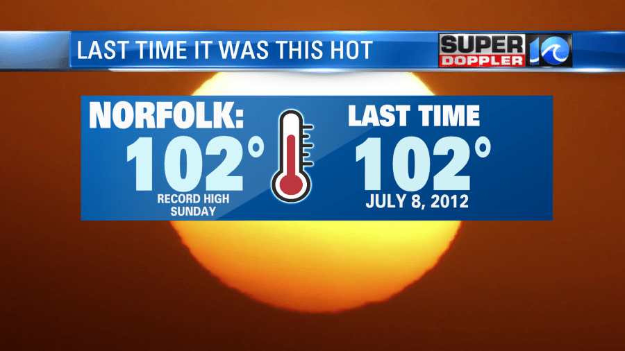
The last time we hit 102 was back in 2012. However, we did hit 100 a couple of days last year around this time. Today we are likely going to tie the record. It currently sits at 102 degrees (1942). The heat is one thing. However, its even rougher when you factor in the humidity. The heat index was well over 100 yesterday. Today there is an Excessive Heat Warning for this effect. The heat index is forecast to be between 110 and 115 for some areas. High temps will be in the upper 90s near the shore, but near 100 or in the lower 100s for everyone else.
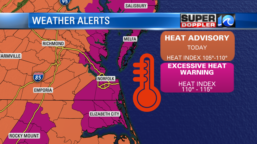
So take precautions if you are going to be outside for a lengthy period of time. Here are some reminders for heat safety:

That is both light-weight and light-colored clothing in the above graphic.
This year we also have to factor in COVID-19. This means that if you are getting light headed or dizzy with your mask on, then get to an area where you can take it off for a while and catch your breath. Also, some cooling centers may have a more limited capacity due to social distancing.
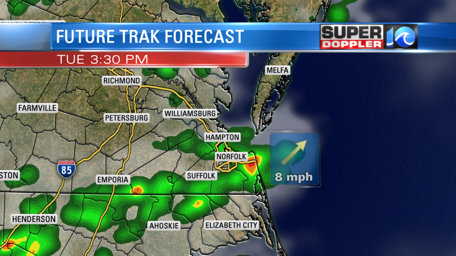
High pressure is offshore. We have a light southwest wind coming in around it. There is a cool front stalling out over West Virginia. It still stay to our northwest during the day.

We may have some isolated showers and storms pop up this afternoon, but I don’t think there will be too much coverage.
Tomorrow the front will drift a little closer to us. This should lower the pressure slightly. So we’ll have increasing clouds with scattered afternoon showers and storms.
There could be a few strong storms and heavy downpours. High temps should be capped in the upper 90s. However, it will still feel likes it’s in the 100s with the heat index. We’ll have about the same weather on Wednesday and Thursday. By Friday we’ll have some slightly cooler air. So high temps will be closer to 90 degrees. Then we’ll finally be back to the 80s by next weekend. Hang in there until then.
There are 2 tropical disturbances that we are watching in the Atlantic. Both are moving generally to the west.
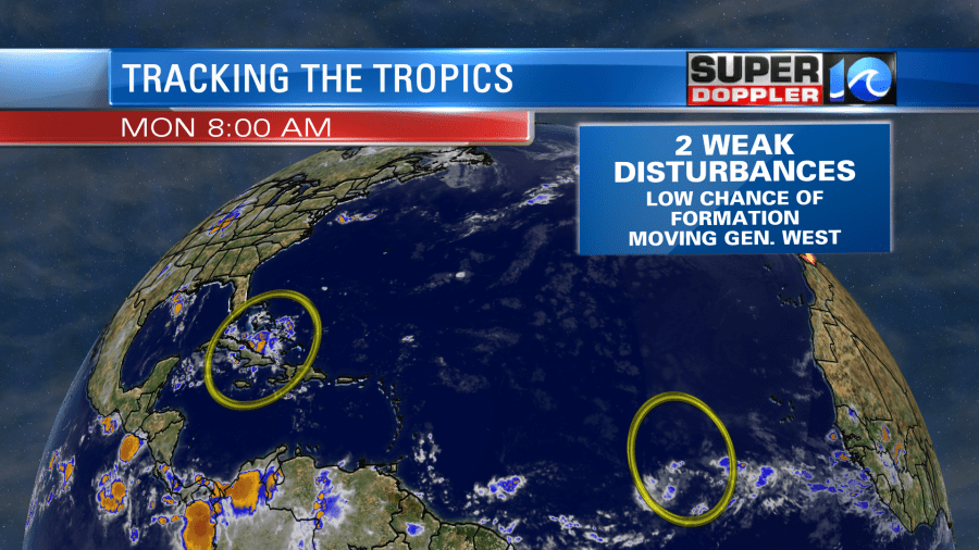
The one in the central Atlantic is pretty far south. The one near Cuba will enter the Gulf of Mexico. The Tropical waters are running pretty hot. So while they have a low chance of formation, we’ll have to watch them closely over the next few days.
Meteorologist: Jeremy Wheeler