11 PM Update
Debby is now over the Atlantic Ocean, the storm is expected to strengthen with wind speeds back up to 50 mph tomorrow and Thursday as it makes a second landfall in South Carolina. Regardless of this, our weather forecast is looking the same. The wind for our area picks up on Thursday. We could see a tornado threat Thursday and maybe Friday as the bands on rain from Debby move through our area. The storm may move out by midday Saturday leaving us with great weather for the weekend.
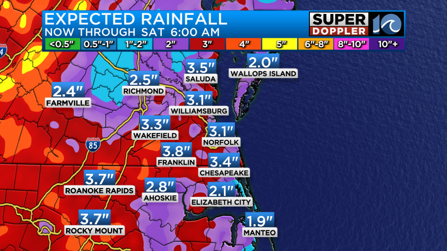
As the tropical moisture from Debby comes up the East Coast, we’re looking at daily doses of rainfall for the rest of the week!
Wednesday:
As the more rain slowly fills in from the south tonight, look for scattered showers and downpours for most of Wednesday. Some pockets of heavy rain here or there could lead to street flooding and in low lying areas (mainly for NE NC). Highs should hold in the low to mid 80s with it remaining very, very muggy.
Thursday:
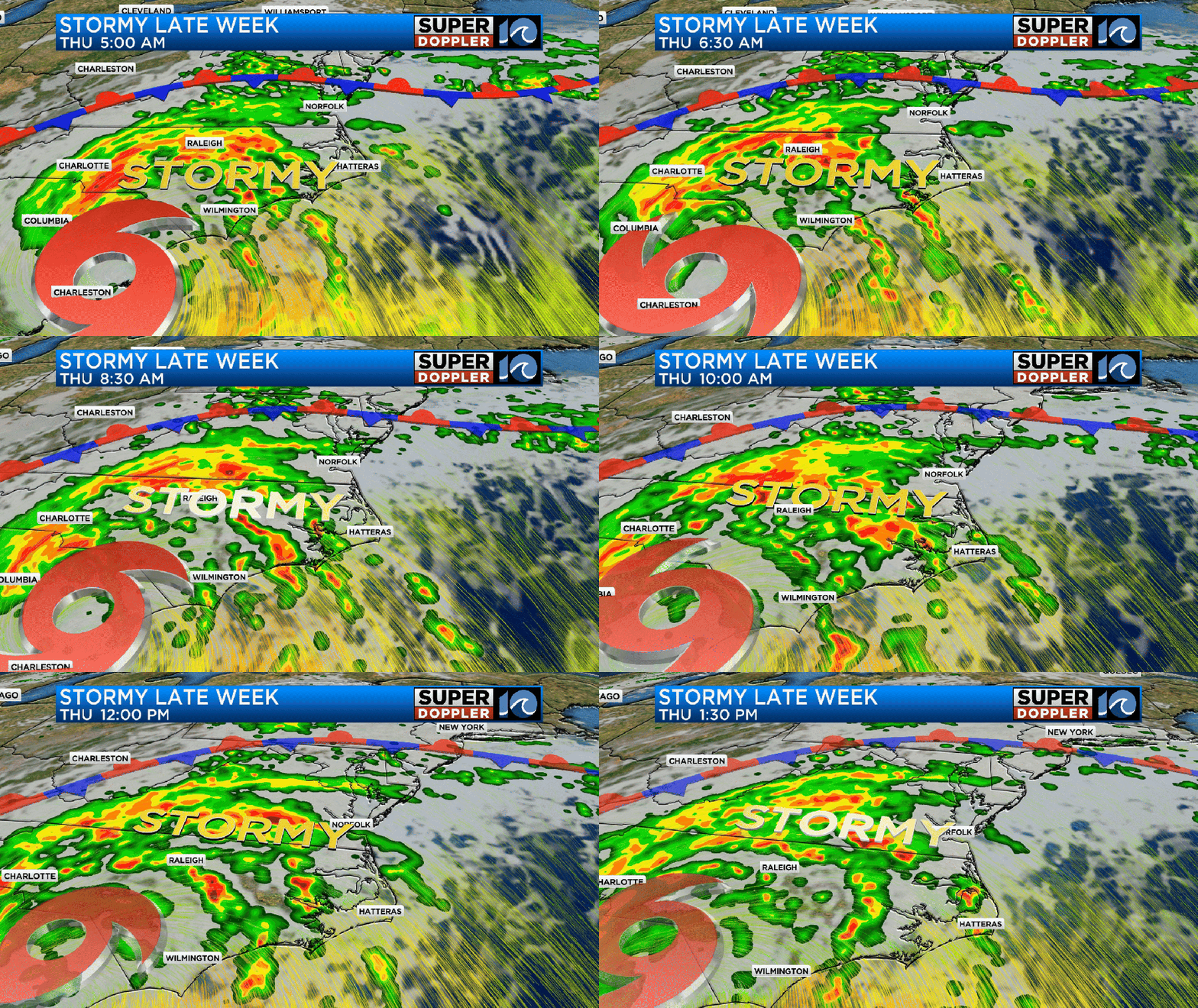
What’s left of Debby will drift northward on Thursday and crash into a stalling front, in doing so, it puts NE NC and Hampton Roads on the stormier side of the system. We can anticipate a gray, muggy and breezier day with scattered downpours and thunderstorms. Some of these storms could be strong to severe (capable of producing damaging wind gusts or a few tornadoes), so we’ll have to stay weather aware on Thursday.
Friday:
Another round of downpours and thunderstorms rolls through the region as what’s left of Debby will soon move out. Again, some of these t-storms could be strong or severe, make sure we stay weather aware! Expect clouds and a warm breeze in between those scattered downpours.
Tidal Flooding:
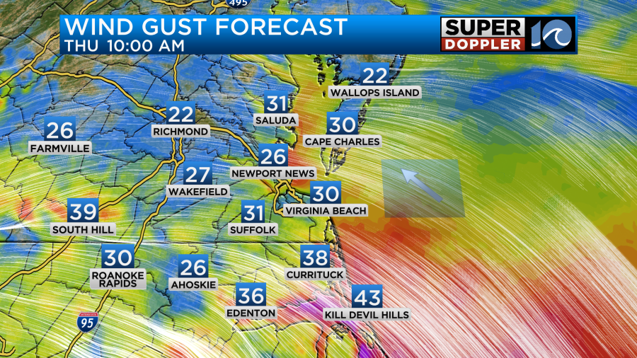
There’s a chance of minor tidal flooding along the Albemarle Sound and in southern Virginia Beach along Back Bay as the southeast winds pick up Thursday and Friday. Winds could occasionally gust to 35+mph, higher gusts are possible along the coastline of the Outer Banks.
Weekend:
Latest guidance has Debby moving a bit faster on it’s track up the East Coast… sure, this gives us a better chance at seeing strong-severe thunderstorms, but it also means the worst of the weather should be moving out by Saturday. We can look for drier conditions Saturday with a nice breeze, then sunshine and low humidity on Sunday!
-Steve


