Well … we got some of what we asked for. Over the last 48 hours we did get some rain in the region. Yesterday afternoon there were several pockets of showers. There were even some isolated downpours.
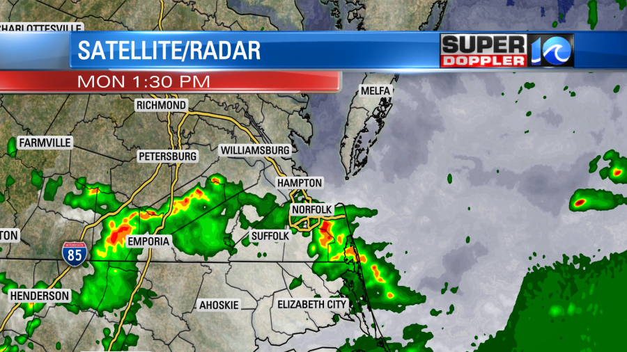
The models actually did a good job on yesterday’s forecast. They said we would have quiet weather for a while in the late afternoon and early evening. We did. Then (as the models forecast) we had a line of showers and storms roll through the region overnight. The line did weaken before arriving, but it didn’t break up too much. So we all had at least some rain.
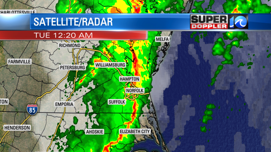
Amounts varied over the viewing area. In the last 48 hours we had about a quarter to a half an inch of rainfall. There were a few locations that had more.
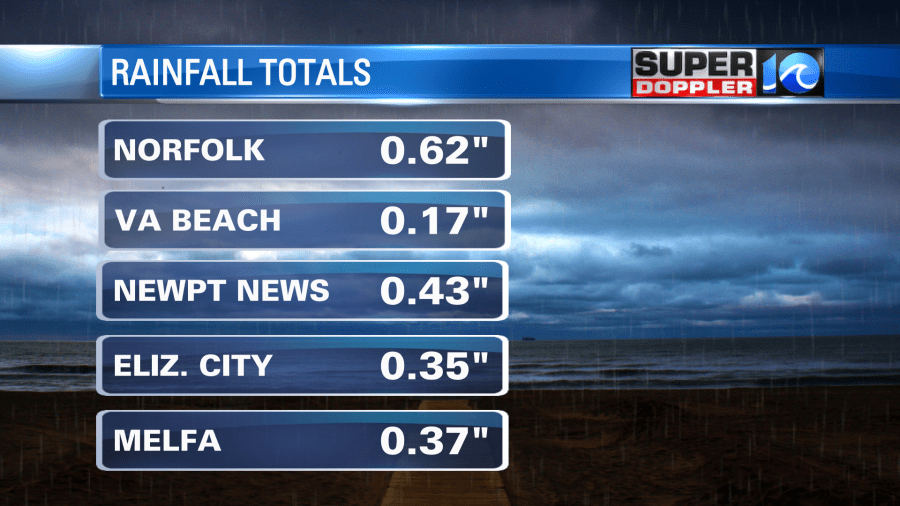
The official number in Virginia Beach was pretty lean, 0.17″. That was from NAS Oceana. However, my weather watcher Donna in Blackwater (southern Virginia Beach) had 1.37″ over the last 48 hours. She was in that isolated downpour yesterday. So this was good, but we still need a lot more rain to get caught up in the longer term. Remember we are over 7″ below average for rainfall for the year.
This was from a cold front that has now pushed offshore. A strong nor’easter is developing to our northeast. strong high pressure is edging closer from the west.
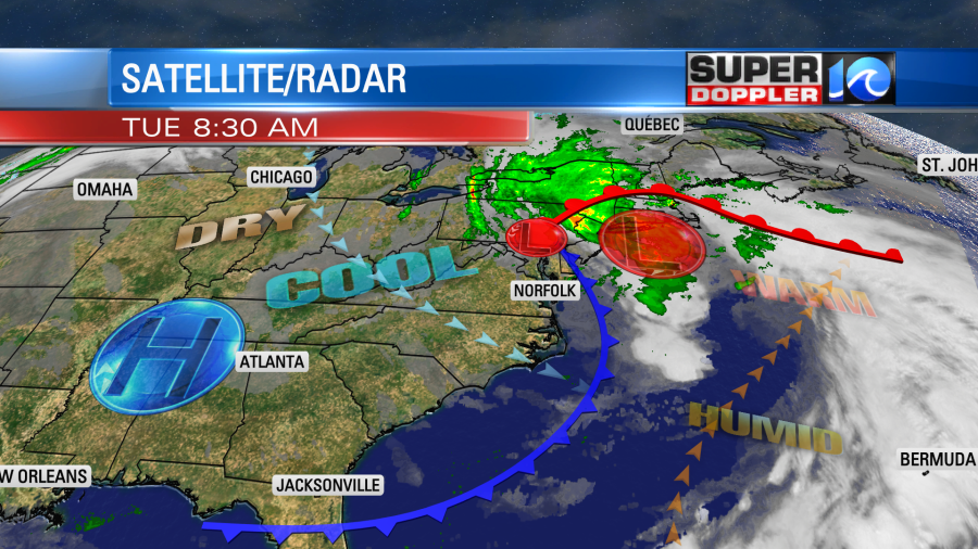
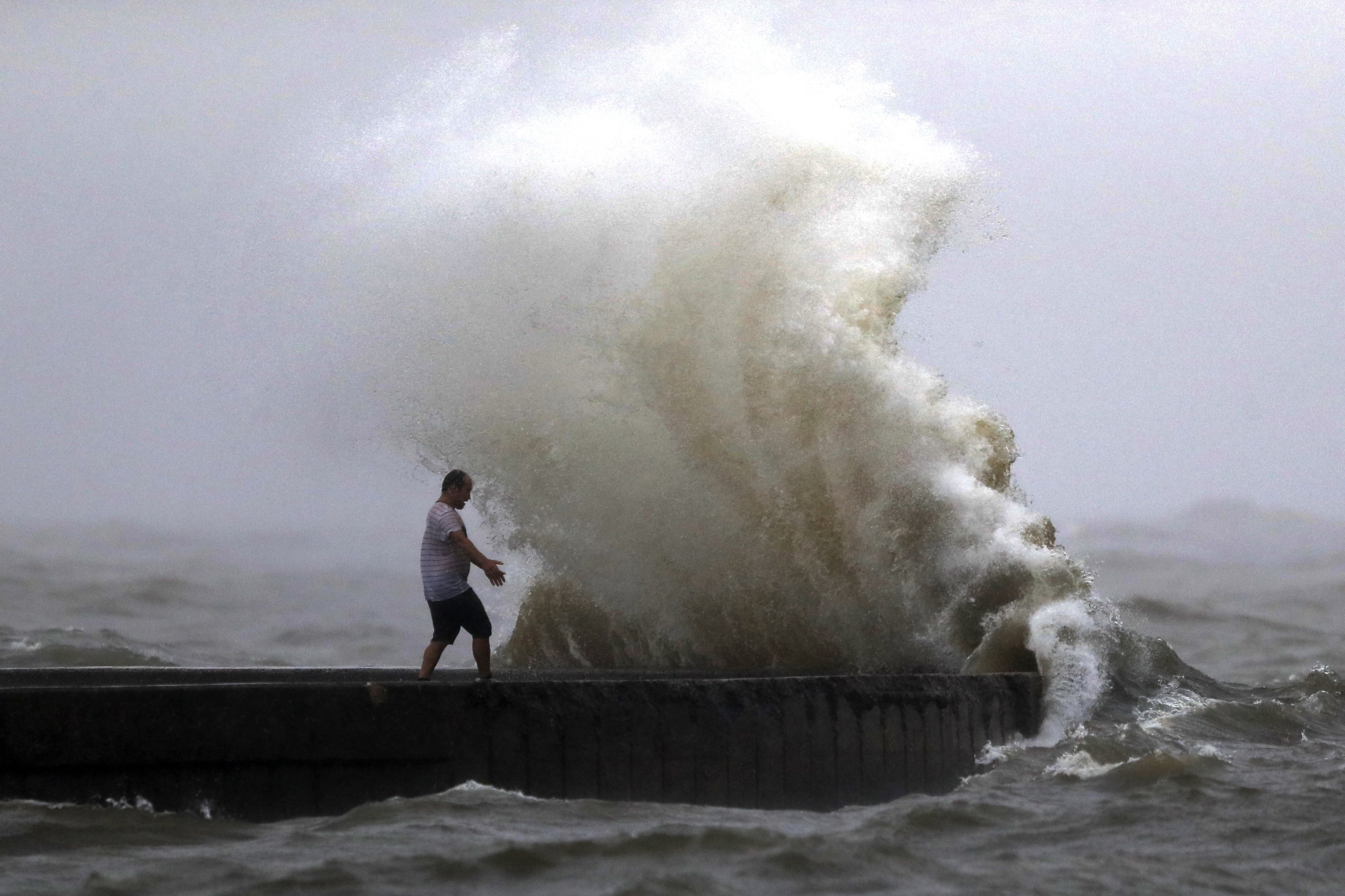
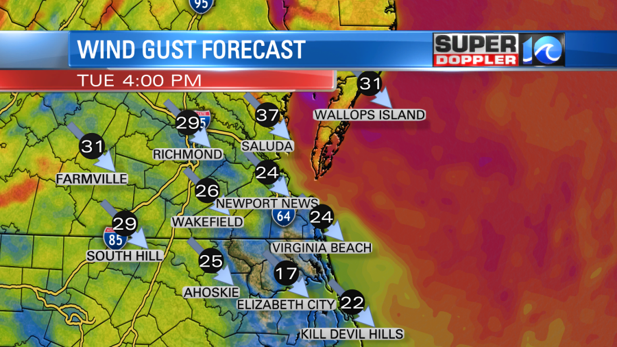
What you can’t see is an upper level low that is sitting overhead. While we do have drier air at the surface there will still be some clouds today. We’ll have a mix of sun and clouds through the afternoon. The upper level low will create a few isolated instability showers or sprinkles. Anything that falls should be very light. The wind is really going to increase. There will be a strong gradient between the developing nor’easter to the northeast and the high to the west. So our local winds will run at 10-20mph with gusts up to 30mph this afternoon and evening. A few gusts could be up to 35mph on the Eastern Shore and near the Chesapeake Bay.
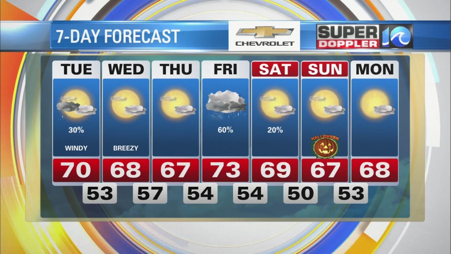
This will keep the high temps down today. Despite starting in the 60s, we’ll only rise to around 70 degrees this afternoon. Dew points are dropping from the 60s to the 50s. Tonight will still be pretty windy in the evening, but it will settle slightly overnight. Low temps will be mainly in the 50s. Tomorrow we’ll be partly cloudy and breezy, but it will be dry. High temps will only be in the upper 60s. We’ll be cool, dry, and quiet on Thursday. Then we’ll have some more rain on Friday.
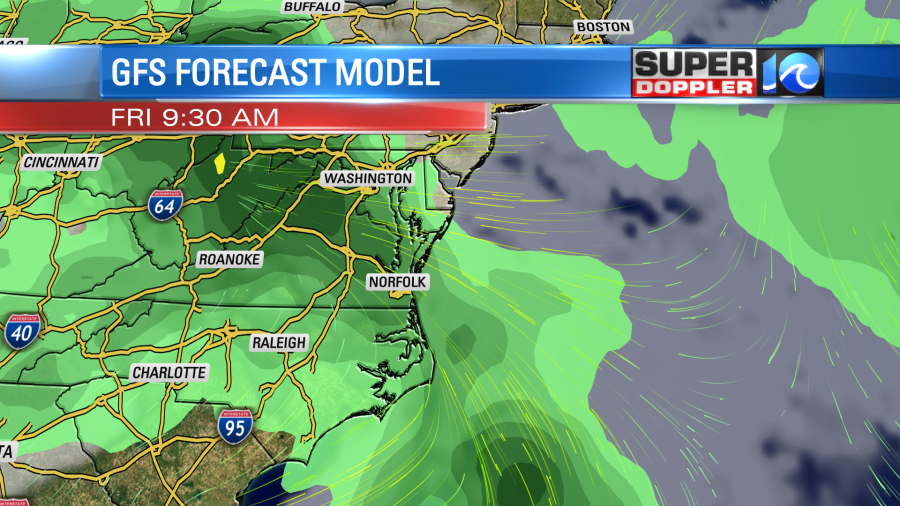
Moisture will stream up out of the southeast ahead of an area of low pressure that will develop to our west. This should move out by Friday night. Other than an isolated shower on Saturday, the weekend looks pretty good. It will be cool with highs in the 60s. For now Halloween is looking cool and dry. I’ll be more specific over the next couple of days.
Meteorologist: Jeremy Wheeler
