
Last night meteorologist Don Slater updated the January high temperature chart (unless it was a weather gremlin). It is revealing a very warm January.
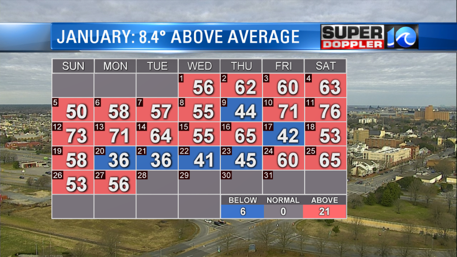
It’s striking to not only see how many days the high temps were not only above average but well above average. Yesterday, we topped off in the mid 50s with a couple of 60s south. Today we have a cooler/colder northwest breeze. High pressure is slowly building in from the west.
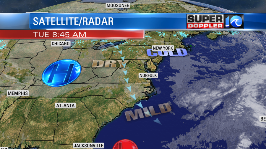
We’ll have clearing skies this morning. Then we’ll have mostly sunny skies for the bulk of the day. High temps will be in the upper 40s to low 50s. Tomorrow and Thursday look dry and cool for our region. Highs will be mainly in the mid-upper 40s. There will be an area of low pressure passing well to our south on Thursday. There’s a higher confidence now that the precipitation will stay to our south. On Friday we’ll warm up slightly as winds turn a little more out of the southeast. High temps will be in the 50s. At that time there will be increasing moisture in the region. We’ll have increasing clouds with some isolated showers by the end of the day. This will be ahead of an area of low pressure that will be riding into the region. This system will move into the area Friday night into Saturday morning. We’ll have a lot of rain moving in during that time. The rain may be heavy at times early Saturday morning.
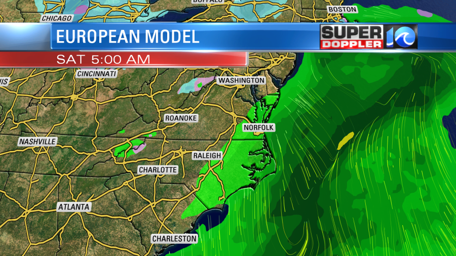
The models now have the rain ending by the afternoon. High temps will be in the low 50s. I’ll talk about the Sunday forecast in tomorrow’s weather blog. Stay tuned for updates.
Before I go. While I was writing the blog this morning I caught Al Roker (NBC) doing the weather out of the corner of my eye. He put up an interesting graphic. It was a current “ice on the Great Lakes compared to normal” graphic. So I looked up some info. This comes from a branch of NOAA (the U.S. National Ice Center). Compared to normal there is barely any ice on the Great Lakes right now. Here is the current coverage of ice on the Great Lakes…or lack of it:

Only about 6% of the lakes are covered with ice right now. Ironically, that has been creating a lot of lake-effect snow. Here is the link for that pic with more information: Great Lakes Environmental Research Lab/NOAA.
Meteorologist: Jeremy Wheeler


