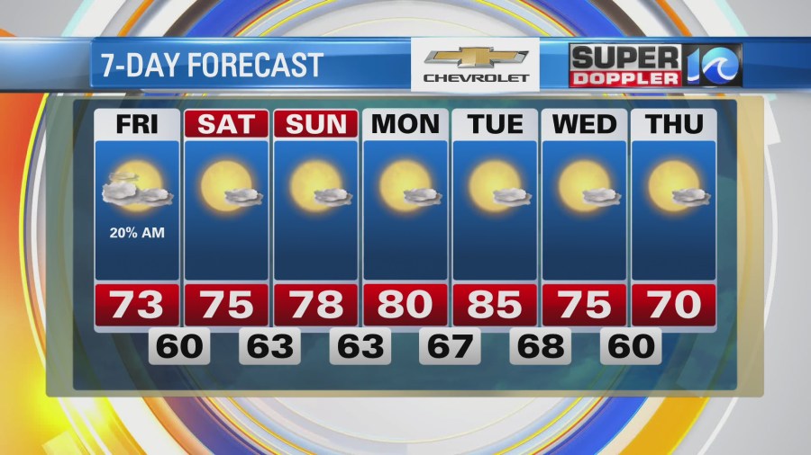
Locally, the weather is looking pretty good today, and it looks great for the weekend! This morning a strong cold front was slowly sliding farther offshore. High pressure was trying to edge in from the west.

There were a lot of clouds this morning with a few showers near the coast. The showers have since moved out except for a couple of coastal sprinkles. As we go through the day we’ll have gradual clearing. Though a couple of stray showers may linger over the Outer Banks. We’ll have a breezy north wind today. It will run out of the north/northeast at 10-15mph with gusts to 20mph. There are small craft advisories on the water. However, this breezy north wind will keep the temps down. Highs will be in the low-mid 70s this afternoon. Humidity will drop from moderate to low through the day.
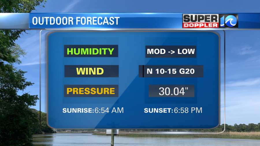
Tonight high pressure will edge into the region. So we’ll have mostly clear skies. Temps will drop down to the upper 50s to low 60s. It will be nice to open up the windows and get some fresh air in the house. It will also give the air conditioners a much needed break.
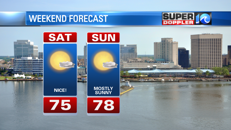
The weather for the weekend looks awesome. We’ll have lots of sun. cool temps, and dry air.
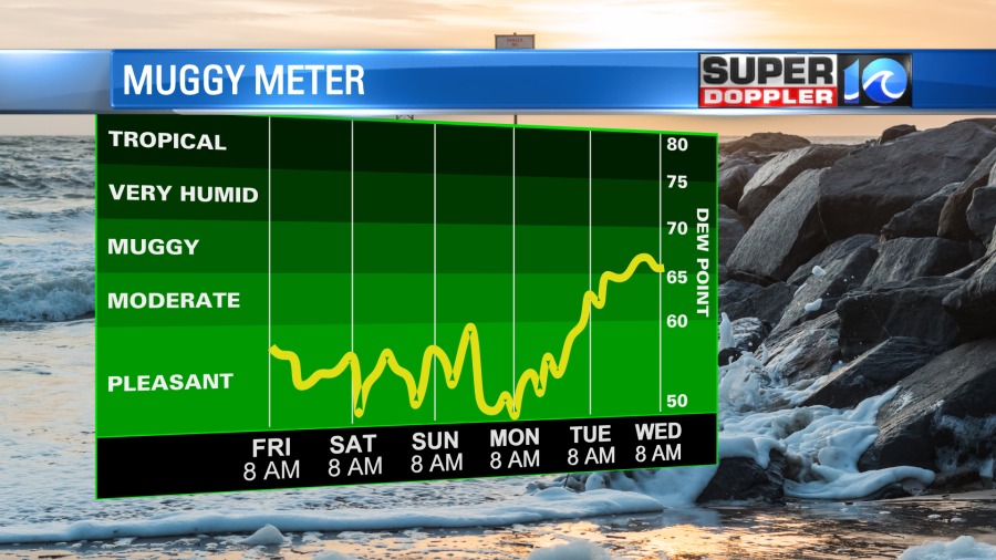
Dew points will drop and stay down all the way through early next week.
We’ll warm back up to the 80s Monday and Tuesday.
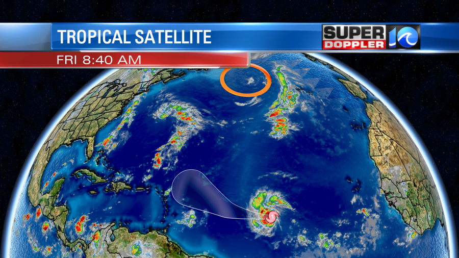
Meanwhile, we are closely monitoring “Hurricane” Sam. That’s right. It rapidly intensified over the last 24 hours from a depression to a hurricane. It is over warm water and an area of low wind shear. Even though it is strong, it is fairly small.
The system will move to the west then to the northwest over the next few days. Eventually, the wind shear will increase. So that could limit its strength in 4-5 days. (A bit)
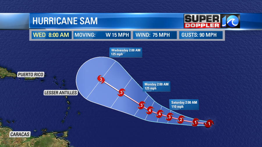
After that point the models generally take it more to the north and keep it away from the U.S. coast. At least that is what the model consensus is for now.
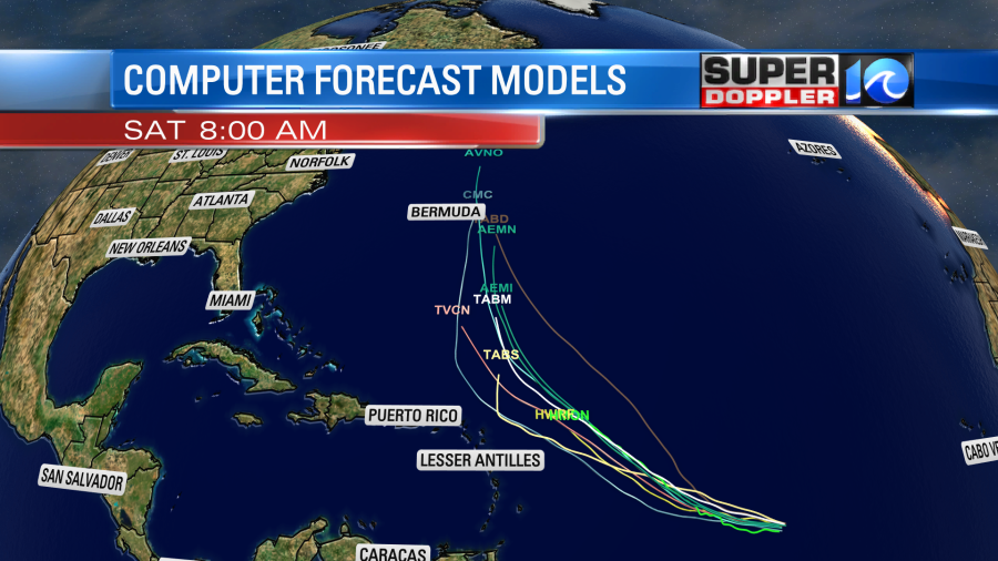
However, there are still a couple of models which do take it closer to the coast. Luckily the European model trended a bit more out to sea. However, it is one of the more southern/western models. You can see how it compares to the GFS model.

As you can see they are still fairly split, but not as much as a couple of days ago. Sam’s long-term track will greatly depend on how strong the system gets and also on the synoptic weather in the mid-latitudes. So stay tuned for updates on it over the weekend, but for now enjoy the nice weather this weekend! I know I will.
Meteorologist: Jeremy Wheeler