Today is going to be a pretty nasty day, but only in how the weather will feel. For some folks, late tonight and early Friday the weather could pose some real problems. Let’s talk about it…
Today we have high pressure far to the northwest at the surface. There is a stationary front to our south with two areas of low pressure moving east/northeast along the boundary.
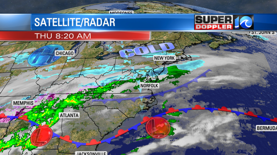
Overhead there is a large/broad trough of low pressure. Moisture is streaming up from the south in the mid and upper levels. Meanwhile there is a northerly breeze at the surface. That north breeze will reinforce the cold air that is already in place. These features will all help to produce cold rain showers that will increase through the day. High temps will be in the mid 40s with upper 30s to near 40 north of the metro.
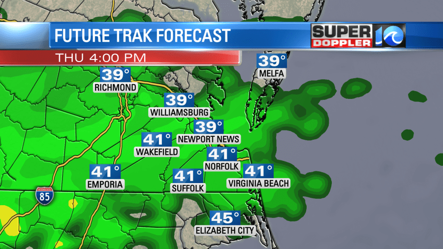
By tonight temperatures will gradually drop. They’ll drop enough north of Hampton Roads that there will be a wintry mix forming. This will happen by around 10-11pm. By 2-5am the rain snow line could drop as far south as Newport News.
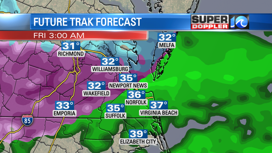
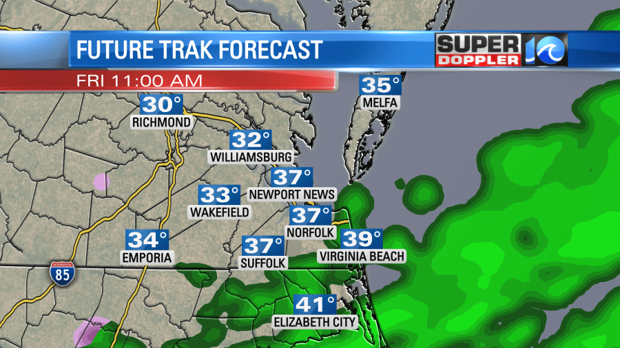
Some snow could be falling during that time from the Middle Peninsula to the Northern Neck to Accomack county. However, the mix zone will probably set up from Wakefield to Williamsburg to parts of Gloucester county. If you look at the above image you’ll notice that temps in those locations could be right around the freezing mark or slightly below 32 degrees. This could create some freezing rain for a time. That is a big concern this go-around.
The ice could accumulate up to 0.1″ to 0.2″. That would create a lot of problems for drivers, but it could also cause some problems with power outages if it gets on the higher end. Going through the morning the rain/snow line will edge north before the precip wraps up during the mid-late morning.
We’ll dry out gradually going into the afternoon. High temps will only be in the upper 30s to low 40s. We’ll have a breezy northeast wind.
The models are split as to how much snow will fall. A couple of them (like the NAM) have been bouncing around all over the place lately with the rain/snow line. The GFS has been milder and wetter over the last 24 hours. The Euro is the snowiest as of this morning.
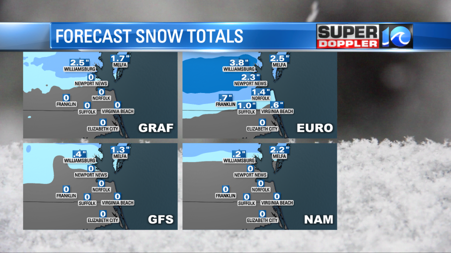
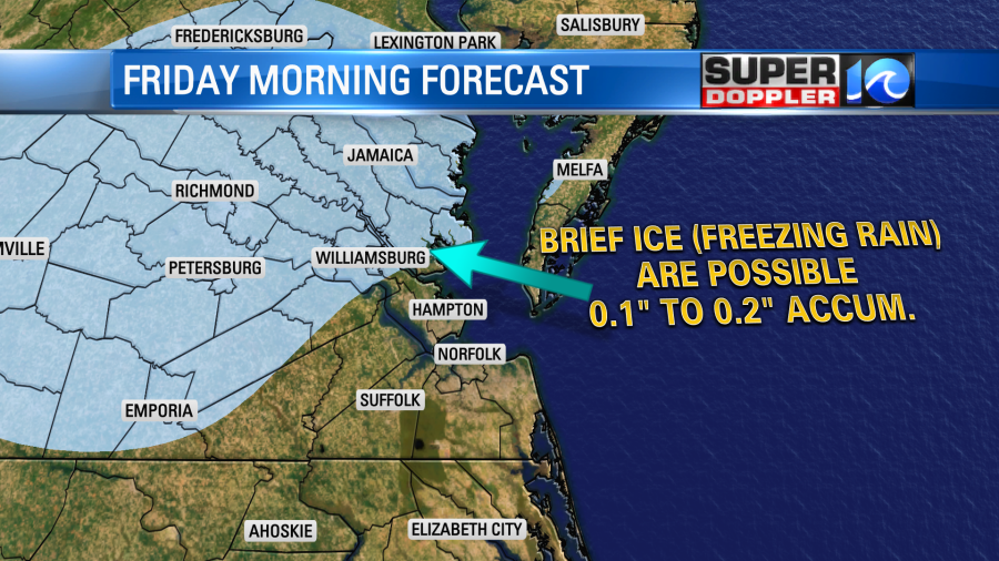
Keep in the mind that the Euro is a better mid-long range model. It doesn’t do too well in the short-term forecasts. So looking that the latest models I put together a (Friday Morning Forecast).
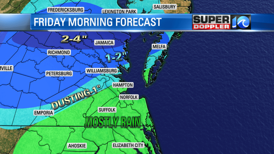
You can see that a lot of the area will likely just see rain with a few sleet pellets. One big factor causing that will be the northeast wind coming in off of the bay and ocean. Water temps are in the low 40s. I have a small area of a dusting up to an inch from southern Sussex county northeast to Mobjack Bay and Machipongo (Eastern Shore). Then I have an area of 1-2″ from northern Sussex/Surry counties northeast to Williamsburg, Gloucester, and near Melfa. 2-4″ on the Northern Neck. Remember though…There could be some glazing on top of the snow in some of those areas. That could compound any problems on the roads there.
Another system will impact us on Saturday. This time an area of low pressure looks to form off of the northern Outer Banks and move northeast (offshore). It looks like things could start as a little mixed precip, but it would likely go to all rain through the day.
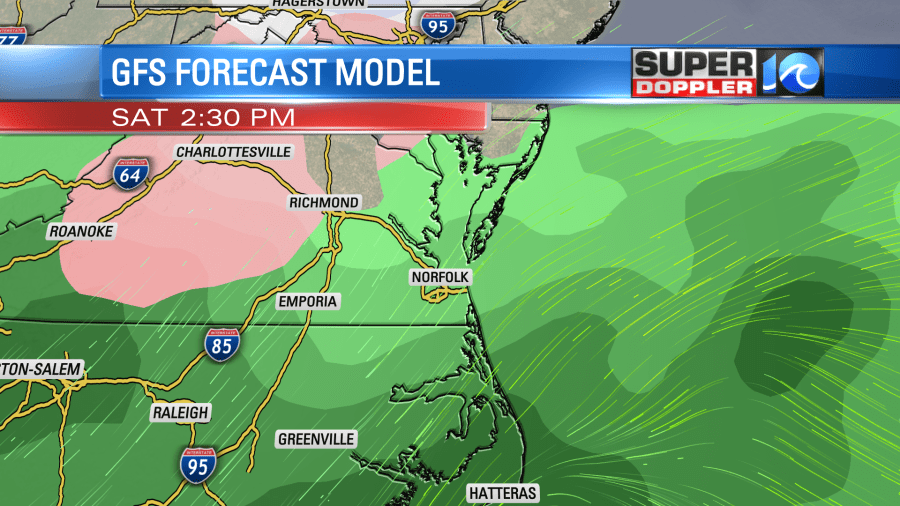
High temps will be in the 40s. We’ll have some rain and a wintry mix continuing Saturday night into Sunday morning. Then we’ll dry out for the rest of Sunday. That’s good news for Valentine’s Day. High temperatures will be in the 40s. We’ll have some more showers Monday and Tuesday. We’ll have more on that after we get past tomorrow’s weather.
Recently there has been a lot of cold air over the central U.S. Some folks have talked about the Polar Vortex, and how it had a major breakdown over the last month. This basically caused cold air to pour southward over different parts of the northern hemisphere. I found a neat article that talks about a new European satellite that monitors this directly. The Aeolus satellite comes from the European Space Agency. It looks directly at the winds around the northern hemisphere. This can directly measure when the Polar Vortex breaks down. Here is the article with more information: Aeolus satellite tracks polar vortex.
Meteorologist: Jeremy Wheeler