last night we had some light snow in the region along with a mix for some.
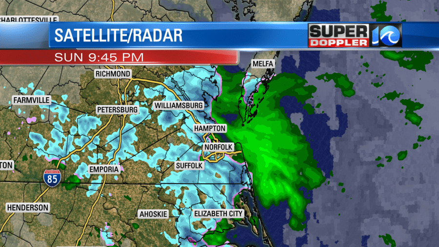
While a lot of it melted on contact, there were some spots where it briefly stuck. Surface temps were above freezing. So it had all melted by this morning. There were some cold rain showers this morning. Temps were only in the upper 30s to near 40. Today we have high pressure moving offshore with low pressure to the west. We have a warm front to our south.
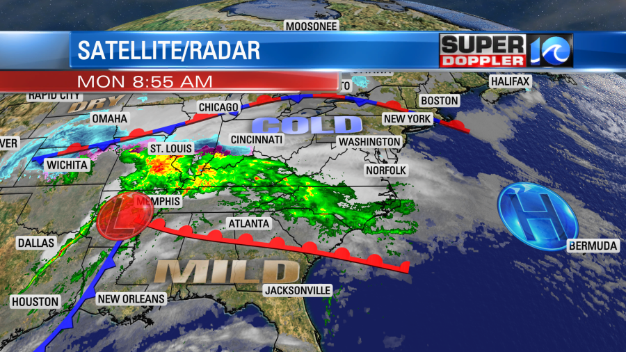
So our precip today isn’t from any big weather systems. Instead it comes from warmer/more humid air pushing north up over a colder air mass. This is called overunning. This will become more prominent this afternoon as the warm front gets a little closer to our region. So rain will become widespread as we go from the late afternoon into the evening.
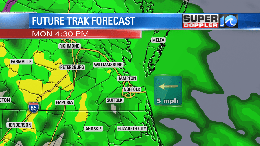
High temps will only be in the upper 40s today with light and variable winds. Overnight we’ll have on and off rain showers as the warm front stalls just to our south. Then we’ll have some scattered rain showers continue into tomorrow morning.
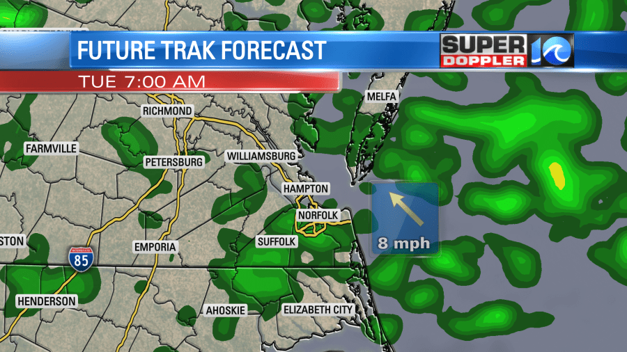
We could see about 0.75″ to 1″ of rain before it ends.
After a soggy/chilly morning we’ll dry out through the afternoon. It should turn into a pretty nice day with high temps in the low-mid 50s. We’ll be mostly dry on Wednesday with just a stray shower in the forecast. High temps will be in the 50s. Then the forecast gets interesting Wednesday night into Thursday morning. A couple of days ago it looked like a strong area of low pressure would form offshore during the day Thursday. This would have allowed for a possible nor’easter to form with a mix and then some snow for a time. The latest models have changed their tune since then. The National Weather Service (Wakefield) really outlined the changes well in their morning forecast discussion. They mentioned that the upper level low isn’t going to dig-in anymore through that time. Instead it looks like the upper level impulse will move faster offshore and will remain more shallow. So while the surface low looks like it will still form offshore, it will now likely be faster and weaker.
The models are in fairly good agreement at forming some rain by Thursday evening in our region with snow to the west.
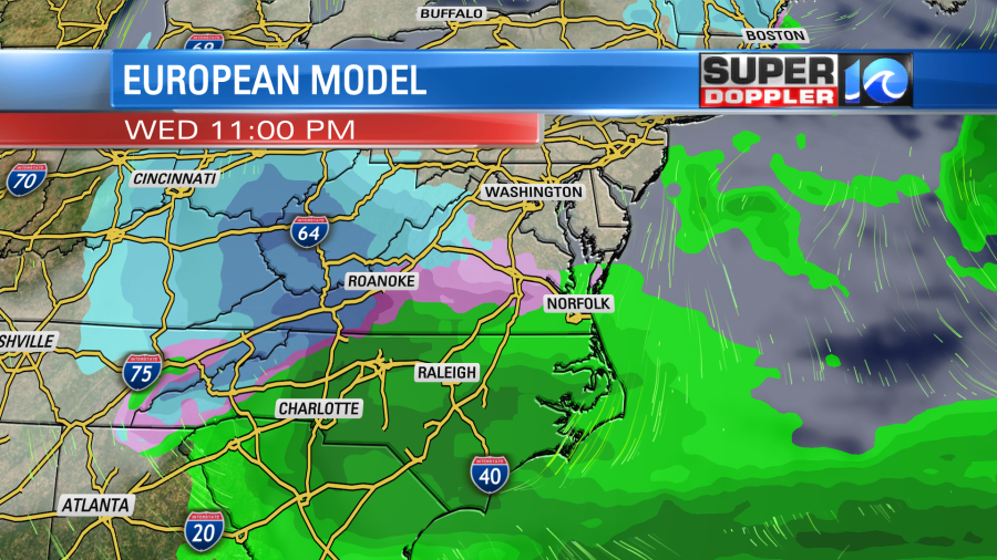
Then during the overnight colder air will drop south as the low strengthens offshore. This will create a wintry mix in our area for a time. It could even change over to all snow briefly.
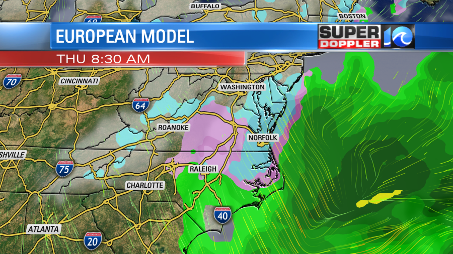
Keep in mind that the surface temps will probably be above freezing. Plus, the ground temps are still above freezing. So a lot of this would likely melt. However, if the snow gets heavy for a time, then it could overcome that obstacle. The models are showing some light accumulating snow. So far they are coming up with about a quarter to a half of an inch. This morning I put the chance for (accumulating) snow at about 15%.
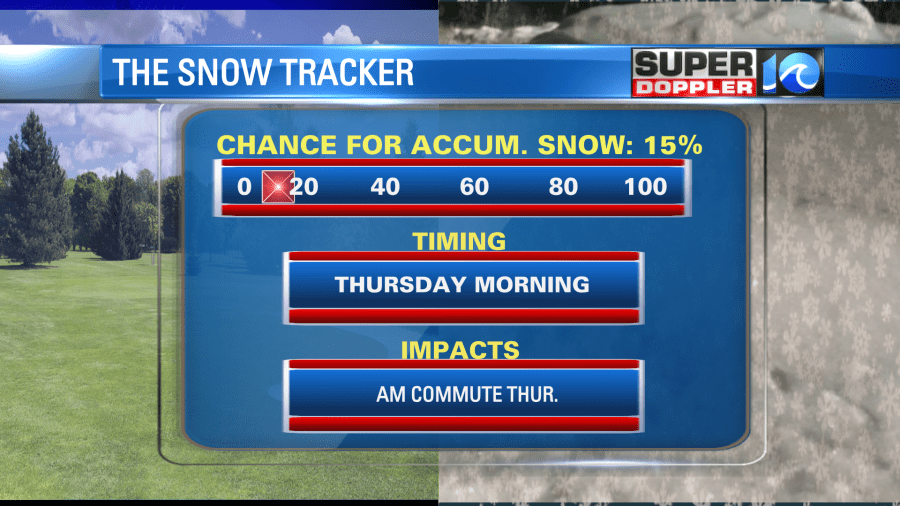
This number could change later today, but I won’t update it until I do the weather tomorrow. It’s still a bit early for the finer details. A difference in the surface temperatures could change the forecast dramatically. That’s the latest that I have. We’ll have updates on this throughout the day.
Meteorologist: Jeremy Wheeler


