Early this morning there was a lot of rain with a brief wintry mix in some locations.
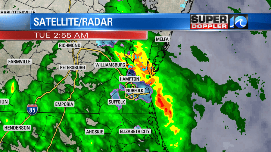
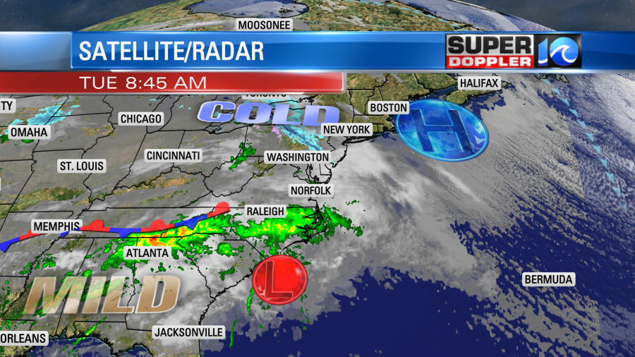
It pretty much all melted with only a couple of reports of residual iciness. Today is going to be a cold/wet day! There is a weak area of low pressure that will scoot just to our south. Rain will spread north of this feature.
We’ll be cloudy all day with on and off rain showers. They will mostly be light, but could be moderate in a few places.

Temperatures were in the 30s this morning. We will struggle to climb into the mid-upper 40s this afternoon. There will be a light southeast wind. So hopefully that will help warm the temps up a bit. The low will push out to sea tonight. We’ll have drier weather moving in late. Tomorrow we’ll be drier, but there will still be quite a bit of clouds. I’m going partly-to-mostly cloudy for the sky forecast tomorrow, but it may lean on mostly cloudy. High temps will warm to the mid-upper 50s. There may be a couple of stray showers in the region, but overall tomorrow will be a decent day. That’s good news for any St. Patrick’s day festivities. (socially distanced). Thursday will be a different story.
During the day tomorrow there will be a bigger/stronger area of low pressure forming to our west. It will create a lot of storms over the Southeast and parts of the Midwest. By Thursday that low will move into our region. It will be able to pull up a lot of warmer and more humid air into our area. High temps will be in the upper 60s, and they may even make it into the lower 70s. Dew points will rise as well. There will also be some decent upper level winds overhead. This will create a decent chance for storms in our area. There could be some severe weather even. It’s still early for the finer details. Remember, there will also be a lot of thick clouds which tends to stabilize things. Just know, for now, that the Storm Prediction Center (SPC) is really talking about this. So we’ll have more details later today and tomorrow on that part of the forecast. Here is what the GFS model is showing for Thursday afternoon.
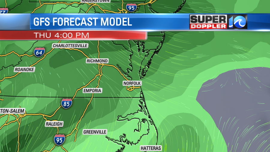
I’ll be honest…As of this writing I’m not seeing anything that ominous on the models for that time frame. However, the SPC does talk about some strong wind shear in the region. That can produce severe weather even when you don’t have a lot of instability. There will also be a southeast wind. So we’ll see what the higher resolution models show tonight and tomorrow. Stay tuned for updates.
Meteorologist: Jeremy Wheeler