We forecast for some cold air for this morning. The forecast verified! Low temps made it down to the low-mid 20s with a few teens inland.
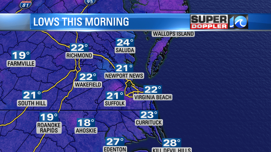
Wind chills were in the teens. Luckily this blast of cold air is moving out already. High pressure is sliding offshore, and that is allowing for the wind to turn to out of the southwest.
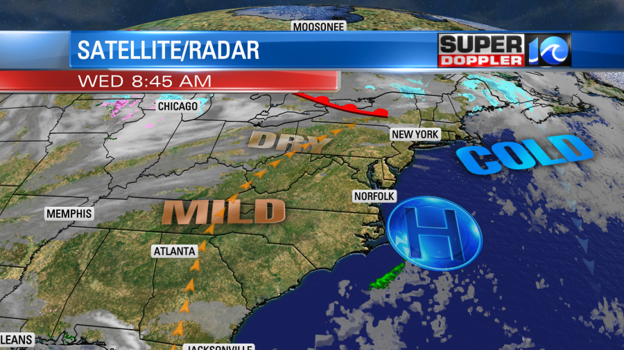
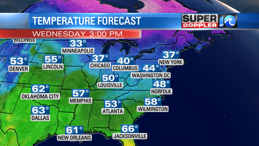
It won’t be a heat wave, but temps this afternoon will rise up to the upper 40s to near 50 degrees. This is close to the average.
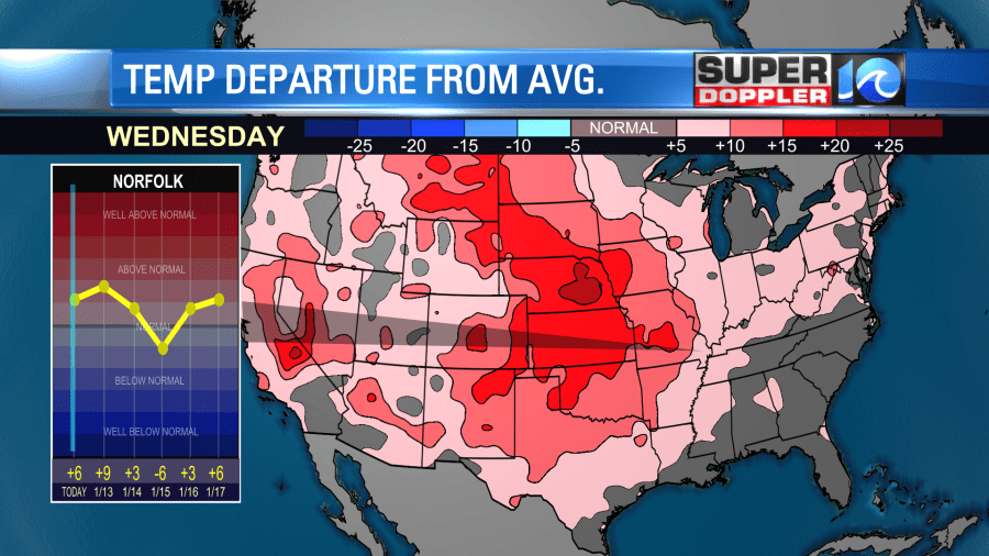
In fact…temps will be way above average over a large part of the country today.
we’ll have a lot of sunshine today locally. It will be a fairly nice day once we make it past the chill this morning. Tomorrow we’ll start off in the upper 20s and low 30s. We’ll end up in the low 50s. It will be very warm in the Deep South. Take a look:
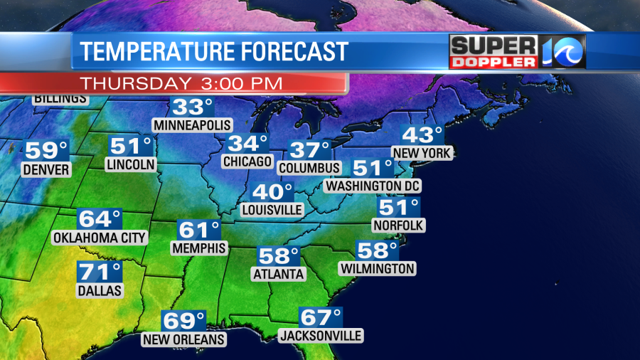
There will be a mix of sun and clouds in our region. We will pull up some moisture from the south. So there may even be some isolated showers in the area. They will mainly be near the shore.
A cold front will swipe through the region on Friday. There will be a slim chance for a shower. Otherwise we’ll have a mix of sun and clouds. High temps will drop to the 40s. Then we’ll drop even further on Saturday. High temps will only be in the upper 30s. We’ll be partly cloudy and breezy.
The good news about the Sunday forecast is that the computer models have all of a sudden come into pretty good agreement. The basic theme is that an area of low pressure will form to our west. A strong upper level low will form over the Tennessee River Valley early Sunday, and it will move over our region Sunday night into Monday morning. It will be on a track that will eventually take it to the northeast. The surface low is now forecast to strengthen off to our west. Before some models had it strengthening out to sea. This most recent scenario could create a big mess to our west. Snow could really stack up fast. However, with the latest track, it’s looking like we’ll have a lot of rain in our area with a brief wintry mix at the start and end.
Here are some of the latest models. The GFS is showing a brief mix and some rain in the region by later Sunday morning. Then it has all rain later in the day.
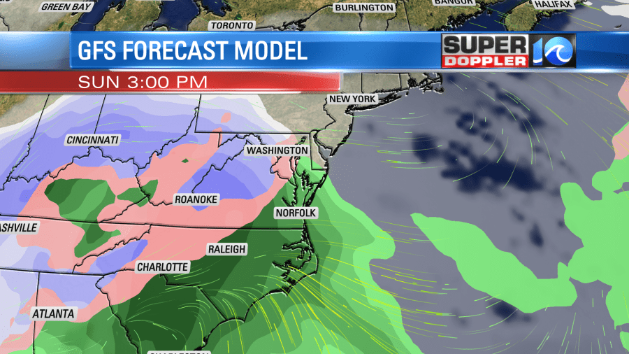
It then has rain overnight into Sunday morning (for us) with snow to the west. It does show a brief mix in the morning.
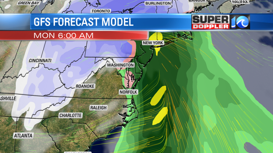
It then has us drying out by the late morning.
If you read yesterday’s weather blog, then you know that the European model did have all the precip to our south on Sunday. Now today it is (ironically) very similar to the GFS and Canadian models.
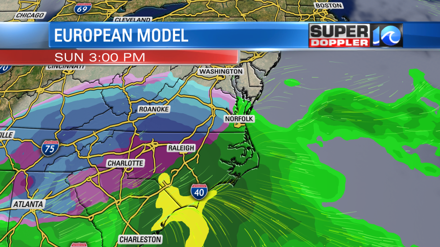
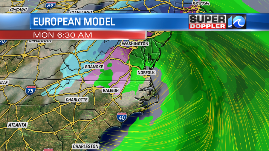
So while the models are in pretty good agreement now, I’m hesitant to put the stamp on the forecast yet. It’s still possible for the models to change before Sunday if not likely. If they go colder, then it’s possible that we could have some snow on the edge of our viewing area, and possibly more of a mix in the region. By tomorrow it will be in range of the NAM model. So stay tuned for updates, but definitely check back if you have outdoor plans this weekend.
Meteorologist: Jeremy Wheeler


