Today we are likely going to break the streak of highs in the 90s. We ended up in the 90s again yesterday with heat indices in the 100s. Norfolk topped off at 95 degrees officially. Today a cool front is dropping into the region, but it is stalling out.
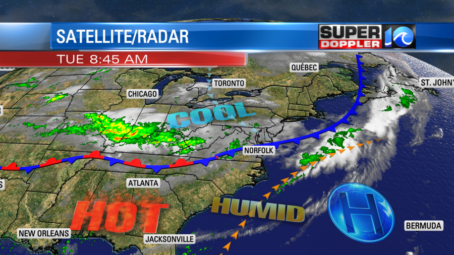
We’ll be on the edge of the cooler air, but I think it will be more of the clouds and rain caused by the front that will keep our high temperatures in the upper 80s.
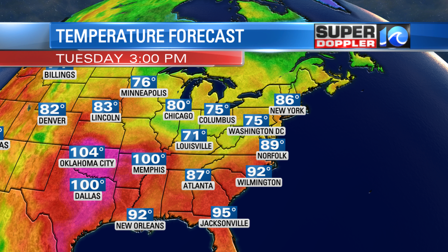
The sun popped out briefly this morning, but we’ll be mostly cloudy and then cloudy today. Keep in mind that we may have just enough sun to pop our high temp up to 90 degrees in Norfolk. That would keep the streak of 90 degree days going.
There will be a few showers during the first half of the day, but scattered showers and storms will increase this afternoon.
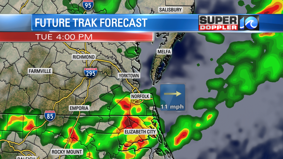
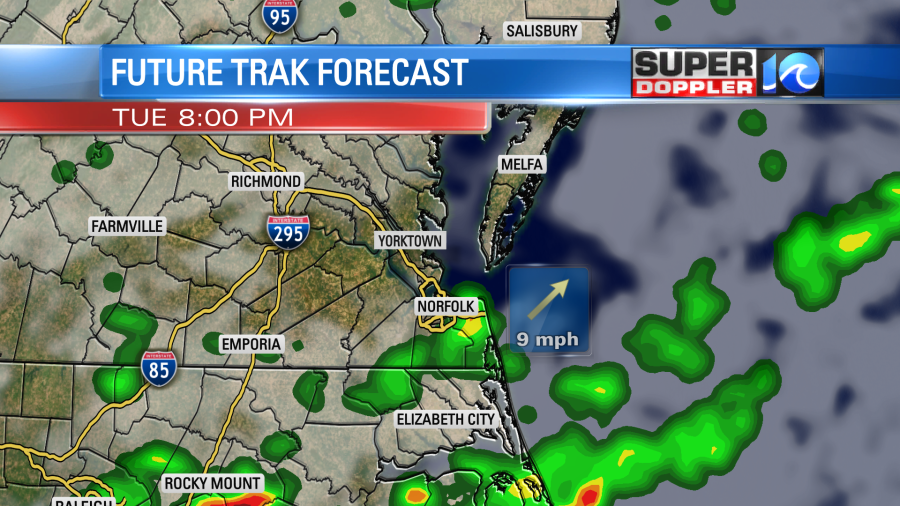
The scattered storms will continue into the evening.
There will be some scattered heavy downpours in the region. Most locations will get about 0.2″ up to 0.6″ of rainfall. A few locales may get up to 1″ to 1.5″. We have a marginal risk for severe weather later today. A few strong gusts of wind (over 45mph) will be possible. There’s a low chance for hail.
The showers and storms will taper off overnight. Then a few spotty showers may continue into tomorrow morning. The front will lift north as a warm front through Wednesday afternoon. We’ll have a lot of moisture and heat as high temps warm back up to the low 90s. The heat index will be near or over 100. We’ll have a mix of sun and clouds with some scattered storms re-forming during the afternoon.
We’ll have quiet/hot weather on Thursday. High temps will be in the mid 90s. Then we’ll have highs in the low 90s on Friday. The heat index will be over 100 again on both of those days. There will be a little more clouds Friday with some scattered storms later in the day. We’ll be cooler over the weekend as another front moves into the area. There will be some scattered showers and storms both days. High temps will be in the 80s. We’ll talk more about the weekend forecast over the next couple of days.
Before I go….there was some pretty bad flooding in St. Louis this morning. They apparently had over 7 inches of rain in a 5 hour period. There are several roads/streets that are blocked off due to the high water. Here is the article with more information: St. Louis Flash Flooding.
Meteorologist: Jeremy Wheeler